<< Our Photo Pages >> Shorwell 1 - Round Barrow(s) in England in Isle of Wight
Submitted by vicky on Monday, 24 March 2003 Page Views: 5760
Neolithic and Bronze AgeSite Name: Shorwell 1Country: England
NOTE: This site is 0.831 km away from the location you searched for.
County: Isle of Wight Type: Round Barrow(s)
Map Ref: SZ464828 Landranger Map Number: 196
Latitude: 50.643048N Longitude: 1.345145W
Condition:
| 5 | Perfect |
| 4 | Almost Perfect |
| 3 | Reasonable but with some damage |
| 2 | Ruined but still recognisable as an ancient site |
| 1 | Pretty much destroyed, possibly visible as crop marks |
| 0 | No data. |
| -1 | Completely destroyed |
| 5 | Superb |
| 4 | Good |
| 3 | Ordinary |
| 2 | Not Good |
| 1 | Awful |
| 0 | No data. |
| 5 | Can be driven to, probably with disabled access |
| 4 | Short walk on a footpath |
| 3 | Requiring a bit more of a walk |
| 2 | A long walk |
| 1 | In the middle of nowhere, a nightmare to find |
| 0 | No data. |
| 5 | co-ordinates taken by GPS or official recorded co-ordinates |
| 4 | co-ordinates scaled from a detailed map |
| 3 | co-ordinates scaled from a bad map |
| 2 | co-ordinates of the nearest village |
| 1 | co-ordinates of the nearest town |
| 0 | no data |
Be the first person to rate this site - see the 'Contribute!' box in the right hand menu.
Internal Links:
External Links:
I have visited· I would like to visit
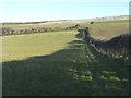
cliffrich visited on 23rd Feb 2019 - their rating: Cond: 1 Amb: 3 Access: 2 I think I walked past this several times during the 2hrs looking for it! Having found the map reference site I continued to look for it. This one is the worst condition barrow that I have found so far. It is unrecognisable as a round barrow, possibly due to ploughing and a general lack of preservation :(. I found RingPaw's description accurate. No ambience, and no tell-tale mound to speak of. There are a few lumps in the ground but nothing else however, a few meters away I found a likely looking earthwork further towards Chillerton but not at the map co-ordinates. All-in-all disappointing :o
See video - https://youtu.be/L7jTxUYCZkA
")
Have you visited this site? Please add a comment below.
You may be viewing yesterday's version of this page. To see the most up to date information please register for a free account.
")
")
")
")
Do not use the above information on other web sites or publications without permission of the contributor.
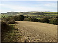
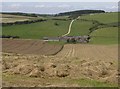
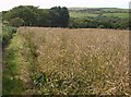
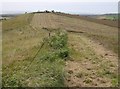
Nearby Images from Geograph Britain and Ireland:
©2013(licence)
©2007(licence)
©2007(licence)
©2007(licence)
©2008(licence)
The above images may not be of the site on this page, they are loaded from Geograph.
Please Submit an Image of this site or go out and take one for us!
Click here to see more info for this site
Nearby sites
Key: Red: member's photo, Blue: 3rd party photo, Yellow: other image, Green: no photo - please go there and take one, Grey: site destroyed
Download sites to:
KML (Google Earth)
GPX (GPS waypoints)
CSV (Garmin/Navman)
CSV (Excel)
To unlock full downloads you need to sign up as a Contributory Member. Otherwise downloads are limited to 50 sites.
Turn off the page maps and other distractions
Nearby sites listing. In the following links * = Image available
903m E 97° Shorwell 2* Round Barrow(s) (SZ473827)
1.9km NE 56° Chillerton Fort* Promontory Fort / Cliff Castle (SZ47998388)
2.4km NW 307° Cheverton Farm* Round Barrow(s) (SZ4450984220)
3.1km NNW 331° Newbarn Down Barrows* Round Barrow(s) (SZ44858552)
3.3km NW 317° Brighstone Forest Enclosure / Moot* Misc. Earthwork (SZ44088520)
3.5km NW 312° Brighstone Forest 2* Barrow Cemetery (SZ438851)
3.5km NW 319° Gallibury Hump* Round Barrow(s) (SZ441854)
4.4km NW 319° Newbarn Combe Enclosures Ancient Village or Settlement (SZ435861)
4.4km N 357° Bowcombe Down* Round Barrow(s) (SZ461872)
4.5km WNW 301° Brighstone Forest 1* Barrow Cemetery (SZ4252285049)
4.5km NW 312° Pitts Down Field System* Ancient Village or Settlement (SZ4301885795)
4.8km NNW 340° Round Copse* Round Barrow(s) (SZ447873)
4.9km WNW 292° East Westover Down - Tennyson Trail* Round Barrow(s) (SZ41868461)
5.1km WNW 286° Black Barrow* Round Barrow(s) (SZ415842)
5.6km WNW 284° Castle Hill, Mottistone* Hillfort (SZ409841)
5.8km WNW 285° Long Stone (IOW)* Standing Stone (Menhir) (SZ40718422)
6.1km WNW 289° Mottistone Down* Barrow Cemetery (SZ40628469)
6.1km WNW 285° Mottistone Common Bowl Barrow* Round Barrow(s) (SZ40428429)
6.3km SSE 152° St Catherine's Hill (Isle of Wight)* Round Barrow(s) (SZ494773)
6.5km SE 146° Bowl barrow 600m north west of Ladyacre Farm* Round Barrow(s) (SZ5007977461)
6.5km WNW 290° Chessell Down - Coombe Plantation* Round Barrow(s) (SZ4027684964)
6.5km W 270° Sud Moor* Round Barrow(s) (SZ399827)
7.0km WNW 290° Pay Down* Barrow Cemetery (SZ398851)
7.0km N 357° Vittlefields Farm Bowl Barrow* Round Barrow(s) (SZ4592389814)
7.6km WNW 291° Shalcombe Manor* Round Barrow(s) (SZ393855)
View more nearby sites and additional images

")
 We would like to know more about this location. Please feel free to add a brief description and any relevant information in your own language.
 Wir möchten mehr über diese Stätte erfahren. Bitte zögern Sie nicht, eine kurze Beschreibung und relevante Informationen in Deutsch hinzuzufügen.
 Nous aimerions en savoir encore un peu sur les lieux. S'il vous plaît n'hesitez pas à ajouter une courte description et tous les renseignements pertinents dans votre propre langue.
 Quisieramos informarnos un poco más de las lugares. No dude en añadir una breve descripción y otros datos relevantes en su propio idioma.