<< Text Pages >> Bicester Burial Mounds - Barrow Cemetery in England in Oxfordshire
Submitted by Andy B on Tuesday, 21 November 2006 Page Views: 8231
Neolithic and Bronze AgeSite Name: Bicester Burial MoundsCountry: England
NOTE: This site is 5.734 km away from the location you searched for.
County: Oxfordshire Type: Barrow Cemetery
Nearest Town: Bicester
Map Ref: SP576223
Latitude: 51.896280N Longitude: 1.164325W
Condition:
| 5 | Perfect |
| 4 | Almost Perfect |
| 3 | Reasonable but with some damage |
| 2 | Ruined but still recognisable as an ancient site |
| 1 | Pretty much destroyed, possibly visible as crop marks |
| 0 | No data. |
| -1 | Completely destroyed |
| 5 | Superb |
| 4 | Good |
| 3 | Ordinary |
| 2 | Not Good |
| 1 | Awful |
| 0 | No data. |
| 5 | Can be driven to, probably with disabled access |
| 4 | Short walk on a footpath |
| 3 | Requiring a bit more of a walk |
| 2 | A long walk |
| 1 | In the middle of nowhere, a nightmare to find |
| 0 | No data. |
| 5 | co-ordinates taken by GPS or official recorded co-ordinates |
| 4 | co-ordinates scaled from a detailed map |
| 3 | co-ordinates scaled from a bad map |
| 2 | co-ordinates of the nearest village |
| 1 | co-ordinates of the nearest town |
| 0 | no data |
Be the first person to rate this site - see the 'Contribute!' box in the right hand menu.
Internal Links:
External Links:
I have visited· I would like to visit
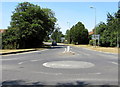
BarryC visited on 21st Sep 2022 - their rating: Cond: -1 Amb: 3 Access: 4 I visited primarily to take a photograph of the location, for uploading, but not expecting to see anything. In that, I wasn't disappointed: nothing to be seen *at all*, not even an information board or marker, which I had half-hoped for.
Checked location from available archaeological reports online - looks to be correct, albeit part of a larger area of excavations which have now totally disappeared under a massive housing estate which seemed to appear over 'lockdown'. Disappointing, but at least it was excavated before disappearing forever.
Experts dug 134 trenches between July and September and found archaeological remains in 41 of them.
As well as the burial mounds, which could be up to 5,500 years old, they found a bronze age palstave (an axe head), an iron age settlement with a possible hearth, a Roman settlement and quarries and what is believed to be a saxon ditch.
Experts from Wessex Archaeology have recommended the burial mounds, which measure 32m and 21m across, be protected by a 50m no-build buffer zone.
Council planning officer Jenny Barker said developers had redrawn their plans so the mounds would be beneath the playing field of one of the proposed primary schools. She added the secondary school and the health village had also been moved.
She said: "These mounds have been identified as significant and, in fact, significant enough that they should not be disturbed."
In its report, Countryside Properties said: "The intention is to impose a 50m buffer around these two sites to ensure no infrastructure works take place that would damage these remains of national importance.
More in the Oxford Mail
You may be viewing yesterday's version of this page. To see the most up to date information please register for a free account.
")
")
Do not use the above information on other web sites or publications without permission of the contributor.
Nearby Images from Geograph Britain and Ireland:
©2010(licence)
©2019(licence)
©2020(licence)
©2020(licence)
©2015(licence)
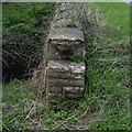
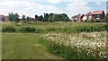
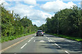
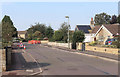
The above images may not be of the site on this page, they are loaded from Geograph.
Please Submit an Image of this site or go out and take one for us!
Click here to see more info for this site
Nearby sites
Key: Red: member's photo, Blue: 3rd party photo, Yellow: other image, Green: no photo - please go there and take one, Grey: site destroyed
Download sites to:
KML (Google Earth)
GPX (GPS waypoints)
CSV (Garmin/Navman)
CSV (Excel)
To unlock full downloads you need to sign up as a Contributory Member. Otherwise downloads are limited to 50 sites.
Turn off the page maps and other distractions
Nearby sites listing. In the following links * = Image available
1.3km ESE 117° Bicester Stone Circle* Modern Stone Circle etc (SP588217)
8.0km NW 315° Somerton Turf Maze (SP5187927901)
11.9km W 279° Hoar Stone at Barton* Long Barrow (SP458241)
13.5km NNW 339° Rainsborough Camp* Hillfort (SP526348)
14.8km SW 226° Yarnton* Ancient Village or Settlement (SP4712)
15.1km WSW 248° Fair Rosamund's Well* Holy Well or Sacred Spring (SP43651646)
15.4km WSW 256° Blenheim Great Park Ancient Village or Settlement (SP427183)
15.5km W 261° Glympton Farm Ancient Village or Settlement (SP423197)
15.6km NNW 334° Astrop Well* Holy Well or Sacred Spring (SP50603624)
15.7km E 83° Botyl Well* Holy Well or Sacred Spring (SP732245)
15.8km NNW 335° St Rumbald's Well* Holy Well or Sacred Spring (SP50783651)
16.0km NE 46° St Rumwald's Well* Holy Well or Sacred Spring (SP690335)
16.0km WNW 301° Ilbury Camp* Hillfort (SP438305)
16.2km W 268° Grimsdyke Farm Ancient Village or Settlement (SP41402141)
16.3km W 265° Out Wood & Berrings Wood Ancient Village or Settlement (SP413208)
16.5km SSW 202° Pitt Rivers Museum* Museum (SP51510695)
16.5km SSW 204° Radcliffe Infirmary prehistoric monumental landscape Round Barrow(s) (SP5103607101)
16.6km SSW 206° Walton Well* Holy Well or Sacred Spring (SP5047907312)
16.6km SSW 203° Kendrew Quadrangle* Henge (SP51200695)
16.9km SSW 213° St Margaret's Well (Binsey)* Holy Well or Sacred Spring (SP486080)
17.1km SSW 203° Ashmolean Museum of Art and Archaeology* Museum (SP511065)
17.3km SSW 194° St Bartholomew's Well Holy Well or Sacred Spring (SP5349805476)
17.4km W 268° Home Farm Ancient Village or Settlement (SP402215)
17.4km SSW 202° Museum of Oxford* Museum (SP513061)
17.6km E 81° Sionhill Farm Henge (SP75012541)
View more nearby sites and additional images


 We would like to know more about this location. Please feel free to add a brief description and any relevant information in your own language.
 Wir möchten mehr über diese Stätte erfahren. Bitte zögern Sie nicht, eine kurze Beschreibung und relevante Informationen in Deutsch hinzuzufügen.
 Nous aimerions en savoir encore un peu sur les lieux. S'il vous plaît n'hesitez pas à ajouter une courte description et tous les renseignements pertinents dans votre propre langue.
 Quisieramos informarnos un poco más de las lugares. No dude en añadir una breve descripción y otros datos relevantes en su propio idioma.