<< Text Pages >> Dva Brata - Natural Stone / Erratic / Other Natural Feature in Russia
Submitted by Andy B on Wednesday, 20 March 2019 Page Views: 1575
Natural PlacesSite Name: Dva Brata Alternative Name: Two BrothersCountry: Russia
NOTE: This site is 153.333 km away from the location you searched for.
Type: Natural Stone / Erratic / Other Natural Feature
Latitude: 69.823984N Longitude: 31.767211E
Condition:
| 5 | Perfect |
| 4 | Almost Perfect |
| 3 | Reasonable but with some damage |
| 2 | Ruined but still recognisable as an ancient site |
| 1 | Pretty much destroyed, possibly visible as crop marks |
| 0 | No data. |
| -1 | Completely destroyed |
| 5 | Superb |
| 4 | Good |
| 3 | Ordinary |
| 2 | Not Good |
| 1 | Awful |
| 0 | No data. |
| 5 | Can be driven to, probably with disabled access |
| 4 | Short walk on a footpath |
| 3 | Requiring a bit more of a walk |
| 2 | A long walk |
| 1 | In the middle of nowhere, a nightmare to find |
| 0 | No data. |
| 5 | co-ordinates taken by GPS or official recorded co-ordinates |
| 4 | co-ordinates scaled from a detailed map |
| 3 | co-ordinates scaled from a bad map |
| 2 | co-ordinates of the nearest village |
| 1 | co-ordinates of the nearest town |
| 0 | no data |
Be the first person to rate this site - see the 'Contribute!' box in the right hand menu.
Internal Links:
External Links:
Dva Brata are two stone outliers (seyds). They are situated right on the coast near the shore cliff in the Zemlyanaya guba (bay) of Rybachy Peninsula. These thirty meters high formations resemble birds ready to fly, with drawn necks, and heads anxiously turned to the sea. Many legends and stores are connected with them.
The Saami considered Dva Btata to be the powerful giant noiades (wizards) Kiiperi-Ukko and Kiiperi-Akko, who ruled this country 10000 years ago. Now the Two Brothers stay on the seashore expiating their evil.
You may be viewing yesterday's version of this page. To see the most up to date information please register for a free account.
Do not use the above information on other web sites or publications without permission of the contributor.
Nearby Images from Flickr
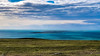
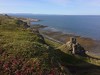

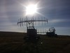
The above images may not be of the site on this page, but were taken nearby. They are loaded from Flickr so please click on them for image credits.
Click here to see more info for this site
Nearby sites
Click here to view sites on an interactive map of the areaKey: Red: member's photo, Blue: 3rd party photo, Yellow: other image, Green: no photo - please go there and take one, Grey: site destroyed
Download sites to:
KML (Google Earth)
GPX (GPS waypoints)
CSV (Garmin/Navman)
CSV (Excel)
To unlock full downloads you need to sign up as a Contributory Member. Otherwise downloads are limited to 50 sites.
Turn off the page maps and other distractions
Nearby sites listing. In the following links * = Image available
70.5km SE 146° Seids Ura-Guba* Natural Stone / Erratic / Other Natural Feature
110.1km SSE 152° Crow Stone complex* Stone Circle
200.9km WSW 243° Ukonkivi Round Cairn
302.5km S 174° Kandalaksha* Turf Maze
307.4km WNW 288° Stallogargo sacrificial site* Natural Stone / Erratic / Other Natural Feature
316.2km W 277° Transfardalen* Cave or Rock Shelter
321.1km W 280° Kviby sacrificial site* Natural Stone / Erratic / Other Natural Feature
321.2km W 280° Slottsbergkjerringa* Natural Stone / Erratic / Other Natural Feature
324.3km W 277° Amtmannsnes* Carving
324.8km W 277° Komsa sacrificial site* Natural Stone / Erratic / Other Natural Feature
325.3km SSE 162° Lake Kanozero* Carving
327.5km W 279° Djupvika sacrificial site* Natural Stone / Erratic / Other Natural Feature
328.1km W 276° Hjemmeluft stone age settlement* Ancient Village or Settlement
328.3km W 276° Alta (Norway)* Rock Art
365.5km SSE 162° Umba ancient labyrinth* Turf Maze
396.4km SSE 168° Seyd of Chupskaya Guba* Natural Stone / Erratic / Other Natural Feature
436.0km SW 236° Kaunisvaara Settlements Ancient Village or Settlement
464.6km W 273° Skarmunken* Natural Stone / Erratic / Other Natural Feature
478.0km W 268° Nordkjosbotn sacrificial site* Natural Stone / Erratic / Other Natural Feature
484.7km SSE 163° Ostrov Bol'shoy Rob'yak* Standing Stones
484.9km W 269° Balsfjord rock carvings* Carving
494.8km W 274° University Museum, Tromso* Museum
499.7km W 274° Håkøya* Ancient Village or Settlement
502.4km W 273° Skavberget* Rock Art
504.5km W 268° Mårfjellskardet sacrificial site* Natural Stone / Erratic / Other Natural Feature
View more nearby sites and additional images


 We would like to know more about this location. Please feel free to add a brief description and any relevant information in your own language.
 Wir möchten mehr über diese Stätte erfahren. Bitte zögern Sie nicht, eine kurze Beschreibung und relevante Informationen in Deutsch hinzuzufügen.
 Nous aimerions en savoir encore un peu sur les lieux. S'il vous plaît n'hesitez pas à ajouter une courte description et tous les renseignements pertinents dans votre propre langue.
 Quisieramos informarnos un poco más de las lugares. No dude en añadir una breve descripción y otros datos relevantes en su propio idioma.