<< Text Pages >> Loch of Kirkabister Burnt Mound - Artificial Mound in Scotland in Shetland
Submitted by SolarMegalith on Wednesday, 01 July 2015 Page Views: 1261
Multi-periodSite Name: Loch of Kirkabister Burnt MoundCountry: Scotland
NOTE: This site is 6.794 km away from the location you searched for.
County: Shetland Type: Artificial Mound
Nearest Town: Lerwick
Map Ref: HU49355821
Latitude: 60.305024N Longitude: 1.108828W
Condition:
| 5 | Perfect |
| 4 | Almost Perfect |
| 3 | Reasonable but with some damage |
| 2 | Ruined but still recognisable as an ancient site |
| 1 | Pretty much destroyed, possibly visible as crop marks |
| 0 | No data. |
| -1 | Completely destroyed |
| 5 | Superb |
| 4 | Good |
| 3 | Ordinary |
| 2 | Not Good |
| 1 | Awful |
| 0 | No data. |
| 5 | Can be driven to, probably with disabled access |
| 4 | Short walk on a footpath |
| 3 | Requiring a bit more of a walk |
| 2 | A long walk |
| 1 | In the middle of nowhere, a nightmare to find |
| 0 | No data. |
| 5 | co-ordinates taken by GPS or official recorded co-ordinates |
| 4 | co-ordinates scaled from a detailed map |
| 3 | co-ordinates scaled from a bad map |
| 2 | co-ordinates of the nearest village |
| 1 | co-ordinates of the nearest town |
| 0 | no data |
Internal Links:
External Links:
Burnt mound in Shetland
A burnt mound of 18 x 11m dimensions and 1.3m of height.
Canmore entry.
You may be viewing yesterday's version of this page. To see the most up to date information please register for a free account.
Do not use the above information on other web sites or publications without permission of the contributor.
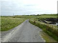
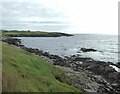
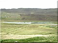
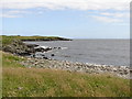
Nearby Images from Geograph Britain and Ireland:
©2022(licence)

©2007(licence)
©2022(licence)
©2022(licence)
©2010(licence)
The above images may not be of the site on this page, they are loaded from Geograph.
Please Submit an Image of this site or go out and take one for us!
Click here to see more info for this site
Nearby sites
Key: Red: member's photo, Blue: 3rd party photo, Yellow: other image, Green: no photo - please go there and take one, Grey: site destroyed
Download sites to:
KML (Google Earth)
GPX (GPS waypoints)
CSV (Garmin/Navman)
CSV (Excel)
To unlock full downloads you need to sign up as a Contributory Member. Otherwise downloads are limited to 50 sites.
Turn off the page maps and other distractions
Nearby sites listing. In the following links * = Image available
862m NNW 337° Loch of Stavaness Broch or Nuraghe (HU490590)
4.3km SW 226° Skellister* Standing Stones (HU463552)
7.4km SSW 199° Gletness Broch or Nuraghe (HU470512)
7.6km NNW 335° Lunnasting Standing Stone* Standing Stone (Menhir) (HU4665)
10.9km N 357° Chapel Knowe Broch or Nuraghe (HU48556910)
12.0km SW 229° Loch Of Strom* Stone Circle (HU4034450203)
12.9km W 269° East Burra Firth Chambered Cairn* Chambered Cairn (HU364577)
13.5km W 270° East Burra Firth Broch* Broch or Nuraghe (HU358580)
14.6km SW 218° Wormadale Hill* Standing Stone (Menhir) (HU4053046490)
14.8km SW 217° Westings Hill* Stone Circle (HU4068346194)
15.4km S 182° Stane o'Cruester* Standing Stone (Menhir) (HU490428)
15.9km S 185° Burnt Mound of Cruester* Ancient Village or Settlement (HU4816142310)
16.1km S 171° Bressay Pictish Cross Slab* Class III Pictish Cross Slab (HU5210042300)
16.1km S 171° Cullingsburgh* Broch or Nuraghe (HU521423)
16.9km SW 219° Easthouse* Standing Stones (HU388450)
17.0km W 263° Gravlaba* Standing Stones (HU325558)
17.0km S 187° Shetland Museum* Museum (HU474413)
17.1km WNW 303° Busta Brae* Standing Stones (HU34886739)
17.1km WSW 243° Semblister Broch or Nuraghe (HU341503)
17.5km S 169° Noss Sound Broch* Broch or Nuraghe (HU528410)
17.6km S 190° Clickhimin* Broch or Nuraghe (HU46434081)
17.9km WSW 246° Semblister Stone Circle* Stone Circle (HU3307450733)
18.1km SSW 207° Tingwall stone* Standing Stone (Menhir) (HU4123742029)
18.8km S 174° Wadbister Souterrain* Souterrain (Fogou, Earth House) (HU5163139487)
18.8km NNW 338° Crooksetter Hill - two Chambered Cairns* Chambered Cairn (HU420756)
View more nearby sites and additional images


 We would like to know more about this location. Please feel free to add a brief description and any relevant information in your own language.
 Wir möchten mehr über diese Stätte erfahren. Bitte zögern Sie nicht, eine kurze Beschreibung und relevante Informationen in Deutsch hinzuzufügen.
 Nous aimerions en savoir encore un peu sur les lieux. S'il vous plaît n'hesitez pas à ajouter une courte description et tous les renseignements pertinents dans votre propre langue.
 Quisieramos informarnos un poco más de las lugares. No dude en añadir una breve descripción y otros datos relevantes en su propio idioma.