

<< Our Photo Pages >> Wadbister Souterrain - Souterrain (Fogou, Earth House) in Scotland in Shetland
Submitted by h_fenton on Friday, 20 February 2015 Page Views: 3908
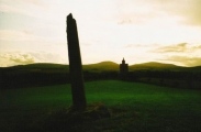
Iron Age and Later PrehistorySite Name: Wadbister SouterrainCountry: Scotland County: Shetland Type: Souterrain (Fogou, Earth House)
Nearest Village: Bressay
Map Ref: HU5163139487
Latitude: 60.136655N Longitude: 1.072319W
Condition:
| 5 | Perfect |
| 4 | Almost Perfect |
| 3 | Reasonable but with some damage |
| 2 | Ruined but still recognisable as an ancient site |
| 1 | Pretty much destroyed, possibly visible as crop marks |
| 0 | No data. |
| -1 | Completely destroyed |
| 5 | Superb |
| 4 | Good |
| 3 | Ordinary |
| 2 | Not Good |
| 1 | Awful |
| 0 | No data. |
| 5 | Can be driven to, probably with disabled access |
| 4 | Short walk on a footpath |
| 3 | Requiring a bit more of a walk |
| 2 | A long walk |
| 1 | In the middle of nowhere, a nightmare to find |
| 0 | No data. |
| 5 | co-ordinates taken by GPS or official recorded co-ordinates |
| 4 | co-ordinates scaled from a detailed map |
| 3 | co-ordinates scaled from a bad map |
| 2 | co-ordinates of the nearest village |
| 1 | co-ordinates of the nearest town |
| 0 | no data |
Internal Links:
External Links:
I have visited· I would like to visit
43559959 coin would like to visit
")
The Wadbister souterrain comprises of a chamber and a short length of passage, RCAHMS states that only the inner third of the passage remains. The souterrain is built of stone with large slabs laid horizontally to form the roof, a broken quern stone has been reused as part of the wall of the chamber. The floor of the chamber has a few pieces of stone slab which probably represent the original floor, elsewhere the floor is rubbly with a few pieces of modern rubbish. The entrance passage is partially filled with earth which makes getting into the souterrain a tight squeeze and wriggle even if you are thin.
RCAHMS Canmore site 1272
You may be viewing yesterday's version of this page. To see the most up to date information please register for a free account.
")
")
")
")
")
")
")
")
Do not use the above information on other web sites or publications without permission of the contributor.
Click here to see more info for this site
Nearby sites
Key: Red: member's photo, Blue: 3rd party photo, Yellow: other image, Green: no photo - please go there and take one, Grey: site destroyed
Download sites to:
KML (Google Earth)
GPX (GPS waypoints)
CSV (Garmin/Navman)
CSV (Excel)
To unlock full downloads you need to sign up as a Contributory Member. Otherwise downloads are limited to 50 sites.
Turn off the page maps and other distractions
Nearby sites listing. In the following links * = Image available
1.9km NE 38° Noss Sound Broch* Broch or Nuraghe (HU528410)
2.8km N 10° Bressay Pictish Cross Slab* Class III Pictish Cross Slab (HU5210042300)
2.8km N 10° Cullingsburgh* Broch or Nuraghe (HU521423)
4.2km NW 322° Stane o'Cruester* Standing Stone (Menhir) (HU490428)
4.5km NW 310° Burnt Mound of Cruester* Ancient Village or Settlement (HU4816142310)
4.6km WNW 294° Shetland Museum* Museum (HU474413)
5.3km WNW 285° Clickhimin* Broch or Nuraghe (HU46434081)
7.8km WSW 245° Broch of Burland* Broch or Nuraghe (HU44553607)
8.7km WSW 254° Loch of Brindister* Stone Fort or Dun (HU43263701)
10.7km WNW 285° Tingwall stone* Standing Stone (Menhir) (HU4123742029)
12.0km W 281° Loch of Houlland Ancient Village or Settlement (HU39754161)
12.6km SW 218° Clodie Knowe* Broch or Nuraghe (HU441294)
12.6km NNW 339° Gletness Broch or Nuraghe (HU470512)
12.8km WNW 302° Westings Hill* Stone Circle (HU4068346194)
13.1km WNW 303° Wormadale Hill* Standing Stone (Menhir) (HU4053046490)
13.3km SW 221° Everglades North Broch or Nuraghe (HU43002930)
13.9km WNW 294° Easthouse* Standing Stones (HU388450)
14.4km SW 216° Broch of Mail* Broch or Nuraghe (HU43252779)
14.6km WSW 251° Gulver Knowe burnt mound* Artificial Mound (HU37893455)
15.3km WSW 245° East Burra, Yaa Field Standing Stone (Menhir) (HU3780532835)
15.5km NW 314° Loch Of Strom* Stone Circle (HU4034450203)
16.1km WSW 246° West Burra, Mid Field Standing Stone (Menhir) (HU3700932591)
16.1km WSW 246° West Burra, Mid Field* Standing Stone (Menhir) (HU37003259)
16.6km NNW 342° Skellister* Standing Stones (HU463552)
16.8km SSW 201° Mousa Burnt Mounds* Artificial Mound (HU45942370)
View more nearby sites and additional images


 We would like to know more about this location. Please feel free to add a brief description and any relevant information in your own language.
 Wir möchten mehr über diese Stätte erfahren. Bitte zögern Sie nicht, eine kurze Beschreibung und relevante Informationen in Deutsch hinzuzufügen.
 Nous aimerions en savoir encore un peu sur les lieux. S'il vous plaît n'hesitez pas à ajouter une courte description et tous les renseignements pertinents dans votre propre langue.
 Quisieramos informarnos un poco más de las lugares. No dude en añadir una breve descripción y otros datos relevantes en su propio idioma.