<< Other Photo Pages >> Belozersky Val - Ancient Village or Settlement in Russia
Submitted by AlexAssa on Sunday, 06 August 2017 Page Views: 1266
Multi-periodSite Name: Belozersky Val Alternative Name: Белозёрский валCountry: Russia
NOTE: This site is 133.624 km away from the location you searched for.
Type: Ancient Village or Settlement
Nearest Town: Belozersk
Latitude: 60.031601N Longitude: 37.785047E
Condition:
| 5 | Perfect |
| 4 | Almost Perfect |
| 3 | Reasonable but with some damage |
| 2 | Ruined but still recognisable as an ancient site |
| 1 | Pretty much destroyed, possibly visible as crop marks |
| 0 | No data. |
| -1 | Completely destroyed |
| 5 | Superb |
| 4 | Good |
| 3 | Ordinary |
| 2 | Not Good |
| 1 | Awful |
| 0 | No data. |
| 5 | Can be driven to, probably with disabled access |
| 4 | Short walk on a footpath |
| 3 | Requiring a bit more of a walk |
| 2 | A long walk |
| 1 | In the middle of nowhere, a nightmare to find |
| 0 | No data. |
| 5 | co-ordinates taken by GPS or official recorded co-ordinates |
| 4 | co-ordinates scaled from a detailed map |
| 3 | co-ordinates scaled from a bad map |
| 2 | co-ordinates of the nearest village |
| 1 | co-ordinates of the nearest town |
| 0 | no data |
Internal Links:
External Links:
")
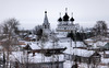
Ancient Settlement Belozersky Val (kremlin) - A large fortified city in the Vologda region, on the shore of Lake Beloe. The remains of the city are impressive and now, the shaft has a total length of about 1000 meters and a height of 15 meters, you can imagine the defensive characteristics of the fortress of the ancient Belozers at that time.
For more information click on Meghalithica.ru.
You may be viewing yesterday's version of this page. To see the most up to date information please register for a free account.
Do not use the above information on other web sites or publications without permission of the contributor.
Nearby Images from Flickr
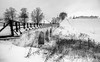
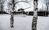
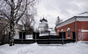
The above images may not be of the site on this page, but were taken nearby. They are loaded from Flickr so please click on them for image credits.
Click here to see more info for this site
Nearby sites
Click here to view sites on an interactive map of the areaKey: Red: member's photo, Blue: 3rd party photo, Yellow: other image, Green: no photo - please go there and take one, Grey: site destroyed
Download sites to:
KML (Google Earth)
GPX (GPS waypoints)
CSV (Garmin/Navman)
CSV (Excel)
To unlock full downloads you need to sign up as a Contributory Member. Otherwise downloads are limited to 50 sites.
Turn off the page maps and other distractions
Nearby sites listing. In the following links * = Image available
83.2km N 0° Vytegorsky Boulder* Natural Stone / Erratic / Other Natural Feature
166.2km SW 215° Complex Kurevaniha* Artificial Mound
206.4km NNW 333° Lake Onega Rock Art* Rock Art
257.5km NNW 329° Olene-ostrovsky burial ground* Ancient Village or Settlement
257.8km NNW 329° Oleny Ostrov burial* Ancient Village or Settlement
260.9km S 171° Bear stone* Natural Stone / Erratic / Other Natural Feature
272.6km NW 319° Solomennoe Stone Circle (modern)* Modern Stone Circle etc
279.6km S 174° Petukhov Stone* Natural Stone / Erratic / Other Natural Feature
299.1km SSE 157° Timerevsky complex stone sanctuary* Stone Circle
303.4km W 272° Lyubshanskoe settlement* Ancient Village or Settlement
304.6km W 272° Staraya Ladoga* Barrow Cemetery
329.0km E 80° Tiunovskoe sanctuary* Carving
330.3km SSE 163° Stone Dunilovo* Carving
360.9km SSW 203° Rudа́evskoe stone nest* Stone Circle
365.0km SSW 208° Big boulder bridge Vasilevo* Ancient Mine, Quarry or other Industry
367.2km S 170° Hillfort Kleschin* Hillfort
371.1km WSW 249° Kamen Scheglets* Carving
390.3km SSW 201° Rock Garden - Morkino settlement* Natural Stone / Erratic / Other Natural Feature
406.0km WSW 248° Historical Museum of Novgorod* Museum
414.7km S 185° Shutov stone* Natural Stone / Erratic / Other Natural Feature
415.1km SSE 159° Irmes* Ancient Village or Settlement
415.5km W 272° Hermitage Museum* Museum
417.2km W 261° Oredezh River stones* Polissoir
437.7km WNW 289° Seid island Burnev* Natural Stone / Erratic / Other Natural Feature
442.2km W 271° Stone Head Peterhof* Sculptured Stone
View more nearby sites and additional images


 We would like to know more about this location. Please feel free to add a brief description and any relevant information in your own language.
 Wir möchten mehr über diese Stätte erfahren. Bitte zögern Sie nicht, eine kurze Beschreibung und relevante Informationen in Deutsch hinzuzufügen.
 Nous aimerions en savoir encore un peu sur les lieux. S'il vous plaît n'hesitez pas à ajouter une courte description et tous les renseignements pertinents dans votre propre langue.
 Quisieramos informarnos un poco más de las lugares. No dude en añadir una breve descripción y otros datos relevantes en su propio idioma.