

<< Our Photo Pages >> Lyubshanskoe settlement - Ancient Village or Settlement in Russia
Submitted by AlexAssa on Wednesday, 14 February 2018 Page Views: 987
Multi-periodSite Name: Lyubshanskoe settlement Alternative Name: Любшанское горо&Country: Russia Type: Ancient Village or Settlement
Nearest Town: Sankt-Petersburg Nearest Village: Old Ladoga
Latitude: 60.010671N Longitude: 32.322441E
Condition:
| 5 | Perfect |
| 4 | Almost Perfect |
| 3 | Reasonable but with some damage |
| 2 | Ruined but still recognisable as an ancient site |
| 1 | Pretty much destroyed, possibly visible as crop marks |
| 0 | No data. |
| -1 | Completely destroyed |
| 5 | Superb |
| 4 | Good |
| 3 | Ordinary |
| 2 | Not Good |
| 1 | Awful |
| 0 | No data. |
| 5 | Can be driven to, probably with disabled access |
| 4 | Short walk on a footpath |
| 3 | Requiring a bit more of a walk |
| 2 | A long walk |
| 1 | In the middle of nowhere, a nightmare to find |
| 0 | No data. |
| 5 | co-ordinates taken by GPS or official recorded co-ordinates |
| 4 | co-ordinates scaled from a detailed map |
| 3 | co-ordinates scaled from a bad map |
| 2 | co-ordinates of the nearest village |
| 1 | co-ordinates of the nearest town |
| 0 | no data |
Internal Links:
External Links:
")
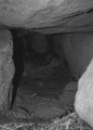
Lubshanskaya fortress is an ancient stone-earth fortress (fortification) in the territory of Ancient Rus at the mouth of the Volkhov. The archaeological monument dates back to the 6th-7th centuries, was erected on the site of an older settlement, about 700 years old it was rebuilt on a stone foundation by the Slavs (Rus) and ceased to exist by the 10th century due to a change in the hydrological relief of the area.
An ancient settlement (fortress) is located practically opposite the Staroladozhsky fortress via the Volkhov River, 2 km from the city, and opposite the famous "Olegov grave" burial mound complex.
Now here are periodically conducted archaeological excavations.
© Megalithica.ru
You may be viewing yesterday's version of this page. To see the most up to date information please register for a free account.
")
")
")
")
")
")
")
Do not use the above information on other web sites or publications without permission of the contributor.
Click here to see more info for this site
Nearby sites
Click here to view sites on an interactive map of the areaKey: Red: member's photo, Blue: 3rd party photo, Yellow: other image, Green: no photo - please go there and take one, Grey: site destroyed
Download sites to:
KML (Google Earth)
GPX (GPS waypoints)
CSV (Garmin/Navman)
CSV (Excel)
To unlock full downloads you need to sign up as a Contributory Member. Otherwise downloads are limited to 50 sites.
Turn off the page maps and other distractions
Nearby sites listing. In the following links * = Image available
1.2km W 277° Staraya Ladoga* Barrow Cemetery
112.1km W 267° Hermitage Museum* Museum
132.6km SW 230° Oredezh River stones* Polissoir
138.8km W 266° Stone Head Peterhof* Sculptured Stone
149.1km SSW 192° Kamen Scheglets* Carving
164.8km NW 305° Tiversk* Ancient Village or Settlement
173.2km NW 316° Seid island Burnev* Natural Stone / Erratic / Other Natural Feature
176.1km SSW 200° Historical Museum of Novgorod* Museum
204.7km SW 216° Shum-Gora* Round Barrow(s)
232.2km NNE 28° Solomennoe Stone Circle (modern)* Modern Stone Circle etc
251.0km WNW 284° Labyrinth Krutoyar* Turf Maze
255.4km ESE 120° Complex Kurevaniha* Artificial Mound
268.1km NW 310° Strange rock Kummakivi* Natural Stone / Erratic / Other Natural Feature
269.9km NNW 329° Pirunpöytä* Rock Art
270.2km NE 34° Oleny Ostrov burial* Ancient Village or Settlement
270.3km NE 34° Olene-ostrovsky burial ground* Ancient Village or Settlement
273.3km WNW 297° Lemin Heiluvakivi* Natural Stone / Erratic / Other Natural Feature
273.8km NE 46° Lake Onega Rock Art* Rock Art
297.0km W 274° Megaliths of Hogland Island* Standing Stones
300.0km WSW 252° Iisaku Muuseum* Museum
303.4km E 87° Belozersky Val* Ancient Village or Settlement
304.7km WNW 304° Astuvansalmi rock paintings* Rock Art
309.1km SW 232° Kamen Dobryak* Natural Stone / Erratic / Other Natural Feature
312.3km ENE 72° Vytegorsky Boulder* Natural Stone / Erratic / Other Natural Feature
324.9km W 263° Ehalkivi* Natural Stone / Erratic / Other Natural Feature
View more nearby sites and additional images


 We would like to know more about this location. Please feel free to add a brief description and any relevant information in your own language.
 Wir möchten mehr über diese Stätte erfahren. Bitte zögern Sie nicht, eine kurze Beschreibung und relevante Informationen in Deutsch hinzuzufügen.
 Nous aimerions en savoir encore un peu sur les lieux. S'il vous plaît n'hesitez pas à ajouter une courte description et tous les renseignements pertinents dans votre propre langue.
 Quisieramos informarnos un poco más de las lugares. No dude en añadir una breve descripción y otros datos relevantes en su propio idioma.