<< Our Photo Pages >> Machriewaterfoot Standing Stone - Standing Stone (Menhir) in Scotland in Isle of Arran
Submitted by Bladup on Thursday, 25 April 2013 Page Views: 2723
Neolithic and Bronze AgeSite Name: Machriewaterfoot Standing StoneCountry: Scotland
NOTE: This site is 0.703 km away from the location you searched for.
County: Isle of Arran Type: Standing Stone (Menhir)
Nearest Village: Machrie
Map Ref: NR89453363
Latitude: 55.550781N Longitude: 5.339473W
Condition:
| 5 | Perfect |
| 4 | Almost Perfect |
| 3 | Reasonable but with some damage |
| 2 | Ruined but still recognisable as an ancient site |
| 1 | Pretty much destroyed, possibly visible as crop marks |
| 0 | No data. |
| -1 | Completely destroyed |
| 5 | Superb |
| 4 | Good |
| 3 | Ordinary |
| 2 | Not Good |
| 1 | Awful |
| 0 | No data. |
| 5 | Can be driven to, probably with disabled access |
| 4 | Short walk on a footpath |
| 3 | Requiring a bit more of a walk |
| 2 | A long walk |
| 1 | In the middle of nowhere, a nightmare to find |
| 0 | No data. |
| 5 | co-ordinates taken by GPS or official recorded co-ordinates |
| 4 | co-ordinates scaled from a detailed map |
| 3 | co-ordinates scaled from a bad map |
| 2 | co-ordinates of the nearest village |
| 1 | co-ordinates of the nearest town |
| 0 | no data |
Internal Links:
External Links:
I have visited· I would like to visit
bishop_pam visited on 29th Apr 2023 - their rating: Cond: 5 Amb: 4 Access: 3 It’s possible to go via Tee 2 of the golf course then over a stile, but there’s also a broken gate opposite a field entrance, which can be scaled. The stone is behind Riverside Cottage.
Andy B visited on 23rd Aug 2016 - their rating: Cond: 5 Amb: 4 Access: 4 Park opposite second tee of golf course. Head over to tee and over to the right. Over a tiny brook and again head to the right. Just off the golf course in a field. There is a very helpful stile for access.
Average ratings for this site from all visit loggers: Condition: 5 Ambience: 4 Access: 3.5
")
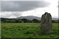
A 5 foot standing stone, marked on OS maps.
Canmore ID 39239
You may be viewing yesterday's version of this page. To see the most up to date information please register for a free account.
")
Do not use the above information on other web sites or publications without permission of the contributor.
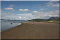
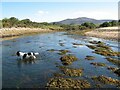
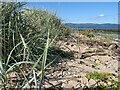
Nearby Images from Geograph Britain and Ireland:
©2008(licence)
©2005(licence)
©2022(licence)
©2022(licence)
©2022(licence)
The above images may not be of the site on this page, they are loaded from Geograph.
Please Submit an Image of this site or go out and take one for us!
Click here to see more info for this site
Nearby sites
Key: Red: member's photo, Blue: 3rd party photo, Yellow: other image, Green: no photo - please go there and take one, Grey: site destroyed
Download sites to:
KML (Google Earth)
GPX (GPS waypoints)
CSV (Garmin/Navman)
CSV (Excel)
To unlock full downloads you need to sign up as a Contributory Member. Otherwise downloads are limited to 50 sites.
Turn off the page maps and other distractions
Nearby sites listing. In the following links * = Image available
1.0km NNW 348° Auchagallon* Stone Circle (NR89293464)
1.2km SE 145° Machrie Moor 10* Stone Circle (NR90063265)
1.2km S 177° Tormore Farm Chambered Cairn (NR89453242)
1.6km SE 130° Moss Farm Stone* Standing Stone (Menhir) (NR90643254)
1.7km SE 135° Tormore 2* Chambered Cairn (NR90583237)
1.8km SE 131° Moss farm chambered cairn* Chambered Cairn (NR90753237)
1.8km ENE 57° Cnoc Na Ceille* Standing Stone (Menhir) (NR9101034553)
1.9km SE 129° Machrie Moor 5* Stone Circle (NR90883235)
2.0km SE 124° Machrie Moor 3* Stone Circle (NR91013245)
2.0km SE 127° Machrie Moor 4* Stone Circle (NR91003236)
2.0km NE 40° Machrie Burn* Stone Circle (NR90843511)
2.1km ESE 123° Machrie Moor 2* Stone Circle (NR91143242)
2.1km ESE 122° Machrie Moor 1.* Stone Circle (NR91203240)
2.1km ESE 122° Machrie Moor 11 Timber Circle (NR912324)
2.1km ESE 122° Machrie Moor 6* Stone Circle (NR91223242)
2.7km ESE 112° Ballymichael Bridge* Stone Circle (NR91913252)
2.7km SSE 159° Tormore 1 Chambered Cairn (NR90313106)
2.7km N 349° Auchencar* Standing Stones (NR89053633)
2.9km SSW 198° Kings Cave* Cave or Rock Shelter (NR88443092)
3.3km ESE 112° Shiskine* Stone Circle (NR92443225)
3.9km S 176° Torbeg Cursus* Cursus (NR8950329741)
4.1km SE 124° Ballymichael Standing Stones* Standing Stones (NR92723119)
4.1km SE 127° Uaigh Finnach* Standing Stone (Menhir) (NR9261631040)
4.3km S 188° Drumadoon Hillfort* Hillfort
4.4km S 188° Drummadoon Standing Stone* Standing Stone (Menhir) (NR8865629273)
View more nearby sites and additional images


 We would like to know more about this location. Please feel free to add a brief description and any relevant information in your own language.
 Wir möchten mehr über diese Stätte erfahren. Bitte zögern Sie nicht, eine kurze Beschreibung und relevante Informationen in Deutsch hinzuzufügen.
 Nous aimerions en savoir encore un peu sur les lieux. S'il vous plaît n'hesitez pas à ajouter une courte description et tous les renseignements pertinents dans votre propre langue.
 Quisieramos informarnos un poco más de las lugares. No dude en añadir una breve descripción y otros datos relevantes en su propio idioma.