<< Text Pages >> Gilliestongues - Promontory Fort / Cliff Castle in Scotland in Scottish Borders
Submitted by SolarMegalith on Monday, 19 December 2011 Page Views: 3653
Iron Age and Later PrehistorySite Name: GilliestonguesCountry: Scotland
NOTE: This site is 2.859 km away from the location you searched for.
County: Scottish Borders Type: Promontory Fort / Cliff Castle
Nearest Town: Jedburgh
Map Ref: NT63721659
Latitude: 55.441833N Longitude: 2.575012W
Condition:
| 5 | Perfect |
| 4 | Almost Perfect |
| 3 | Reasonable but with some damage |
| 2 | Ruined but still recognisable as an ancient site |
| 1 | Pretty much destroyed, possibly visible as crop marks |
| 0 | No data. |
| -1 | Completely destroyed |
| 5 | Superb |
| 4 | Good |
| 3 | Ordinary |
| 2 | Not Good |
| 1 | Awful |
| 0 | No data. |
| 5 | Can be driven to, probably with disabled access |
| 4 | Short walk on a footpath |
| 3 | Requiring a bit more of a walk |
| 2 | A long walk |
| 1 | In the middle of nowhere, a nightmare to find |
| 0 | No data. |
| 5 | co-ordinates taken by GPS or official recorded co-ordinates |
| 4 | co-ordinates scaled from a detailed map |
| 3 | co-ordinates scaled from a bad map |
| 2 | co-ordinates of the nearest village |
| 1 | co-ordinates of the nearest town |
| 0 | no data |
Internal Links:
External Links:
Promontory Fort in Scottish Borders
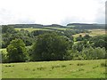
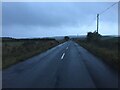
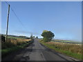
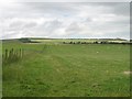
An Iron Age promontory fort near Gilliestongues has a double rampart with remains of the causeway leading to the entrance.
Read More at ScotlandsPlaces.
You may be viewing yesterday's version of this page. To see the most up to date information please register for a free account.
Do not use the above information on other web sites or publications without permission of the contributor.
Nearby Images from Geograph Britain and Ireland:
©2008(licence)
©2023(licence)
©2015(licence)
©2008(licence)
©2007(licence)
The above images may not be of the site on this page, they are loaded from Geograph.
Please Submit an Image of this site or go out and take one for us!
Click here to see more info for this site
Nearby sites
Key: Red: member's photo, Blue: 3rd party photo, Yellow: other image, Green: no photo - please go there and take one, Grey: site destroyed
Download sites to:
KML (Google Earth)
GPX (GPS waypoints)
CSV (Garmin/Navman)
CSV (Excel)
To unlock full downloads you need to sign up as a Contributory Member. Otherwise downloads are limited to 50 sites.
Turn off the page maps and other distractions
Nearby sites listing. In the following links * = Image available
4.0km NNE 19° Jedburgh Ancient Christian Stones* Ancient Cross (NT65052038)
4.0km WNW 289° Bedrule Parish Church* Sculptured Stone (NT5992217925)
4.0km NNE 19° Jedburgh Rock Art Rock Art (NT651204)
4.4km WNW 287° Bedrule Sculptured Stone (NT59501793)
4.5km WNW 291° Fast Castle (Bedrule)* Misc. Earthwork (NT59531822)
5.8km W 259° Rubers Law* Hillfort (NT58031557)
5.9km SE 134° Edgerston Hillfort (NT67981245)
7.2km S 181° Southdean Law* Hillfort (NT63500938)
7.4km N 2° Harestanes (Ancrum) Stone Circle (NT640240)
7.4km N 2° Harestanes (Ancrum) Stone Circle (NT641240)
8.0km SSE 153° Shaw Craigs Hillfort (NT67270945)
8.2km WSW 236° Hawthornside Farm (Bonchester Bridge)* Holy Well or Sacred Spring (NT5678612089)
8.4km N 350° Castle Hill (Ancrum)* Hillfort (NT6239424909)
8.4km N 349° Ancrum Old Church* Sculptured Stone (NT6215024885)
8.6km SE 138° Knock Hill Cairn Cairn (NT69451016)
8.6km N 5° Woodside (Crailing) Standing Stone (Menhir) (NT64552517)
9.4km N 358° Harrietsfield Standing Stone (Menhir) (NT63442599)
9.5km NNE 32° Crailing Cross* Ancient Cross (NT6879724676)
9.7km W 264° Cavers Cross* Ancient Cross (NT54071564)
9.7km ESE 122° Moor Head (Brundean Laws)* Standing Stones (NT7193111439)
9.8km ESE 106° Dark Wood* Cairn (NT73111377)
9.8km NNE 21° Nisbet 2 Sculptured Stone (NT67322572)
10.4km W 276° Midshiels Standing Stone* Standing Stone (Menhir) (NT53391774)
10.4km W 276° Midshiels Cairn* Cairn (NT53311770)
11.1km E 99° Falla Knowe Cairn* Cairn (NT74711475)
View more nearby sites and additional images


 We would like to know more about this location. Please feel free to add a brief description and any relevant information in your own language.
 Wir möchten mehr über diese Stätte erfahren. Bitte zögern Sie nicht, eine kurze Beschreibung und relevante Informationen in Deutsch hinzuzufügen.
 Nous aimerions en savoir encore un peu sur les lieux. S'il vous plaît n'hesitez pas à ajouter une courte description et tous les renseignements pertinents dans votre propre langue.
 Quisieramos informarnos un poco más de las lugares. No dude en añadir una breve descripción y otros datos relevantes en su propio idioma.