<< Our Photo Pages >> Browndod Court Tomb - Court Tomb in Ireland (Northern) in Co. Antrim
Submitted by ainsloch on Friday, 21 September 2012 Page Views: 5342
Neolithic and Bronze AgeSite Name: Browndod Court TombCountry: Ireland (Northern)
NOTE: This site is 4.942 km away from the location you searched for.
County: Co. Antrim Type: Court Tomb
Nearest Town: Ballyclare Nearest Village: Templepatrick
Latitude: 54.764714N Longitude: 6.126673W
Condition:
| 5 | Perfect |
| 4 | Almost Perfect |
| 3 | Reasonable but with some damage |
| 2 | Ruined but still recognisable as an ancient site |
| 1 | Pretty much destroyed, possibly visible as crop marks |
| 0 | No data. |
| -1 | Completely destroyed |
| 5 | Superb |
| 4 | Good |
| 3 | Ordinary |
| 2 | Not Good |
| 1 | Awful |
| 0 | No data. |
| 5 | Can be driven to, probably with disabled access |
| 4 | Short walk on a footpath |
| 3 | Requiring a bit more of a walk |
| 2 | A long walk |
| 1 | In the middle of nowhere, a nightmare to find |
| 0 | No data. |
| 5 | co-ordinates taken by GPS or official recorded co-ordinates |
| 4 | co-ordinates scaled from a detailed map |
| 3 | co-ordinates scaled from a bad map |
| 2 | co-ordinates of the nearest village |
| 1 | co-ordinates of the nearest town |
| 0 | no data |
Internal Links:
External Links:
")
To access the site you need to park just before a lane leading off the Browndod road (there is a small sign with several house numbers on it), then walk up the lane by an old shed on your left, enter the field just after the shed and head straight up the hill, crossing into another field as you go. There is a pylon at the top of the hill and the court tomb is located right next to it.
You may be viewing yesterday's version of this page. To see the most up to date information please register for a free account.
")
")
Do not use the above information on other web sites or publications without permission of the contributor.
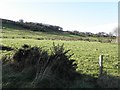
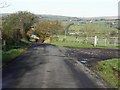
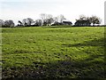
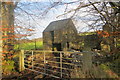
Nearby Images from Geograph Britain and Ireland:
©2009(licence)
©2009(licence)

©2013(licence)
©2009(licence)
©2013(licence)
The above images may not be of the site on this page, they are loaded from Geograph.
Please Submit an Image of this site or go out and take one for us!
Click here to see more info for this site
Nearby sites
Click here to view sites on an interactive map of the areaKey: Red: member's photo, Blue: 3rd party photo, Yellow: other image, Green: no photo - please go there and take one, Grey: site destroyed
Download sites to:
KML (Google Earth)
GPX (GPS waypoints)
CSV (Garmin/Navman)
CSV (Excel)
To unlock full downloads you need to sign up as a Contributory Member. Otherwise downloads are limited to 50 sites.
Turn off the page maps and other distractions
Nearby sites listing. In the following links * = Image available
1.9km S 175° Tobergill Stone Circle (J20839051)
3.3km SSE 168° Donegore Hill Causewayed Enclosure
3.9km ESE 117° Doagh* Holed Stone (J2416590683)
4.5km S 183° Donegore Moat* Artificial Mound
5.4km NW 317° Carncome Standing Stone* Standing Stone (Menhir)
6.0km SE 134° Moyadam* Standing Stone (Menhir) (J2510388312)
10.3km SE 144° Craigarogan* Chambered Tomb (J270842)
11.4km NNW 327° Ballymarlagh* Court Tomb (D14040175)
12.1km NW 318° Ballymena Ring Fort Hillfort
13.1km ENE 69° Carndoo* Court Tomb (J32849731)
13.6km ESE 107° West Division Stone Row / Alignment (J338887)
13.7km NNW 341° St. Patrick's Stone* Standing Stone (Menhir) (NW310621)
14.8km ENE 77° Tureagh Stone Circle (J350960)
15.4km SSE 149° Ballyutoag Court Tomb Court Tomb
16.4km SE 139° Collinward Cairn* Cairn
16.5km ENE 71° Ballrickard More Stone Circle (J362981)
16.8km SE 142° Ballyaghagan Cashel Ancient Village or Settlement (J31287936)
17.2km SE 139° Ballyaghagan Cairn* Cairn
17.3km SE 138° The Devil's Punchbowl Cave or Rock Shelter
17.4km SE 139° McArts Fort* Stone Fort or Dun
17.7km NE 49° Larne Standing Stone* Standing Stone (Menhir)
17.9km NNE 14° Tamybuck Wedge Tomb* Wedge Tomb (NW401660)
18.0km SSE 155° Ballygomartin Standing Stone* Standing Stone (Menhir)
18.6km SSE 167° Tournagrough Stone Row / Alignment (J252743)
19.2km NNE 16° Antynanum* Court Tomb (D25561094)
View more nearby sites and additional images


 We would like to know more about this location. Please feel free to add a brief description and any relevant information in your own language.
 Wir möchten mehr über diese Stätte erfahren. Bitte zögern Sie nicht, eine kurze Beschreibung und relevante Informationen in Deutsch hinzuzufügen.
 Nous aimerions en savoir encore un peu sur les lieux. S'il vous plaît n'hesitez pas à ajouter une courte description et tous les renseignements pertinents dans votre propre langue.
 Quisieramos informarnos un poco más de las lugares. No dude en añadir una breve descripción y otros datos relevantes en su propio idioma.