<< Text Pages >> Donegore Hill - Causewayed Enclosure in Ireland (Northern) in Co. Antrim
Submitted by ainsloch on Sunday, 12 May 2013 Page Views: 6032
Neolithic and Bronze AgeSite Name: Donegore Hill Alternative Name: TobergillCountry: Ireland (Northern) County: Co. Antrim Type: Causewayed Enclosure
Nearest Town: Antrim
Latitude: 54.735657N Longitude: 6.115735W
Condition:
| 5 | Perfect |
| 4 | Almost Perfect |
| 3 | Reasonable but with some damage |
| 2 | Ruined but still recognisable as an ancient site |
| 1 | Pretty much destroyed, possibly visible as crop marks |
| 0 | No data. |
| -1 | Completely destroyed |
| 5 | Superb |
| 4 | Good |
| 3 | Ordinary |
| 2 | Not Good |
| 1 | Awful |
| 0 | No data. |
| 5 | Can be driven to, probably with disabled access |
| 4 | Short walk on a footpath |
| 3 | Requiring a bit more of a walk |
| 2 | A long walk |
| 1 | In the middle of nowhere, a nightmare to find |
| 0 | No data. |
| 5 | co-ordinates taken by GPS or official recorded co-ordinates |
| 4 | co-ordinates scaled from a detailed map |
| 3 | co-ordinates scaled from a bad map |
| 2 | co-ordinates of the nearest village |
| 1 | co-ordinates of the nearest town |
| 0 | no data |
Internal Links:
External Links:
Causewayed Enclosure in Co. Antrim
The following description is from "Ireland - An Oxford Archaeological Guide" by Andy Halpin and Conor Newman:
"Rising to heights of 210 m and 234 m, the twin peaks of Donegore Hill are a prominent landmark to the north-east of Antrim town. The hill overlooks the upper reaches of Six Mile Water Valley and across to Lyles Hill, only 6 km to the south-east. To the west is Lough Neagh. There is a long history of diverse human activity here, even if only a small selection of the sites is accessible to the visitor. Systematic fieldwalking on the highest summit of Donegore in the early 1980s produced thousands of sherds of Neolithic pottery and lithics, including several porcellanite axes. A short exploratory excavation followed in 1983. At the same time, aerial photography by Barrie Hartwell revealed crop-marks of an interrupted, double-fossed (1–2 m deep, 3 m wide) enclosure, measuring about 200 m by 150 m. This was Ireland’s first, and so far only ‘causewayed camp’, a classic site type of the English Neolithic."
Nothing remains visible of the causewayed enclosure on the ground, however there is a huge motte at the south western foot of Donegore Hill which is believed to have been constructed on top of a Neolithic burial mound, in the middle of a passage grave cemetery.
You may be viewing yesterday's version of this page. To see the most up to date information please register for a free account.
Do not use the above information on other web sites or publications without permission of the contributor.
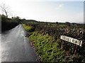
Nearby Images from Geograph Britain and Ireland:
©2007(licence)
©2009(licence)
©2013(licence)
©2014(licence)
©2009(licence)
The above images may not be of the site on this page, they are loaded from Geograph.
Please Submit an Image of this site or go out and take one for us!
Click here to see more info for this site
Nearby sites
Click here to view sites on an interactive map of the areaKey: Red: member's photo, Blue: 3rd party photo, Yellow: other image, Green: no photo - please go there and take one, Grey: site destroyed
Download sites to:
KML (Google Earth)
GPX (GPS waypoints)
CSV (Garmin/Navman)
CSV (Excel)
To unlock full downloads you need to sign up as a Contributory Member. Otherwise downloads are limited to 50 sites.
Turn off the page maps and other distractions
Nearby sites listing. In the following links * = Image available
1.5km NNW 338° Tobergill Stone Circle (J20839051)
1.6km SW 217° Donegore Moat* Artificial Mound
3.1km ENE 62° Doagh* Holed Stone (J2416590683)
3.3km NNW 348° Browndod Court Tomb* Court Tomb
3.8km ESE 104° Moyadam* Standing Stone (Menhir) (J2510388312)
7.4km SE 133° Craigarogan* Chambered Tomb (J270842)
8.5km NNW 329° Carncome Standing Stone* Standing Stone (Menhir)
12.3km E 94° West Division Stone Row / Alignment (J338887)
12.3km SE 144° Ballyutoag Court Tomb Court Tomb
13.7km SE 132° Collinward Cairn* Cairn
13.9km SE 136° Ballyaghagan Cashel Ancient Village or Settlement (J31287936)
14.0km NE 56° Carndoo* Court Tomb (J32849731)
14.4km SE 132° Ballyaghagan Cairn* Cairn
14.5km SE 131° The Devil's Punchbowl Cave or Rock Shelter
14.6km NNW 331° Ballymarlagh* Court Tomb (D14040175)
14.6km SE 132° McArts Fort* Stone Fort or Dun
14.8km SSE 152° Ballygomartin Standing Stone* Standing Stone (Menhir)
15.1km NW 325° Ballymena Ring Fort Hillfort
15.2km ENE 65° Tureagh Stone Circle (J350960)
15.3km SSE 167° Tournagrough Stone Row / Alignment (J252743)
17.0km NNW 342° St. Patrick's Stone* Standing Stone (Menhir) (NW310621)
17.2km ENE 60° Ballrickard More Stone Circle (J362981)
19.4km S 171° White Mountain, Lisburn and Castlereagh Standing Stone (Menhir) (J2502870021)
19.5km NE 40° Larne Standing Stone* Standing Stone (Menhir)
20.5km SE 146° Belfast (Ulster Museum)* Court Tomb (J335725)
View more nearby sites and additional images


 We would like to know more about this location. Please feel free to add a brief description and any relevant information in your own language.
 Wir möchten mehr über diese Stätte erfahren. Bitte zögern Sie nicht, eine kurze Beschreibung und relevante Informationen in Deutsch hinzuzufügen.
 Nous aimerions en savoir encore un peu sur les lieux. S'il vous plaît n'hesitez pas à ajouter une courte description et tous les renseignements pertinents dans votre propre langue.
 Quisieramos informarnos un poco más de las lugares. No dude en añadir una breve descripción y otros datos relevantes en su propio idioma.