<< Our Photo Pages >> Ballybotemple - Standing Stones in Ireland (Republic of) in Co. Donegal
Submitted by twentytrees on Sunday, 06 May 2007 Page Views: 4297
Neolithic and Bronze AgeSite Name: BallybotempleCountry: Ireland (Republic of)
NOTE: This site is 11.31 km away from the location you searched for.
County: Co. Donegal Type: Standing Stones
Nearest Town: Ballybofey Nearest Village: Cloghan
Map Ref: H0517297963
Latitude: 54.829448N Longitude: 7.920274W
Condition:
| 5 | Perfect |
| 4 | Almost Perfect |
| 3 | Reasonable but with some damage |
| 2 | Ruined but still recognisable as an ancient site |
| 1 | Pretty much destroyed, possibly visible as crop marks |
| 0 | No data. |
| -1 | Completely destroyed |
| 5 | Superb |
| 4 | Good |
| 3 | Ordinary |
| 2 | Not Good |
| 1 | Awful |
| 0 | No data. |
| 5 | Can be driven to, probably with disabled access |
| 4 | Short walk on a footpath |
| 3 | Requiring a bit more of a walk |
| 2 | A long walk |
| 1 | In the middle of nowhere, a nightmare to find |
| 0 | No data. |
| 5 | co-ordinates taken by GPS or official recorded co-ordinates |
| 4 | co-ordinates scaled from a detailed map |
| 3 | co-ordinates scaled from a bad map |
| 2 | co-ordinates of the nearest village |
| 1 | co-ordinates of the nearest town |
| 0 | no data |
Internal Links:
External Links:
")
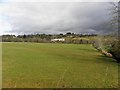
Standing stone marked on OS map adjacent to what appears to be a mound some 15m across. Nearby, around 200m away, appears to be a well defined larger mound some 40m across and 4m high.
You may be viewing yesterday's version of this page. To see the most up to date information please register for a free account.
Do not use the above information on other web sites or publications without permission of the contributor.
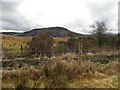
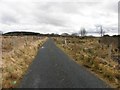
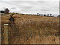
Nearby Images from Geograph Britain and Ireland:
©2010(licence)
©2010(licence)
©2010(licence)
©2010(licence)
©2010(licence)
The above images may not be of the site on this page, they are loaded from Geograph.
Please Submit an Image of this site or go out and take one for us!
Click here to see more info for this site
Nearby sites
Click here to view sites on an interactive map of the areaKey: Red: member's photo, Blue: 3rd party photo, Yellow: other image, Green: no photo - please go there and take one, Grey: site destroyed
Download sites to:
KML (Google Earth)
GPX (GPS waypoints)
CSV (Garmin/Navman)
CSV (Excel)
To unlock full downloads you need to sign up as a Contributory Member. Otherwise downloads are limited to 50 sites.
Turn off the page maps and other distractions
Nearby sites listing. In the following links * = Image available
3.1km NNE 14° Moonbeg* Chambered Tomb (C059010)
8.6km ENE 72° Magherayall* Chambered Tomb (C134007)
18.5km SE 127° Garvagh Court Tomb Court Tomb (H201869)
19.9km N 1° St. Colmcille's Stone* Wedge Tomb (C0535617857)
20.3km E 83° Beltany* Stone Circle (C2543600364)
21.9km ENE 58° Labbadish Stone Row / Alignment (C238096)
21.9km E 91° Kilmonaster Site D* Passage Grave
22.1km E 91° Kilmonaster Site A* Passage Grave
22.4km ESE 115° Creevy Upper Stone Row / Alignment (H255885)
24.7km E 91° Croaghan Hill* Cairn
24.8km SE 135° Leitrim Portal Tomb* Portal Tomb (H227803)
24.8km WSW 238° Lettermore Stone Circle (G841847)
26.3km SSE 153° Cashelenny Stone Circle (H172745)
27.0km NNE 12° Barnes Lower Standing Stones* Standing Stones (C1077024449)
28.0km NNE 25° Portleon Stone Row / Alignment (C172233)
28.3km SSE 147° Scraghy NW* Stone Circle (H208743)
29.2km NNE 14° Barnes Lower NE Row Stone Row / Alignment (C122263)
29.3km ESE 117° Crew Lower* Standing Stones (H315848)
29.5km SE 145° Crockalaghta* Chambered Tomb (H222738)
29.5km NNE 21° Drumard* Chambered Tomb (C159255)
29.6km SSE 148° Scraghy SE Stone Circle (H211730)
30.6km SSE 148° Meenacloy Standing Stones* Standing Stones
31.0km SSE 151° Drumskinny* Stone Circle (H2008670721)
31.8km SSE 154° Montiaghroe Centre* Stone Circle (H19326948)
31.8km SSE 154° Montiaghroe SE Stone Circle (H191693)
View more nearby sites and additional images


 We would like to know more about this location. Please feel free to add a brief description and any relevant information in your own language.
 Wir möchten mehr über diese Stätte erfahren. Bitte zögern Sie nicht, eine kurze Beschreibung und relevante Informationen in Deutsch hinzuzufügen.
 Nous aimerions en savoir encore un peu sur les lieux. S'il vous plaît n'hesitez pas à ajouter une courte description et tous les renseignements pertinents dans votre propre langue.
 Quisieramos informarnos un poco más de las lugares. No dude en añadir una breve descripción y otros datos relevantes en su propio idioma.