<< Text Pages >> Lynx Cave - Cave or Rock Shelter in Wales in Denbighshire
Submitted by coldrum on Sunday, 15 November 2020 Page Views: 729
Neolithic and Bronze AgeSite Name: Lynx Cave Alternative Name: Bryn AlynCountry: Wales
NOTE: This site is 0.446 km away from the location you searched for.
County: Denbighshire Type: Cave or Rock Shelter
Nearest Town: Mold
Map Ref: SJ19765931
Latitude: 53.124897N Longitude: 3.200548W
Condition:
| 5 | Perfect |
| 4 | Almost Perfect |
| 3 | Reasonable but with some damage |
| 2 | Ruined but still recognisable as an ancient site |
| 1 | Pretty much destroyed, possibly visible as crop marks |
| 0 | No data. |
| -1 | Completely destroyed |
| 5 | Superb |
| 4 | Good |
| 3 | Ordinary |
| 2 | Not Good |
| 1 | Awful |
| 0 | No data. |
| 5 | Can be driven to, probably with disabled access |
| 4 | Short walk on a footpath |
| 3 | Requiring a bit more of a walk |
| 2 | A long walk |
| 1 | In the middle of nowhere, a nightmare to find |
| 0 | No data. |
| 5 | co-ordinates taken by GPS or official recorded co-ordinates |
| 4 | co-ordinates scaled from a detailed map |
| 3 | co-ordinates scaled from a bad map |
| 2 | co-ordinates of the nearest village |
| 1 | co-ordinates of the nearest town |
| 0 | no data |
Be the first person to rate this site - see the 'Contribute!' box in the right hand menu.
Internal Links:
External Links:
Cave or Rock Shelter in Wales
Named after the discovery of a Lynx mandible during excavation.
Remains from the Paleolithic, Bronze age and Romano British periods have been discovered here.
This is a link
You may be viewing yesterday's version of this page. To see the most up to date information please register for a free account.
Do not use the above information on other web sites or publications without permission of the contributor.
Nearby Images from Geograph Britain and Ireland:
©2009(licence)
©2010(licence)
©2010(licence)
©2008(licence)
©2009(licence)
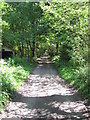
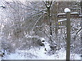
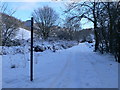
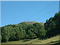
The above images may not be of the site on this page, they are loaded from Geograph.
Please Submit an Image of this site or go out and take one for us!
Click here to see more info for this site
Nearby sites
Key: Red: member's photo, Blue: 3rd party photo, Yellow: other image, Green: no photo - please go there and take one, Grey: site destroyed
Download sites to:
KML (Google Earth)
GPX (GPS waypoints)
CSV (Garmin/Navman)
CSV (Excel)
To unlock full downloads you need to sign up as a Contributory Member. Otherwise downloads are limited to 50 sites.
Turn off the page maps and other distractions
Nearby sites listing. In the following links * = Image available
1.2km N 0° Big Covert Cave or Rock Shelter (SJ19796055)
3.1km SW 235° Moel Gwy Tumulus* Round Cairn (SJ172576)
3.1km S 187° Llanarmon Cave Cave or Rock Shelter (SJ1933956265)
3.2km S 190° Llanarmon Yn Ial (St Garmon)* Stone Circle (SJ1912656153)
3.3km N 7° Carreg Carn March Arthur Marker Stone (SJ202626)
3.3km S 185° Tomen Y Faerdre Standing Stone* Standing Stone (Menhir) (SJ194560)
3.4km S 185° Cefn Canol* Round Barrow(s) (SJ194559)
3.5km WNW 282° Foel Fenlli* Hillfort (SJ1632060080)
4.2km WNW 297° Coed Clwyd Cairns* Burial Chamber or Dolmen (SJ16026127)
4.5km WNW 298° Bwlch Penbarra Marker Stone (SJ1584661500)
4.6km SW 219° Llanarmon Yn Lal Burial Mounds* Round Barrow(s) (SJ168558)
4.6km ESE 113° Pentre Round Barrow* Round Barrow(s) (SJ2401057440)
4.6km SW 214° Moel Y Plas Tumulus* Round Cairn (SJ171555)
4.7km ESE 107° Pen Y Stryt Barrow* Round Barrow(s) (SJ2423057830)
4.8km ESE 103° Bryntirion Round Barrows* Round Barrow(s) (SJ2445058160)
4.9km SSE 158° Llyn Cyfynwy Round Cairn* Round Cairn (SJ215547)
5.2km E 100° Carreg-y-Llech* Standing Stone (Menhir) (SJ24875835)
5.5km WNW 296° Moel-y-Gaer (Loggerheads)* Hillfort (SJ14866175)
5.8km S 189° Perthi Chwarae Farm Cave 1 Cave or Rock Shelter (SJ18795363)
5.8km S 188° Rhos Isaf Cave* Cave or Rock Shelter (SJ18845355)
5.9km NNE 24° Goblins Well Holy Well or Sacred Spring (SJ22256469)
6.0km WSW 254° St Meugan's Cross Early Christian Sculptured Stone (SJ14005774)
6.0km NE 40° Mold Library and Museum* Museum (SJ237639)
6.2km WSW 245° Cefn Coch Tumulus Round Barrow(s) (SJ141568)
6.2km NE 37° Standing Stone St Mary's Church* Standing Stone (Menhir) (SJ2363864213)
View more nearby sites and additional images


 We would like to know more about this location. Please feel free to add a brief description and any relevant information in your own language.
 Wir möchten mehr über diese Stätte erfahren. Bitte zögern Sie nicht, eine kurze Beschreibung und relevante Informationen in Deutsch hinzuzufügen.
 Nous aimerions en savoir encore un peu sur les lieux. S'il vous plaît n'hesitez pas à ajouter une courte description et tous les renseignements pertinents dans votre propre langue.
 Quisieramos informarnos un poco más de las lugares. No dude en añadir una breve descripción y otros datos relevantes en su propio idioma.