<< Our Photo Pages >> Warren Tump (Wrexham) - Round Barrow(s) in Wales in Wrexham
Submitted by TimPrevett on Thursday, 11 September 2008 Page Views: 4078
Neolithic and Bronze AgeSite Name: Warren Tump (Wrexham)Country: Wales
NOTE: This site is 7.71 km away from the location you searched for.
County: Wrexham Type: Round Barrow(s)
Nearest Town: Whitchurch (Shrops) Nearest Village: Whitewell
Map Ref: SJ49974206
Latitude: 52.973545N Longitude: 2.746465W
Condition:
| 5 | Perfect |
| 4 | Almost Perfect |
| 3 | Reasonable but with some damage |
| 2 | Ruined but still recognisable as an ancient site |
| 1 | Pretty much destroyed, possibly visible as crop marks |
| 0 | No data. |
| -1 | Completely destroyed |
| 5 | Superb |
| 4 | Good |
| 3 | Ordinary |
| 2 | Not Good |
| 1 | Awful |
| 0 | No data. |
| 5 | Can be driven to, probably with disabled access |
| 4 | Short walk on a footpath |
| 3 | Requiring a bit more of a walk |
| 2 | A long walk |
| 1 | In the middle of nowhere, a nightmare to find |
| 0 | No data. |
| 5 | co-ordinates taken by GPS or official recorded co-ordinates |
| 4 | co-ordinates scaled from a detailed map |
| 3 | co-ordinates scaled from a bad map |
| 2 | co-ordinates of the nearest village |
| 1 | co-ordinates of the nearest town |
| 0 | no data |
Internal Links:
External Links:
 (PID:102035)")
A large (likely) barrow upon a natural rise in the landscape.
You may be viewing yesterday's version of this page. To see the most up to date information please register for a free account.
 (PID:102037)")
 (PID:102036)")
 (PID:102034)")
Do not use the above information on other web sites or publications without permission of the contributor.
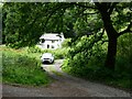
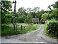
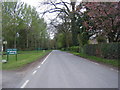
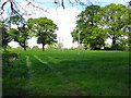
Nearby Images from Geograph Britain and Ireland:
©2023(licence)
©2023(licence)
©2011(licence)
©2019(licence)
©2016(licence)
The above images may not be of the site on this page, they are loaded from Geograph.
Please Submit an Image of this site or go out and take one for us!
Click here to see more info for this site
Nearby sites
Key: Red: member's photo, Blue: 3rd party photo, Yellow: other image, Green: no photo - please go there and take one, Grey: site destroyed
Download sites to:
KML (Google Earth)
GPX (GPS waypoints)
CSV (Garmin/Navman)
CSV (Excel)
To unlock full downloads you need to sign up as a Contributory Member. Otherwise downloads are limited to 50 sites.
Turn off the page maps and other distractions
Nearby sites listing. In the following links * = Image available
615m SW 221° Whitewell 1* Round Barrow(s) (SJ49564160)
845m SW 215° Whitewell (St Marys)* Holy Well or Sacred Spring (SJ49484137)
3.7km WSW 252° Bryn Rossett* Round Barrow(s) (SJ46454095)
3.8km WNW 302° Oldcastle* Hillfort (SJ468441)
7.5km S 182° Lady Well (Whixall)* Holy Well or Sacred Spring (SJ496346)
7.7km NW 324° Meadows Farm Barrow* Round Barrow(s) (SJ45454834)
9.1km SW 223° Hoar Stone (Welshampton)* Standing Stone (Menhir) (SJ43613550)
9.5km SW 221° Welshampton Bowl Barrow* Round Barrow(s) (SJ43573499)
10.8km N 359° Maiden Castle (Cheshire)* Hillfort (SJ49805286)
12.0km SSE 158° Soulton Long Barrow* Modern Stone Circle etc (SJ5441330922)
12.0km NNW 342° Carden Park Barrow Round Barrow(s) (SJ46365352)
12.2km NNW 342° Carden Park* Cave or Rock Shelter (SJ463537)
13.4km NNW 348° St Winefride's (Clutton)* Holy Well or Sacred Spring (SJ47395524)
13.6km WNW 286° Gerwyn Fechan Cursus (SJ36884584)
16.1km E 84° St James the Great, Audlem* Round Barrow(s) (SJ66004365)
16.1km E 84° The Bear Stone* Natural Stone / Erratic / Other Natural Feature (SJ66004365)
16.2km NNE 15° Peckforton Mere* Ancient Village or Settlement (SJ543577)
16.3km NNW 327° Churton* Long Barrow (SJ411558)
16.5km SSE 151° Bury Walls* Hillfort (SJ577275)
16.6km NNW 327° Knowl Plantation Barrow Cemetery (SJ410561)
17.2km NE 49° Church of St Mary the Virgin (Acton)* Ancient Cross (SJ63175308)
17.5km NW 306° Borras Quarry Neolithic Village Ancient Village or Settlement (SJ35855243)
17.6km NNE 12° Beeston Castle* Hillfort (SJ538592)
18.1km WNW 293° Hillbury* Round Barrow(s) (SJ33424939)
18.2km NE 55° Old Biot* Holy Well or Sacred Spring (SJ64965243)
View more nearby sites and additional images

")
 We would like to know more about this location. Please feel free to add a brief description and any relevant information in your own language.
 Wir möchten mehr über diese Stätte erfahren. Bitte zögern Sie nicht, eine kurze Beschreibung und relevante Informationen in Deutsch hinzuzufügen.
 Nous aimerions en savoir encore un peu sur les lieux. S'il vous plaît n'hesitez pas à ajouter une courte description et tous les renseignements pertinents dans votre propre langue.
 Quisieramos informarnos un poco más de las lugares. No dude en añadir una breve descripción y otros datos relevantes en su propio idioma.