<< Text Pages >> Rearsby Timber Circle - Timber Circle in England in Leicestershire and Rutland
Submitted by enkidu41 on Friday, 13 August 2004 Page Views: 5731
Neolithic and Bronze AgeSite Name: Rearsby Timber Circle Alternative Name: Rearsby GrangeCountry: England County: Leicestershire and Rutland Type: Timber Circle
Map Ref: SK643142 Landranger Map Number: 129
Latitude: 52.721638N Longitude: 1.049443W
Condition:
| 5 | Perfect |
| 4 | Almost Perfect |
| 3 | Reasonable but with some damage |
| 2 | Ruined but still recognisable as an ancient site |
| 1 | Pretty much destroyed, possibly visible as crop marks |
| 0 | No data. |
| -1 | Completely destroyed |
| 5 | Superb |
| 4 | Good |
| 3 | Ordinary |
| 2 | Not Good |
| 1 | Awful |
| 0 | No data. |
| 5 | Can be driven to, probably with disabled access |
| 4 | Short walk on a footpath |
| 3 | Requiring a bit more of a walk |
| 2 | A long walk |
| 1 | In the middle of nowhere, a nightmare to find |
| 0 | No data. |
| 5 | co-ordinates taken by GPS or official recorded co-ordinates |
| 4 | co-ordinates scaled from a detailed map |
| 3 | co-ordinates scaled from a bad map |
| 2 | co-ordinates of the nearest village |
| 1 | co-ordinates of the nearest town |
| 0 | no data |
Internal Links:
External Links:
I have visited· I would like to visit
Jilljill would like to visit
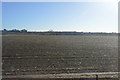
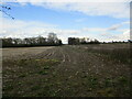
Cropmarks are the only evidence remaining and they show a 65' diameter ring of 80 large post holes which probably held wooden markers to form a timber circle.
It is likely that the whole may have been a small henge or simply a ring ditch.
You may be viewing yesterday's version of this page. To see the most up to date information please register for a free account.
Do not use the above information on other web sites or publications without permission of the contributor.
Nearby Images from Geograph Britain and Ireland:
©2015(licence)

©2011(licence)
©2015(licence)
©2022(licence)
©2022(licence)
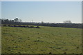
The above images may not be of the site on this page, they are loaded from Geograph.
Please Submit an Image of this site or go out and take one for us!
Click here to see more info for this site
Nearby sites
Key: Red: member's photo, Blue: 3rd party photo, Yellow: other image, Green: no photo - please go there and take one, Grey: site destroyed
Download sites to:
KML (Google Earth)
GPX (GPS waypoints)
CSV (Garmin/Navman)
CSV (Excel)
To unlock full downloads you need to sign up as a Contributory Member. Otherwise downloads are limited to 50 sites.
Turn off the page maps and other distractions
Nearby sites listing. In the following links * = Image available
743m ENE 65° Blue Stone (Rearsby)* Natural Stone / Erratic / Other Natural Feature (SK6497414518)
2.3km SSE 155° Queniborough Stones* Standing Stones (SK653121)
3.3km S 170° Mowde Bush Stone* Standing Stone (Menhir) (SK649110)
3.9km NE 38° Hoby Stone Standing Stone (Menhir) (SK667173)
4.0km WSW 252° Cossington Bronze Age Barrows* Barrow Cemetery (SK605129)
4.5km ESE 104° The Blue Stone (Gaddesby)* Standing Stone (Menhir) (SK687132)
5.9km WSW 255° Rothley Cross* Ancient Cross (SK5861312637)
6.0km NNE 18° Ragdale Stone* Standing Stone (Menhir) (SK661199)
6.1km ENE 63° Stump Cross (Frisby on the Wreake) Ancient Cross (SK6969917032)
6.1km SSE 165° Beeby Henge (SK660083)
6.2km ENE 57° Frisby Cross Ancient Cross (SK6942017659)
6.3km SSE 161° Beeby Holy Well* Holy Well or Sacred Spring (SK664083)
7.1km SW 222° St James (Birstall) Early Christian Sculptured Stone (SK59630884)
7.2km E 97° Folville Cross* Ancient Cross (SK715134)
7.3km SSW 196° The Humber Stone* Standing Stone (Menhir) (SK6241607095)
8.0km NE 55° All Saints (Asfordby)* Ancient Cross (SK7081218939)
8.1km NE 54° Asfordby Cross* Ancient Cross (SK7078419006)
8.6km WSW 246° Thurcaston A* Standing Stone (Menhir) (SK56501060)
8.6km NNE 29° Grimston Stone* Standing Stone (Menhir) (SK684218)
8.7km WSW 244° Thurcaston B Standing Stone (Menhir) (SK56481030)
8.7km W 260° Cross (near Swithland)* Ancient Cross (SK557126)
8.8km NNE 29° Grimston Church Monolith* Standing Stone (Menhir) (SK685219)
8.8km WSW 244° Thurcaston C and D Standing Stones (SK56431020)
9.2km WSW 237° Beaumont Leys* Standing Stones (SK566091)
9.3km NE 44° Saxelbye Stone* Standing Stone (Menhir) (SK707210)
View more nearby sites and additional images


 We would like to know more about this location. Please feel free to add a brief description and any relevant information in your own language.
 Wir möchten mehr über diese Stätte erfahren. Bitte zögern Sie nicht, eine kurze Beschreibung und relevante Informationen in Deutsch hinzuzufügen.
 Nous aimerions en savoir encore un peu sur les lieux. S'il vous plaît n'hesitez pas à ajouter une courte description et tous les renseignements pertinents dans votre propre langue.
 Quisieramos informarnos un poco más de las lugares. No dude en añadir una breve descripción y otros datos relevantes en su propio idioma.