<< Text Pages >> Llandrilo Cross - Standing Stones in Wales in Carmarthenshire
Submitted by vicky on Sunday, 29 September 2002 Page Views: 3991
Neolithic and Bronze AgeSite Name: Llandrilo CrossCountry: Wales
NOTE: This site is 2.07 km away from the location you searched for.
County: Carmarthenshire Type: Standing Stones
Nearest Town: Newcastle Emlyn Nearest Village: Trelech
Map Ref: SN298288 Landranger Map Number: 145
Latitude: 51.931617N Longitude: 4.476972W
Condition:
| 5 | Perfect |
| 4 | Almost Perfect |
| 3 | Reasonable but with some damage |
| 2 | Ruined but still recognisable as an ancient site |
| 1 | Pretty much destroyed, possibly visible as crop marks |
| 0 | No data. |
| -1 | Completely destroyed |
| 5 | Superb |
| 4 | Good |
| 3 | Ordinary |
| 2 | Not Good |
| 1 | Awful |
| 0 | No data. |
| 5 | Can be driven to, probably with disabled access |
| 4 | Short walk on a footpath |
| 3 | Requiring a bit more of a walk |
| 2 | A long walk |
| 1 | In the middle of nowhere, a nightmare to find |
| 0 | No data. |
| 5 | co-ordinates taken by GPS or official recorded co-ordinates |
| 4 | co-ordinates scaled from a detailed map |
| 3 | co-ordinates scaled from a bad map |
| 2 | co-ordinates of the nearest village |
| 1 | co-ordinates of the nearest town |
| 0 | no data |
Internal Links:
External Links:
Standing Stones in Carmarthenshire
Have you visited this site? Please add a comment below.
You may be viewing yesterday's version of this page. To see the most up to date information please register for a free account.
Do not use the above information on other web sites or publications without permission of the contributor.
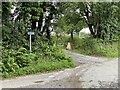
Nearby Images from Geograph Britain and Ireland:
©2008(licence)
©2008(licence)
©2021(licence)
©2008(licence)
©2021(licence)
The above images may not be of the site on this page, they are loaded from Geograph.
Please Submit an Image of this site or go out and take one for us!
Click here to see more info for this site
Nearby sites
Key: Red: member's photo, Blue: 3rd party photo, Yellow: other image, Green: no photo - please go there and take one, Grey: site destroyed
Download sites to:
KML (Google Earth)
GPX (GPS waypoints)
CSV (Garmin/Navman)
CSV (Excel)
To unlock full downloads you need to sign up as a Contributory Member. Otherwise downloads are limited to 50 sites.
Turn off the page maps and other distractions
Nearby sites listing. In the following links * = Image available
2.6km N 358° Crug Glas Cairn* Cairn (SN298314)
2.8km NNE 29° Crugievan* Round Barrow(s) (SN3124931238)
3.1km WSW 243° Castell Mawr (Carmarthenshire) Hillfort (SN27032750)
3.8km S 185° Crug-Y-Dryn* Chambered Cairn (SN29342500)
4.1km W 271° Pencastell Promontory Fort / Cliff Castle (SN25722899)
5.9km NNW 343° Hen Caerau Misc. Earthwork (SN283345)
6.0km WNW 287° Castell y Blaidd* Cairn (SN241308)
6.3km W 269° Crugel Win* Round Barrow(s) (SN23492888)
7.5km N 359° Ban-Y-Felin Burnt Mound Misc. Earthwork (SN29963633)
7.8km W 262° Ffynnonwen Iron Age Settlement Ancient Village or Settlement (SN2228)
7.9km S 169° Pen-Y-Gaer (Meidrim) Hillfort (SN31002102)
8.0km NE 43° Ty-Mathiau Stone Row / Alignment (SN35483452)
8.1km SE 132° Pen-Y-Gaer (Abernant) Hillfort (SN35602316)
8.2km NW 323° St Clydau's Church* Early Christian Sculptured Stone (SN251355)
8.5km ENE 61° Cerrig Llwydion (Carms)* Chambered Tomb (SN374326)
8.5km ESE 121° Cilcrug Hillfort (SN37002416)
8.6km WNW 285° Rhyd-y-Gath* Early Christian Sculptured Stone (SN21503125)
8.7km WSW 253° Crug Hywel Cairn Cairn (SN214266)
8.7km WSW 251° Tumulus at Pantglas* Cairn (SN215262)
8.9km WNW 283° Llanfyrnach C* Standing Stone (Menhir) (SN21163105)
9.1km ENE 58° Clawdd Mawr* Misc. Earthwork (SN37743335)
9.3km WNW 283° Llanfyrnach B* Standing Stone (Menhir) (SN20793121)
9.4km WNW 284° Llanfyrnach A* Standing Stone (Menhir) (SN20753141)
9.4km NW 308° Frenni Fach* Round Barrow(s) (SN226349)
10.1km ENE 73° Crug Bach* Round Barrow(s) (SN39603147)
View more nearby sites and additional images


 We would like to know more about this location. Please feel free to add a brief description and any relevant information in your own language.
 Wir möchten mehr über diese Stätte erfahren. Bitte zögern Sie nicht, eine kurze Beschreibung und relevante Informationen in Deutsch hinzuzufügen.
 Nous aimerions en savoir encore un peu sur les lieux. S'il vous plaît n'hesitez pas à ajouter une courte description et tous les renseignements pertinents dans votre propre langue.
 Quisieramos informarnos un poco más de las lugares. No dude en añadir una breve descripción y otros datos relevantes en su propio idioma.