<< Our Photo Pages >> Le Gal de Gauchin - Standing Stone (Menhir) in France in Nord:Pas-de-Calais (62)
Submitted by LaDragonne on Monday, 26 February 2024 Page Views: 150
Neolithic and Bronze AgeSite Name: Le Gal de GauchinCountry: France
NOTE: This site is 18.789 km away from the location you searched for.
Département: Nord:Pas-de-Calais (62) Type: Standing Stone (Menhir)
Nearest Town: Lens Nearest Village: Gauchin-le-Gal
Latitude: 50.415070N Longitude: 2.580950E
Condition:
| 5 | Perfect |
| 4 | Almost Perfect |
| 3 | Reasonable but with some damage |
| 2 | Ruined but still recognisable as an ancient site |
| 1 | Pretty much destroyed, possibly visible as crop marks |
| 0 | No data. |
| -1 | Completely destroyed |
| 5 | Superb |
| 4 | Good |
| 3 | Ordinary |
| 2 | Not Good |
| 1 | Awful |
| 0 | No data. |
| 5 | Can be driven to, probably with disabled access |
| 4 | Short walk on a footpath |
| 3 | Requiring a bit more of a walk |
| 2 | A long walk |
| 1 | In the middle of nowhere, a nightmare to find |
| 0 | No data. |
| 5 | co-ordinates taken by GPS or official recorded co-ordinates |
| 4 | co-ordinates scaled from a detailed map |
| 3 | co-ordinates scaled from a bad map |
| 2 | co-ordinates of the nearest village |
| 1 | co-ordinates of the nearest town |
| 0 | no data |
Internal Links:
External Links:
")
Pierre initialement ovoïde en grès de plus de 130kg, reliée par une chaine à un socle fruste de grès, lui aussi. Elle est installée sur la place du village. Elle est réputée rouler la nuit bruyamment sur les chaussées, d'où la chaîne maintenant pour garantir la tranquillité.
Elle est moins grande qu'il y a deux siècles.
Elle est polie, signe d'un usage intensif.
C'est une pierre à légendes, dont une relative à la sexualité.
Le terme Gal est un mot d'ancien français qui a donné le mot "galet" au 12ème siècle.
Sa datation et sa localisation première sont incertaines : mégalithe? œuf funéraire gallo-romain? pilori?
You may be viewing yesterday's version of this page. To see the most up to date information please register for a free account.
Do not use the above information on other web sites or publications without permission of the contributor.
Nearby Images from Flickr

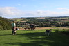
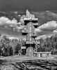
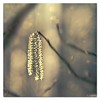

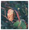
The above images may not be of the site on this page, but were taken nearby. They are loaded from Flickr so please click on them for image credits.
Click here to see more info for this site
Nearby sites
Click here to view sites on an interactive map of the areaKey: Red: member's photo, Blue: 3rd party photo, Yellow: other image, Green: no photo - please go there and take one, Grey: site destroyed
Download sites to:
KML (Google Earth)
GPX (GPS waypoints)
CSV (Garmin/Navman)
CSV (Excel)
To unlock full downloads you need to sign up as a Contributory Member. Otherwise downloads are limited to 50 sites.
Turn off the page maps and other distractions
Nearby sites listing. In the following links * = Image available
1.9km E 85° Dolmen dit la Table des Fées* Burial Chamber or Dolmen
10.1km SE 138° Les Pierres Jumelles (Mont-Saint-Éloi)* Standing Stones
22.1km ENE 75° Tombe de Pont-a-Vendin Burial Chamber or Dolmen
31.9km ESE 119° Cromlech dit Les-Sept-Bonnettes* Stone Circle
35.5km ESE 117° La Pierre du Diable (Lécluse)* Standing Stone (Menhir)
36.8km ESE 113° Dolmen dit les Pierres Chavattes* Burial Chamber or Dolmen
37.8km SW 229° Dolmen de Béalcourt* Burial Chamber or Dolmen
37.8km NNE 16° La Pierre-qui-Tourne de Bailleul Standing Stone (Menhir)
38.9km E 91° Douai Musée d'Archéologie* Museum
40.3km ESE 114° Palluel Menhir Statue* Standing Stone (Menhir)
40.6km ESE 116° Le Gros Caillou (Oisy-le-Verger)* Standing Stone (Menhir)
41.8km NNE 14° Petit Janne de Yourcenar* Standing Stone (Menhir)
43.4km ESE 112° La-Pierre-qui-Pousse (Aubigny-au-Bac)* Standing Stone (Menhir)
43.4km ESE 105° Menhir dit la Borne-Grand-Père* Marker Stone
46.7km ENE 64° Mont des Tombes Hillfort
47.4km SSW 207° Underground City of Naours Ancient Mine, Quarry or other Industry
47.8km ESE 110° Féchain Polissoir* Polissoir
47.9km S 189° Menhir dit la Pierre d'Oblicamp* Standing Stone (Menhir)
50.6km S 181° Ribemont-Sur-Ancre Centre archéologique départemental* Museum
53.9km ESE 119° Pierres Jumelles (Cambrai)* Standing Stone (Menhir)
55.9km ESE 122° Cromlech de Niergnies* Stone Circle
56.9km NNE 31° Porch am Tir Nan Myfyr* Stone Circle
57.2km SSW 207° Les Gres Burial Chamber or Dolmen
57.5km NNE 21° Boezinge* Modern Stone Circle etc
59.1km SSW 209° Oppidum dit Camp de César (Saint-Sauveur) Ancient Village or Settlement
View more nearby sites and additional images


 We would like to know more about this location. Please feel free to add a brief description and any relevant information in your own language.
 Wir möchten mehr über diese Stätte erfahren. Bitte zögern Sie nicht, eine kurze Beschreibung und relevante Informationen in Deutsch hinzuzufügen.
 Nous aimerions en savoir encore un peu sur les lieux. S'il vous plaît n'hesitez pas à ajouter une courte description et tous les renseignements pertinents dans votre propre langue.
 Quisieramos informarnos un poco más de las lugares. No dude en añadir una breve descripción y otros datos relevantes en su propio idioma.