<< Our Photo Pages >> Gungywamp - Standing Stones in United States in New England
Submitted by thecaptain on Wednesday, 06 February 2008 Page Views: 17356
Neolithic and Bronze AgeSite Name: GungywampCountry: United States Region: New England Type: Standing Stones
Nearest Town: New London, Ct Nearest Village: Groton
Latitude: 41.416000N Longitude: 72.056W
Condition:
| 5 | Perfect |
| 4 | Almost Perfect |
| 3 | Reasonable but with some damage |
| 2 | Ruined but still recognisable as an ancient site |
| 1 | Pretty much destroyed, possibly visible as crop marks |
| 0 | No data. |
| -1 | Completely destroyed |
| 5 | Superb |
| 4 | Good |
| 3 | Ordinary |
| 2 | Not Good |
| 1 | Awful |
| 0 | No data. |
| 5 | Can be driven to, probably with disabled access |
| 4 | Short walk on a footpath |
| 3 | Requiring a bit more of a walk |
| 2 | A long walk |
| 1 | In the middle of nowhere, a nightmare to find |
| 0 | No data. |
| 5 | co-ordinates taken by GPS or official recorded co-ordinates |
| 4 | co-ordinates scaled from a detailed map |
| 3 | co-ordinates scaled from a bad map |
| 2 | co-ordinates of the nearest village |
| 1 | co-ordinates of the nearest town |
| 0 | no data |
Be the first person to rate this site - see the 'Contribute!' box in the right hand menu.
Internal Links:
External Links:
")
Please note :- Site position approximate, taken from local map.
Note: Recent newspaper description of mysterious site.
You may be viewing yesterday's version of this page. To see the most up to date information please register for a free account.
")
")
Do not use the above information on other web sites or publications without permission of the contributor.
Nearby Images from Flickr


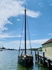

The above images may not be of the site on this page, but were taken nearby. They are loaded from Flickr so please click on them for image credits.
Click here to see more info for this site
Nearby sites
Click here to view sites on an interactive map of the areaKey: Red: member's photo, Blue: 3rd party photo, Yellow: other image, Green: no photo - please go there and take one, Grey: site destroyed
Download sites to:
KML (Google Earth)
GPX (GPS waypoints)
CSV (Garmin/Navman)
CSV (Excel)
To unlock full downloads you need to sign up as a Contributory Member. Otherwise downloads are limited to 50 sites.
Turn off the page maps and other distractions
Nearby sites listing. In the following links * = Image available
5.5km E 87° Ledyard Stone Enclosures Cairn
8.4km ENE 58° Mashantucket Pit Houses Ancient Village or Settlement
11.4km NNW 326° Montville Chamber* Souterrain (Fogou, Earth House)
46.2km NNW 339° Connecticut Archaeology Center* Museum
60.0km ENE 64° Narragansett Rune Stone* Modern Stone Circle etc
66.1km NE 47° Ochee Spring Quarry Ancient Mine, Quarry or other Industry
73.1km W 262° Connecticut Seid* Natural Stone / Erratic / Other Natural Feature
74.3km NE 34° Nipsachuk Cairn
90.1km ENE 60° The Dighton Rock* Carving
94.8km NE 42° Foxborough Perched Boulder (2)* Natural Stone / Erratic / Other Natural Feature
95.0km NE 42° Foxborough Perched Boulder (6)* Natural Stone / Erratic / Other Natural Feature
95.1km NE 42° Foxborough Perched Boulder (3)* Natural Stone / Erratic / Other Natural Feature
95.2km NE 42° Foxborough Standing Stone (3)* Marker Stone
95.2km NE 42° Foxborough Prayer Seat (10)* Cairn
95.2km NE 42° Foxborough Perched Boulder (4)* Natural Stone / Erratic / Other Natural Feature
95.3km NE 42° Foxborough Stone Ring* Ring Cairn
95.3km NE 42° Foxborough Cairn* Cairn
95.4km NE 42° Foxborough Prayer Seat (5)* Cairn
95.4km NE 42° Foxborough Perched Boulder (5)* Natural Stone / Erratic / Other Natural Feature
95.5km NE 42° Foxborough Standing Stone (5)* Marker Stone
95.5km NE 42° Foxborough Prayer Seat (7)* Cairn
95.5km NE 42° Foxborough Prayer Seat (8)* Cairn
95.5km NE 42° Foxborough Standing Stone (2)* Marker Stone
95.5km NE 42° Foxborough Prayer Seat and Stone Ring* Cairn
95.6km NE 42° Foxborough Standing Stone (4)* Marker Stone
View more nearby sites and additional images


 We would like to know more about this location. Please feel free to add a brief description and any relevant information in your own language.
 Wir möchten mehr über diese Stätte erfahren. Bitte zögern Sie nicht, eine kurze Beschreibung und relevante Informationen in Deutsch hinzuzufügen.
 Nous aimerions en savoir encore un peu sur les lieux. S'il vous plaît n'hesitez pas à ajouter une courte description et tous les renseignements pertinents dans votre propre langue.
 Quisieramos informarnos un poco más de las lugares. No dude en añadir una breve descripción y otros datos relevantes en su propio idioma.