<< Other Photo Pages >> Collins Site - Ancient Village or Settlement in United States in Great Lakes Midwest
Submitted by bat400 on Sunday, 01 November 2015 Page Views: 6000
Multi-periodSite Name: Collins Site Alternative Name: ISAS nos. V-15, V-82, & V-394, Indian Springs Mound (11V82)Country: United States
NOTE: This site is 89.182 km away from the location you searched for.
Region: Great Lakes Midwest Type: Ancient Village or Settlement
Nearest Town: Danville, IL
Latitude: 40.211384N Longitude: 87.743W
Condition:
| 5 | Perfect |
| 4 | Almost Perfect |
| 3 | Reasonable but with some damage |
| 2 | Ruined but still recognisable as an ancient site |
| 1 | Pretty much destroyed, possibly visible as crop marks |
| 0 | No data. |
| -1 | Completely destroyed |
| 5 | Superb |
| 4 | Good |
| 3 | Ordinary |
| 2 | Not Good |
| 1 | Awful |
| 0 | No data. |
| 5 | Can be driven to, probably with disabled access |
| 4 | Short walk on a footpath |
| 3 | Requiring a bit more of a walk |
| 2 | A long walk |
| 1 | In the middle of nowhere, a nightmare to find |
| 0 | No data. |
| 5 | co-ordinates taken by GPS or official recorded co-ordinates |
| 4 | co-ordinates scaled from a detailed map |
| 3 | co-ordinates scaled from a bad map |
| 2 | co-ordinates of the nearest village |
| 1 | co-ordinates of the nearest town |
| 0 | no data |
Internal Links:
External Links:
")
Per the Illinois State Archaeological Survey, "Extensive excavations were conducted here in the 1970s by University of Illinois archaeologists, and over 70 boxes of material and samples from these site excavations are curated in the ISAS collections." The sites lie within the Kennekuk Cove County Park and partially accessible on a marked hiking trail. Recent activities at the site include removing invasive plant species from the area.
National Register of Historic Places Listing:
Collins Archeological District (added 1979 - - #79000872)
Also known as Illinois Archaeological Survey Nos. V-15, V-82, & V-394
Address Restricted , Danville
Historic Significance: Information Potential
Area of Significance: Prehistoric
Cultural Affiliation: Late Woodland
Period of Significance: 1850-1874, 1825-1849
Owner: State
Historic Function: Domestic
Historic Sub-function: Village Site
Current Function: Landscape
Current Sub-function: Underwater
Note: ISAS Staff Restores the Collins Mound Complex in East-Central Illinois. See comments.
You may be viewing yesterday's version of this page. To see the most up to date information please register for a free account.
")
Do not use the above information on other web sites or publications without permission of the contributor.
Nearby Images from Flickr
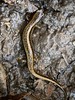
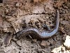


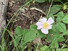
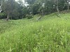
The above images may not be of the site on this page, but were taken nearby. They are loaded from Flickr so please click on them for image credits.
Click here to see more info for this site
Nearby sites
Click here to view sites on an interactive map of the areaKey: Red: member's photo, Blue: 3rd party photo, Yellow: other image, Green: no photo - please go there and take one, Grey: site destroyed
Download sites to:
KML (Google Earth)
GPX (GPS waypoints)
CSV (Garmin/Navman)
CSV (Excel)
To unlock full downloads you need to sign up as a Contributory Member. Otherwise downloads are limited to 50 sites.
Turn off the page maps and other distractions
Nearby sites listing. In the following links * = Image available
129.3km S 173° Merom Hillfort Ancient Village or Settlement
139.9km SE 124° Blue Bluff Rock Outcrop
140.3km NNW 344° Briscoe Mounds* Artificial Mound
140.6km SE 128° Bundy-Voyles Site* Ancient Village or Settlement
142.8km ESE 110° Indiana State Museum* Museum
152.5km E 93° Strawtown Enclosure* Ancient Village or Settlement
152.6km E 93° Castor Farm Ancient Village or Settlement
155.7km SE 138° Glenn Black Laboratory* Museum
169.3km WSW 255° Illinois State Museum* Museum
172.5km S 173° Indiana - Sugarloaf Mound* Barrow Cemetery
174.2km S 174° Pyramid Mound* Barrow Cemetery
175.9km N 4° University of Chicago Institute* Museum
177.7km NNE 29° Goodall Site* Barrow Cemetery
180.6km E 93° Mounds State Park (Indiana) - Earthwork D* Misc. Earthwork
180.6km E 93° Mounds (Indiana) - Fiddleback Mound* Misc. Earthwork
180.7km E 93° Mounds (Indiana) - Great Mound* Henge
180.7km E 93° Mounds (Indiana) - Earthwork B* Misc. Earthwork
180.9km E 93° Mounds (Indiana)* Henge
180.9km E 93° Mounds (Indiana) - Circle Mound* Misc. Earthwork
184.3km N 3° The Field Museum* Museum
193.1km E 90° Yorktown Enclosure Misc. Earthwork
196.6km SSE 161° Glendale Ridge Archaeological Site Ancient Village or Settlement
197.2km W 274° Rockwell* Artificial Mound
201.9km W 275° Dickson Mounds* Barrow Cemetery
204.2km E 99° Chrysler Enclosure* Henge
View more nearby sites and additional images


 We would like to know more about this location. Please feel free to add a brief description and any relevant information in your own language.
 Wir möchten mehr über diese Stätte erfahren. Bitte zögern Sie nicht, eine kurze Beschreibung und relevante Informationen in Deutsch hinzuzufügen.
 Nous aimerions en savoir encore un peu sur les lieux. S'il vous plaît n'hesitez pas à ajouter une courte description et tous les renseignements pertinents dans votre propre langue.
 Quisieramos informarnos un poco más de las lugares. No dude en añadir una breve descripción y otros datos relevantes en su propio idioma.