<< Our Photo Pages >> Monumento Megalítico da Roça do Casal do Meio - Chambered Tomb in Portugal in Setúbal
Submitted by Bak_teria on Friday, 02 January 2015 Page Views: 3629
Neolithic and Bronze AgeSite Name: Monumento Megalítico da Roça do Casal do MeioCountry: Portugal
NOTE: This site is 16.21 km away from the location you searched for.
Distrito: Setúbal Type: Chambered Tomb
Nearest Town: Sesimbra
Latitude: 38.462842N Longitude: 9.036875W
Condition:
| 5 | Perfect |
| 4 | Almost Perfect |
| 3 | Reasonable but with some damage |
| 2 | Ruined but still recognisable as an ancient site |
| 1 | Pretty much destroyed, possibly visible as crop marks |
| 0 | No data. |
| -1 | Completely destroyed |
| 5 | Superb |
| 4 | Good |
| 3 | Ordinary |
| 2 | Not Good |
| 1 | Awful |
| 0 | No data. |
| 5 | Can be driven to, probably with disabled access |
| 4 | Short walk on a footpath |
| 3 | Requiring a bit more of a walk |
| 2 | A long walk |
| 1 | In the middle of nowhere, a nightmare to find |
| 0 | No data. |
| 5 | co-ordinates taken by GPS or official recorded co-ordinates |
| 4 | co-ordinates scaled from a detailed map |
| 3 | co-ordinates scaled from a bad map |
| 2 | co-ordinates of the nearest village |
| 1 | co-ordinates of the nearest town |
| 0 | no data |
Internal Links:
External Links:
I have visited· I would like to visit
BrunoG would like to visit
Bak_teria visited on 27th Dec 2014 - their rating: Cond: 3 Amb: 5 Access: 3
")
This tholos built with the local limestone have been made during the first half of the 1st millennium BC (mid-eleventh century BC / end of the ninth century BC), corresponding roughly to the Late Bronze Age. This tomb was identified in the early sixties by Octavio da Veiga Ferreira and Georges Zbyszewski, during their survey work for the Geological Map of Portugal. About ten years later, between 16 of October and 11 of November 1972, the archaeological site was the subject of an excavation conducted by KonradSpindler and Veiga Ferreira. This monument was classified as a cultural heritage (Imóvel de Interesse Público) on 25 June, 1984.
About the burials
This megalithic funerary monument provided only two burials. The bodies were deposited in dorsal and lateral position, one of them with legs bent. Recent anthropological studies revealed that both of them show evidence of a regular horse riding practice.
About the artefacts
To these two burials are associated a significant quantity of estate, with particular emphasis on some bronze artefacts (one belt buckle, a ring and some tweezers). In addition to these objects an ivory comb was also found and various ceramic vessels, some of which having a special decorative element known as ornatos brunidos (polished ornaments). The burnishing technique is made with the use of a tool (the burnisher) in which it passes over a ceramic slurry or ceramic engobe before baking the piece and also when it has already been dried, yielding polished grooves that will contrast with the non polished and clearer background.
About the architecture
Making a comparative analysis of the architecture of this monument, we can state that it seems to approach other similar existing structures in the Mediterranean area, with parallels in small characteristics of the type of tholos from Mycenaean time as with some nuraghes of Sardinia. This tomb consists of a subcircular chamber with a false dome and a small access corridor. It was originally covered by a sizeable tumulus. It was also bounded on the outside by a stony circle, reinforced by large limestone blocks. Between the outer wall and the central chamber was possible to observe a circular corridor with no apparent entrance.
About the location
This monument can be visited by walking on a footpath through the site known as Roça do Casal do Meio located in Quinta do Calhariz, at about 1km (0.6 miles) west of the road from Azeitão to Portinho da Arrábida. The route is not signposted, is located in the woods and the monument is well hidden though it is well protected, surrounded by a fence and provided with a descriptive plaque with detailed information about it.
Links and information sources
IGESPAR (webpage where the official classification and asset of this monument is referenced)
Portal do Arqueólogo
PhotoArch - Blog (More detailed Information about this Monument – Text written in Portuguese)
You may be viewing yesterday's version of this page. To see the most up to date information please register for a free account.
")
")
")
Do not use the above information on other web sites or publications without permission of the contributor.
Nearby Images from Flickr

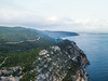


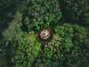
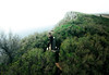
The above images may not be of the site on this page, but were taken nearby. They are loaded from Flickr so please click on them for image credits.
Click here to see more info for this site
Nearby sites
Click here to view sites on an interactive map of the areaKey: Red: member's photo, Blue: 3rd party photo, Yellow: other image, Green: no photo - please go there and take one, Grey: site destroyed
Download sites to:
KML (Google Earth)
GPX (GPS waypoints)
CSV (Garmin/Navman)
CSV (Excel)
To unlock full downloads you need to sign up as a Contributory Member. Otherwise downloads are limited to 50 sites.
Turn off the page maps and other distractions
Nearby sites listing. In the following links * = Image available
13.5km E 79° Cetóbriga Ancient Village or Settlement
14.2km NE 37° Grutas da Quinta do Anjo* Rock Cut Tomb
15.3km NE 43° Castro de Chibanes* Castro or Chafurdão
29.5km NNW 341° Museo Geológico - Lisboa* Museum
30.0km NNW 330° Museu Nacional de Arqueologia* Museum
31.2km E 97° Abul* Ancient Mine, Quarry or other Industry
34.4km N 352° Humming Stone Lisbon (Summstein) Modern Stone Circle etc
36.4km NW 324° Castro de Leceia* Castro or Chafurdão
37.7km NW 325° Fábrica da Pólvora de Barcarena* Museum
38.9km NNW 333° Necrópole de Carenque* Rock Cut Tomb
39.3km NNW 330° Anta do Monte Abraão* Burial Chamber or Dolmen
39.6km NNW 330° Anta da Estria* Burial Chamber or Dolmen
39.9km NNW 330° Anta do Senhor da Serra* Burial Chamber or Dolmen
40.1km NW 313° Grutas Artificiais de Alapraia* Rock Cut Tomb
40.8km NNW 328° Anta da Agualva* Burial Chamber or Dolmen
41.4km NNW 338° Anta das Pedras Grandes* Burial Chamber or Dolmen
42.6km NW 308° Grutas do Poço Velho Cave or Rock Shelter
47.3km NW 308° Villa Romana Casais Velhos Ancient Village or Settlement
47.5km SE 144° Necrópole de Cistas das Casas Velhas* Cist
47.5km SE 145° Dólmen da Pedra Branca* Burial Chamber or Dolmen
47.7km NW 320° Castelo dos Mouros, Sintra* Cave or Rock Shelter
47.9km NNW 346° Anta de Casaínhos* Burial Chamber or Dolmen
47.9km NW 322° Sintra Menhir* Standing Stone (Menhir)
48.0km NNW 343° Anta do Alto da Toupeira* Burial Chamber or Dolmen
48.1km NNW 343° Gruta de Salemas* Cave or Rock Shelter
View more nearby sites and additional images


 We would like to know more about this location. Please feel free to add a brief description and any relevant information in your own language.
 Wir möchten mehr über diese Stätte erfahren. Bitte zögern Sie nicht, eine kurze Beschreibung und relevante Informationen in Deutsch hinzuzufügen.
 Nous aimerions en savoir encore un peu sur les lieux. S'il vous plaît n'hesitez pas à ajouter une courte description et tous les renseignements pertinents dans votre propre langue.
 Quisieramos informarnos un poco más de las lugares. No dude en añadir una breve descripción y otros datos relevantes en su propio idioma.