<< Text Pages >> Moundbuilder's Fort - Not Known (by us) in United States in Great Lakes Midwest
Submitted by bat400 on Saturday, 26 August 2006 Page Views: 13447
Date UncertainSite Name: Moundbuilder's Fort Alternative Name: Charlestown Fort, Rose Island Hillfort, Devil's BackboneCountry: United States Region: Great Lakes Midwest Type: Not Known (by us)
Nearest Town: Charlestown, Indiana
Latitude: 38.431000N Longitude: 85.616W
Condition:
| 5 | Perfect |
| 4 | Almost Perfect |
| 3 | Reasonable but with some damage |
| 2 | Ruined but still recognisable as an ancient site |
| 1 | Pretty much destroyed, possibly visible as crop marks |
| 0 | No data. |
| -1 | Completely destroyed |
| 5 | Superb |
| 4 | Good |
| 3 | Ordinary |
| 2 | Not Good |
| 1 | Awful |
| 0 | No data. |
| 5 | Can be driven to, probably with disabled access |
| 4 | Short walk on a footpath |
| 3 | Requiring a bit more of a walk |
| 2 | A long walk |
| 1 | In the middle of nowhere, a nightmare to find |
| 0 | No data. |
| 5 | co-ordinates taken by GPS or official recorded co-ordinates |
| 4 | co-ordinates scaled from a detailed map |
| 3 | co-ordinates scaled from a bad map |
| 2 | co-ordinates of the nearest village |
| 1 | co-ordinates of the nearest town |
| 0 | no data |
Internal Links:
External Links:
Natural Structure with possible constructions in Clark County, Indiana.
A natural limestone ridge at the bluff's top was well known to early European settlers and local historic Indians. Early surveyors felt that some of the constructions were man-made defensive structures and Mississippian era stone box burials have been found in the area, but the site does not appear to be recognized as a hillfort of the types seen farther east in Ohio.
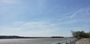
The Ohio lies on the south side and Fourteen Mile Creek on the north and west side, leaving a narrow connection to land.
This was one of the ancient sites reputed to have been examined by William Clark immediately prior to his great western expedition with Meriwether Lewis. Now the site is part of the Charlestown State Park and the only access is either hiking from a new bridge across Fourteen Mile Creek from the rest of the park property, or a hike up from boat landing on the Ohio River.
Sources include:
"Archaeological Investigations at the Prather Site, Clark County, Indiana: The 2003 Baseline Archaeological Survey," Munson and McCullough, 2004.
History of the Ohio falls cities and their counties : with illustrations and bibliographical sketches, Williams, L.A., & Co., Cleveland, 1882.
You may be viewing yesterday's version of this page. To see the most up to date information please register for a free account.
Do not use the above information on other web sites or publications without permission of the contributor.
Nearby Images from Flickr

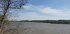
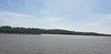
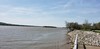
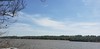
The above images may not be of the site on this page, but were taken nearby. They are loaded from Flickr so please click on them for image credits.
Click here to see more info for this site
Nearby sites
Click here to view sites on an interactive map of the areaKey: Red: member's photo, Blue: 3rd party photo, Yellow: other image, Green: no photo - please go there and take one, Grey: site destroyed
Download sites to:
KML (Google Earth)
GPX (GPS waypoints)
CSV (Garmin/Navman)
CSV (Excel)
To unlock full downloads you need to sign up as a Contributory Member. Otherwise downloads are limited to 50 sites.
Turn off the page maps and other distractions
Nearby sites listing. In the following links * = Image available
63.5km WSW 249° Wyandotte Cave* Ancient Mine, Quarry or other Industry
73.7km W 280° Cox's Woods site Ancient Village or Settlement
91.6km NE 43° River View Cemetery Mounds* Artificial Mound
101.2km NE 42° Jennison Guard Ancient Village or Settlement
103.7km NE 42° Miami Fort* Misc. Earthwork
104.9km ESE 106° Mt. Horeb Earthworks Complex* Misc. Earthwork
108.2km NE 42° Conrad Mound* Artificial Mound
110.8km NE 46° Short Woods Park Mound* Artificial Mound
110.8km NE 46° Sayler Story Mound* Artificial Mound
113.9km NW 316° Glenn Black Laboratory* Museum
121.1km W 276° Glendale Ridge Archaeological Site Ancient Village or Settlement
127.1km NE 41° Dunlap Works* Artificial Mound
129.4km E 99° Gaitskill Mound Site* Artificial Mound
130.4km NE 51° Norwood Mound* Artificial Mound
132.5km NNW 327° Bundy-Voyles Site* Ancient Village or Settlement
133.0km NNE 33° Reily Cemetery Mound* Artificial Mound
133.8km NE 50° Benham Mound* Artificial Mound
133.9km NE 54° Odd Fellows' Cemetery Mound* Artificial Mound
133.9km NNE 33° Enyart Mound* Artificial Mound
134.2km SE 128° Round Hill Mound Site* Artificial Mound
136.1km NNW 330° Blue Bluff Rock Outcrop
136.3km NE 40° Fortified Hill Works* Hillfort
137.4km NE 47° Mathew Mound* Artificial Mound
142.0km NE 54° Millford Earthworks Circle Diverging Lines* Hill Figure or Geoglyph
144.4km SSW 197° Mammoth Cave Kentucky* Cave or Rock Shelter
View more nearby sites and additional images


 We would like to know more about this location. Please feel free to add a brief description and any relevant information in your own language.
 Wir möchten mehr über diese Stätte erfahren. Bitte zögern Sie nicht, eine kurze Beschreibung und relevante Informationen in Deutsch hinzuzufügen.
 Nous aimerions en savoir encore un peu sur les lieux. S'il vous plaît n'hesitez pas à ajouter une courte description et tous les renseignements pertinents dans votre propre langue.
 Quisieramos informarnos un poco más de las lugares. No dude en añadir una breve descripción y otros datos relevantes en su propio idioma.