<< Our Photo Pages >> Agate House - Ancient Village or Settlement in United States in The Southwest
Submitted by bat400 on Thursday, 28 May 2009 Page Views: 10778
Multi-periodSite Name: Agate House Alternative Name: Petrified Forest National ParkCountry: United States Region: The Southwest Type: Ancient Village or Settlement
Nearest Town: Winslow, AZ
Latitude: 34.805100N Longitude: 109.8616W
Condition:
| 5 | Perfect |
| 4 | Almost Perfect |
| 3 | Reasonable but with some damage |
| 2 | Ruined but still recognisable as an ancient site |
| 1 | Pretty much destroyed, possibly visible as crop marks |
| 0 | No data. |
| -1 | Completely destroyed |
| 5 | Superb |
| 4 | Good |
| 3 | Ordinary |
| 2 | Not Good |
| 1 | Awful |
| 0 | No data. |
| 5 | Can be driven to, probably with disabled access |
| 4 | Short walk on a footpath |
| 3 | Requiring a bit more of a walk |
| 2 | A long walk |
| 1 | In the middle of nowhere, a nightmare to find |
| 0 | No data. |
| 5 | co-ordinates taken by GPS or official recorded co-ordinates |
| 4 | co-ordinates scaled from a detailed map |
| 3 | co-ordinates scaled from a bad map |
| 2 | co-ordinates of the nearest village |
| 1 | co-ordinates of the nearest town |
| 0 | no data |
Internal Links:
External Links:
I have visited· I would like to visit
TheCaptain has visited here
")
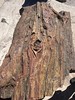
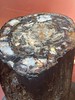
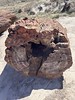
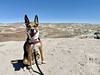
The site is part of the Petrified Forest National Park, in Navajo County, Arizona.
You may be viewing yesterday's version of this page. To see the most up to date information please register for a free account.
")
")
")
Do not use the above information on other web sites or publications without permission of the contributor.
Nearby Images from Flickr

The above images may not be of the site on this page, but were taken nearby. They are loaded from Flickr so please click on them for image credits.
Click here to see more info for this site
Nearby sites
Click here to view sites on an interactive map of the areaKey: Red: member's photo, Blue: 3rd party photo, Yellow: other image, Green: no photo - please go there and take one, Grey: site destroyed
Download sites to:
KML (Google Earth)
GPX (GPS waypoints)
CSV (Garmin/Navman)
CSV (Excel)
To unlock full downloads you need to sign up as a Contributory Member. Otherwise downloads are limited to 50 sites.
Turn off the page maps and other distractions
Nearby sites listing. In the following links * = Image available
18.4km NNE 18° Newspaper Rock (Petrified Forest)* Rock Art
19.8km NNE 18° Puerco Pueblo Petroglyphs* Rock Art
19.9km NNE 18° Puerco Pueblo.* Ancient Village or Settlement
56.8km SE 126° Table Rock Pueblo* Ancient Village or Settlement
77.6km WNW 290° Homol'ovi 1* Ancient Village or Settlement
77.7km WNW 294° Homol'ovi II* Ancient Village or Settlement
81.2km E 80° Hawikku* Ancient Village or Settlement
88.9km SE 144° Casa Malpais* Ancient Village or Settlement
111.5km S 189° Kinishba Ruins* Ancient Village or Settlement
139.9km E 79° Atsinna Pueblo* Ancient Village or Settlement
151.5km NNE 15° Canyon de Chelly - Sliding House* Ancient Village or Settlement
151.6km NNW 330° Taawaki Rock Art
151.9km NNE 13° Canyon de Chelly - White House* Ancient Village or Settlement
155.0km NNE 14° Canyon de Chelly - Antelope House Ruins* Ancient Village or Settlement
155.5km WNW 286° Walnut Canyon Nat. Mon.* Ancient Village or Settlement
155.9km WNW 302° Wukoki Pueblo Ancient Village or Settlement
157.1km WSW 254° V/V* Rock Art
157.1km SE 131° Tularosa cave* Cave or Rock Shelter
158.8km WNW 301° Wupatki Pueblo* Ancient Village or Settlement
160.9km SE 143° Cordova Cave* Cave or Rock Shelter
162.9km WNW 288° Elden Pueblo* Ancient Village or Settlement
165.2km NNE 16° Canyon de Chelly - Mummy Cave* Ancient Village or Settlement
169.0km WNW 300° Citadel Pueblo Ancient Village or Settlement
169.5km WNW 301° Lomaki Pueblo Ancient Village or Settlement
169.5km WNW 301° Box Canyon Pueblo Ancient Village or Settlement
View more nearby sites and additional images


 We would like to know more about this location. Please feel free to add a brief description and any relevant information in your own language.
 Wir möchten mehr über diese Stätte erfahren. Bitte zögern Sie nicht, eine kurze Beschreibung und relevante Informationen in Deutsch hinzuzufügen.
 Nous aimerions en savoir encore un peu sur les lieux. S'il vous plaît n'hesitez pas à ajouter une courte description et tous les renseignements pertinents dans votre propre langue.
 Quisieramos informarnos un poco más de las lugares. No dude en añadir una breve descripción y otros datos relevantes en su propio idioma.