<< Text Pages >> Boca de Potrerillos - Rock Art in Mexico in Mexico Other
Submitted by davidmorgan on Monday, 18 February 2019 Page Views: 2125
Rock ArtSite Name: Boca de PotrerillosCountry: Mexico
NOTE: This site is 204.153 km away from the location you searched for.
Region: Mexico Other Type: Rock Art
Nearest Town: Monterrey Nearest Village: Mina
Latitude: 26.044770N Longitude: 100.6421W
Condition:
| 5 | Perfect |
| 4 | Almost Perfect |
| 3 | Reasonable but with some damage |
| 2 | Ruined but still recognisable as an ancient site |
| 1 | Pretty much destroyed, possibly visible as crop marks |
| 0 | No data. |
| -1 | Completely destroyed |
| 5 | Superb |
| 4 | Good |
| 3 | Ordinary |
| 2 | Not Good |
| 1 | Awful |
| 0 | No data. |
| 5 | Can be driven to, probably with disabled access |
| 4 | Short walk on a footpath |
| 3 | Requiring a bit more of a walk |
| 2 | A long walk |
| 1 | In the middle of nowhere, a nightmare to find |
| 0 | No data. |
| 5 | co-ordinates taken by GPS or official recorded co-ordinates |
| 4 | co-ordinates scaled from a detailed map |
| 3 | co-ordinates scaled from a bad map |
| 2 | co-ordinates of the nearest village |
| 1 | co-ordinates of the nearest town |
| 0 | no data |
Internal Links:
External Links:
Rock Art in Nuevo León State, Mexico
A large area containing more than 3000 petroglyphs.
You may be viewing yesterday's version of this page. To see the most up to date information please register for a free account.
Do not use the above information on other web sites or publications without permission of the contributor.
Nearby Images from Flickr
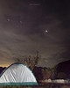

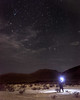

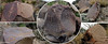

The above images may not be of the site on this page, but were taken nearby. They are loaded from Flickr so please click on them for image credits.
Click here to see more info for this site
Nearby sites
Click here to view sites on an interactive map of the areaKey: Red: member's photo, Blue: 3rd party photo, Yellow: other image, Green: no photo - please go there and take one, Grey: site destroyed
Download sites to:
KML (Google Earth)
GPX (GPS waypoints)
CSV (Garmin/Navman)
CSV (Excel)
To unlock full downloads you need to sign up as a Contributory Member. Otherwise downloads are limited to 50 sites.
Turn off the page maps and other distractions
Nearby sites listing. In the following links * = Image available
176.2km NW 307° Cuatro Cienegas Footprints Ancient Trackway
310.4km SSE 151° Balcon de Montezuma Ancient Village or Settlement
353.0km SSW 210° La Florida (Zacatecas) Shaft Tomb* Chambered Tomb
407.6km N 351° Seminole Canyon State Park and Historic Site* Rock Art
413.0km N 355° Delicado Shelter Rock Art
424.2km N 352° Little Sotol Ancient Village or Settlement
434.7km N 350° Hinds Cave Cave or Rock Shelter
456.0km SSW 209° La Quemada* Ancient Village or Settlement
465.4km NNE 15° Stonehenge II (Original Location)* Modern Stone Circle etc
468.2km NNE 17° Stonehenge II (Ingram, TX)* Modern Stone Circle etc
487.6km NNW 328° Bee Cave Canyon* Cave or Rock Shelter
494.4km SSE 158° Tamtoc Ancient Village or Settlement
503.8km NNE 31° Spring Lake Ancient Village or Settlement
506.7km SE 146° Las Flores Pyramid / Mastaba
527.0km NNE 19° Enchanted Rock* Natural Stone / Erratic / Other Natural Feature
538.8km WSW 243° Cueva del Maguey Ancient Village or Settlement
555.0km NNE 23° Nightengale Archaeological Center* Ancient Village or Settlement
577.5km S 183° Cañada de la Virgen Ancient Village or Settlement
586.2km SSW 210° El Teul Archaeological Zone Ancient Village or Settlement
611.2km S 178° El Cerrito Pyramid / Mastaba
612.6km NNE 28° Gault Site Ancient Village or Settlement
613.7km NNE 28° Debra L. Friedkin Ancient Mine, Quarry or other Industry
642.1km SSE 153° Cerro del Sombrerete Rock Art
645.2km SW 223° Cantil de las animas Rock Art
658.4km NE 50° Houston Museum of Natural Science* Museum
View more nearby sites and additional images


 We would like to know more about this location. Please feel free to add a brief description and any relevant information in your own language.
 Wir möchten mehr über diese Stätte erfahren. Bitte zögern Sie nicht, eine kurze Beschreibung und relevante Informationen in Deutsch hinzuzufügen.
 Nous aimerions en savoir encore un peu sur les lieux. S'il vous plaît n'hesitez pas à ajouter une courte description et tous les renseignements pertinents dans votre propre langue.
 Quisieramos informarnos un poco más de las lugares. No dude en añadir una breve descripción y otros datos relevantes en su propio idioma.