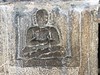
<< Our Photo Pages >> Sulthan Bather Dolmen - Burial Chamber or Dolmen in India
Submitted by AlexAssa on Friday, 27 January 2017 Page Views: 1590
Neolithic and Bronze AgeSite Name: Sulthan Bather Dolmen Alternative Name: Дольмен Салтэн БCountry: India
NOTE: This site is 55.515 km away from the location you searched for.
Type: Burial Chamber or Dolmen
Nearest Town: Kalpetta Nearest Village: Salten Bathery
Latitude: 11.662402N Longitude: 76.266528E
Condition:
| 5 | Perfect |
| 4 | Almost Perfect |
| 3 | Reasonable but with some damage |
| 2 | Ruined but still recognisable as an ancient site |
| 1 | Pretty much destroyed, possibly visible as crop marks |
| 0 | No data. |
| -1 | Completely destroyed |
| 5 | Superb |
| 4 | Good |
| 3 | Ordinary |
| 2 | Not Good |
| 1 | Awful |
| 0 | No data. |
| 5 | Can be driven to, probably with disabled access |
| 4 | Short walk on a footpath |
| 3 | Requiring a bit more of a walk |
| 2 | A long walk |
| 1 | In the middle of nowhere, a nightmare to find |
| 0 | No data. |
| 5 | co-ordinates taken by GPS or official recorded co-ordinates |
| 4 | co-ordinates scaled from a detailed map |
| 3 | co-ordinates scaled from a bad map |
| 2 | co-ordinates of the nearest village |
| 1 | co-ordinates of the nearest town |
| 0 | no data |
Internal Links:
External Links:
")
Two-chamber Dolmen - Passage Grave is in Salten Bathery, Kerala
More details at megalithica.ru
You may be viewing yesterday's version of this page. To see the most up to date information please register for a free account.
Do not use the above information on other web sites or publications without permission of the contributor.
Nearby Images from Flickr


The above images may not be of the site on this page, but were taken nearby. They are loaded from Flickr so please click on them for image credits.
Click here to see more info for this site
Nearby sites
Click here to view sites on an interactive map of the areaKey: Red: member's photo, Blue: 3rd party photo, Yellow: other image, Green: no photo - please go there and take one, Grey: site destroyed
Download sites to:
KML (Google Earth)
GPX (GPS waypoints)
CSV (Garmin/Navman)
CSV (Excel)
To unlock full downloads you need to sign up as a Contributory Member. Otherwise downloads are limited to 50 sites.
Turn off the page maps and other distractions
Nearby sites listing. In the following links * = Image available
462m WNW 296° Edakkal Caves Cave or Rock Shelter
18.2km NW 325° Kappikunnu Rock Art
95.9km NNE 28° Sri Ranganathaswamy Temple (Srirangapatna)* Ancient Temple
110.3km S 189° Cherumangadu Kudakkalparambu* Burial Chamber or Dolmen
118.0km SSE 164° Dayananda Ashram Ancient Village or Settlement
135.1km N 10° Sravanabelagola* Ancient Temple
148.9km ESE 114° Kodumanal Ancient Village or Settlement
150.0km ENE 74° Male Mahadeshwara Hills* Stone Circle
155.8km E 99° Shri Sangameshvara temple, Bhavani, Tamil Nadu* Ancient Temple
165.8km S 183° Muziris Ancient Village or Settlement
172.9km NNW 345° Kerareshwarah Temple* Ancient Temple
174.9km N 350° Halebidu* Ancient Temple
184.7km SSE 148° Marayoor Muniyaras* Barrow Cemetery
195.7km SSE 167° Nedumala Caves Cave or Rock Shelter
200.2km NE 47° Sri Pancha Lingaeshwara Temple* Ancient Temple
200.7km NE 44° Gavi Gangadhareshwara Temple* Ancient Temple
226.8km ENE 61° Moralepara Dolmens* Burial Chamber or Dolmen
237.2km NNW 334° Kavishaila* Modern Stone Circle etc
237.6km SSE 152° Thovalappady Cist
254.6km NE 54° Tekel* Rock Art
256.2km ENE 62° Kangundi* Rock Art
256.7km SE 138° Puthurmalai Rock Art
260.8km ENE 56° Ghatta Madamangala* Rock Art
278.8km ESE 108° Sri Ranganathaswamy Temple (Tiruchirapalli)* Ancient Temple
280.3km SE 134° Sri Meenakshi Devi temple* Ancient Temple
View more nearby sites and additional images


 We would like to know more about this location. Please feel free to add a brief description and any relevant information in your own language.
 Wir möchten mehr über diese Stätte erfahren. Bitte zögern Sie nicht, eine kurze Beschreibung und relevante Informationen in Deutsch hinzuzufügen.
 Nous aimerions en savoir encore un peu sur les lieux. S'il vous plaît n'hesitez pas à ajouter une courte description et tous les renseignements pertinents dans votre propre langue.
 Quisieramos informarnos un poco más de las lugares. No dude en añadir una breve descripción y otros datos relevantes en su propio idioma.