<< Other Photo Pages >> Peruaçu - Rock Art in Brazil
Submitted by davidmorgan on Saturday, 02 December 2017 Page Views: 2270
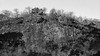
Rock ArtSite Name: Peruaçu Alternative Name: Parque Nacional Cavernas do PeruaçuCountry: Brazil
NOTE: This site is 460.209 km away from the location you searched for.
Type: Rock Art
Nearest Town: Itacarambi
Latitude: 15.16802S Longitude: 44.22668W
Condition:
| 5 | Perfect |
| 4 | Almost Perfect |
| 3 | Reasonable but with some damage |
| 2 | Ruined but still recognisable as an ancient site |
| 1 | Pretty much destroyed, possibly visible as crop marks |
| 0 | No data. |
| -1 | Completely destroyed |
| 5 | Superb |
| 4 | Good |
| 3 | Ordinary |
| 2 | Not Good |
| 1 | Awful |
| 0 | No data. |
| 5 | Can be driven to, probably with disabled access |
| 4 | Short walk on a footpath |
| 3 | Requiring a bit more of a walk |
| 2 | A long walk |
| 1 | In the middle of nowhere, a nightmare to find |
| 0 | No data. |
| 5 | co-ordinates taken by GPS or official recorded co-ordinates |
| 4 | co-ordinates scaled from a detailed map |
| 3 | co-ordinates scaled from a bad map |
| 2 | co-ordinates of the nearest village |
| 1 | co-ordinates of the nearest town |
| 0 | no data |
Internal Links:
External Links:
")
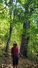
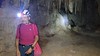
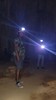
In the Parque Nacional Cavernas do Peruaçu there are several prehistoric rock art sites in the caverns along the Peruaçu River: Lapa do Caboclo, Lapa do Índio, Lapa do Boquete, Lapa dos Desenhos, Lapa do Rezar, Lapa Piolho de Urubu.
More information at the Instituto Chico Mendes de Conservação da Biodiversidade website.
You may be viewing yesterday's version of this page. To see the most up to date information please register for a free account.
Do not use the above information on other web sites or publications without permission of the contributor.
Nearby Images from Flickr
The above images may not be of the site on this page, but were taken nearby. They are loaded from Flickr so please click on them for image credits.
Click here to see more info for this site
Nearby sites
Click here to view sites on an interactive map of the areaKey: Red: member's photo, Blue: 3rd party photo, Yellow: other image, Green: no photo - please go there and take one, Grey: site destroyed
Download sites to:
KML (Google Earth)
GPX (GPS waypoints)
CSV (Garmin/Navman)
CSV (Excel)
To unlock full downloads you need to sign up as a Contributory Member. Otherwise downloads are limited to 50 sites.
Turn off the page maps and other distractions
Nearby sites listing. In the following links * = Image available
369.8km NW 315° Baixao-Tocantins rock art* Rock Art
479.7km S 178° Lapa do Santo Rock shelter* Cave or Rock Shelter
1201.6km NNE 33° Erere rock art* Rock Art
1238.5km WSW 244° Taboco* Rock Art
1285.3km NE 48° Pedra do Ingá* Rock Art
1364.9km W 268° Santa Elena (Brazil)* Rock Art
1533.9km SSW 200° Avencal 1* Rock Art
1568.9km SSW 197° Jabuticabeira II Barrow Cemetery
1824.8km NW 320° Santarém Settlements Ancient Village or Settlement
1894.9km NW 319° Serra da Escama rock art* Rock Art
2076.6km W 274° Loma Chacolatalito Artificial Mound
2099.1km NNW 339° Calçoene Stone Circle* Stone Circle
2112.6km WSW 258° El Fuerte de Samaipata Pyramid / Mastaba
2126.9km WSW 258° Mairana Circular Pyramid Pyramid / Mastaba
2189.2km NW 306° Hatahara* Ancient Village or Settlement
2189.9km NW 306° Area das Lajes Rock Art
2189.9km NW 306° Dona Stella Quarry Ancient Mine, Quarry or other Industry
2200.6km NW 306° Acutuba Ancient Village or Settlement
2275.0km WSW 256° Sucre Museum of Anthropology Museum
2316.8km NNW 339° Mont d'Argent rock art* Rock Art
2335.0km WSW 255° Cerro Rico* Ancient Mine, Quarry or other Industry
2337.1km WSW 255° Tarapaya* Natural Stone / Erratic / Other Natural Feature
2379.9km WSW 245° Coctaca Ancient Village or Settlement
2386.7km WSW 245° Pucará de Peñas Blancas Hillfort
2391.9km SSW 209° Localidad Rupestre de Chamangá Rock Art
View more nearby sites and additional images


 We would like to know more about this location. Please feel free to add a brief description and any relevant information in your own language.
 Wir möchten mehr über diese Stätte erfahren. Bitte zögern Sie nicht, eine kurze Beschreibung und relevante Informationen in Deutsch hinzuzufügen.
 Nous aimerions en savoir encore un peu sur les lieux. S'il vous plaît n'hesitez pas à ajouter une courte description et tous les renseignements pertinents dans votre propre langue.
 Quisieramos informarnos un poco más de las lugares. No dude en añadir una breve descripción y otros datos relevantes en su propio idioma.