


How Archaeologists Record Ancient Footprints Before the Sea Wears Them Away
Submitted by Andy_B on Wednesday, 18 November 2026 Page Views: 5
Resources
The Footprints the Sea Gives Back
In May 2013, a storm at Happisburgh exposed a dark patch of silt on the Norfolk foreshore. It was dotted with shallow hollows. A few had the outline of a heel or an arch. One even showed traces of toes. By the end of the month, the sea had worn away the surface. The researchers who photographed it in the meantime had a record of people walking along an estuary roughly 900,000 years ago.On the other side of England, the tide at Formby exposes human and animal tracks in beds of ancient mud. The people who left them lived in a much later world. Both sites show how much a short spell of visibility can add to the history of a coast.
What Makes a Hollow Worth a Second Look
A footprint on a beach can be hard to recognise once its edges soften. At Happisburgh, the researchers had a spread of shallow depressions to work with. Any one mark might have looked ordinary. Seen together, the hollows gave the team something to measure and compare.Several details helped the researchers assess what they were looking at.
• The outline. A heel, arch or broader forefoot can help distinguish a footprint from an irregular hollow.
• The size. Differences in length can suggest that several individuals crossed the surface.
• The orientation. When several impressions face a similar way, they can give a clue to the direction of travel.
The clearest features were scattered across different impressions. An arch could be visible in one hollow while another showed the shape of the front of the foot. Looking at the whole surface gave those details more weight.
A closer look at an online casino catalogue can also turn up games that get little space on the front page. Someone browsing a site such as Royal Reels can look through recent releases and lesser-known slots, then compare the figures in each game’s rules. RTP is the share of total stakes the game is designed to return as prizes over many plays. Volatility describes how much payouts can vary. Together, they help explain a game’s payout profile.
The outcome of an individual session remains uncertain.
A Camera Can Save the Shape
The team at Happisburgh could see the surface getting less distinct with successive tides. There was little time to measure the marks in the field. Instead, researchers took overlapping photographs at different angles. Software used those views to reconstruct the contours of the silt in three dimensions. In the published Happisburgh study, the team explains how the digital record let researchers measure the hollows after the fieldwork. The measurements suggested that people of different sizes had walked along the mudflats. The orientation of the impressions pointed south.
A single photograph gives a sense of how the beach looked that day. The model gives researchers a surface they can examine at different angles and measure. That mattered once there was no patch of silt to go back to. The team could still compare the length and shape of individual impressions after the sea had removed them.
Formby Has More Than One Surface
At Formby, a stretch of exposed mud can look like one continuous record. Long-term monitoring has identified hundreds of human and animal prints in 31 separate sediment beds. In the Formby footprint study, radiocarbon dating showed that the record spans at least 8,000 years. The oldest beds in the study date to the Mesolithic and the youngest to medieval times.Some early beds record a coast used by red deer, wild boar and aurochs, the large wild cattle that once lived in Britain. Human footprints dominate the Neolithic and later beds in the study. Those beds also contain evidence of a smaller variety of large mammals.
Two questions help make sense of what turns up on the beach.
• Which surface did the prints come from? Tracks found close together on the modern shore can belong to beds laid down thousands of years apart.
• What does that surface record? A bed preserves activity that left impressions on that patch of ground. A comparison across beds gives researchers a basis for talking about longer-term change.
One surface might preserve a crossing. A series of dated surfaces can show how the mix of tracks changed as the coastal landscape and the way people used it changed too.
What Remains When the Tide Returns
At Happisburgh, the photographs and digital model preserved enough detail for researchers to study a surface that disappeared in weeks. At Formby, much of the evidence came from repeated visits as different layers came into view. The dates let researchers put those finds in order, even though the beach revealed them at different times.A footprint preserves a small event. Someone crossed soft ground and left enough of an impression for it to hold. When it reappears on a modern beach, its position in the sediment and the marks around it can tell as much as its outline. That context can survive in a field record even when the next tide changes the shore.
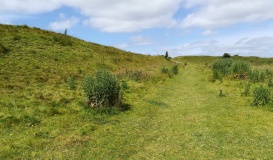
With many thanks to David Dixon for the Creative Commons photo above.
