


<< Our Photo Pages >> Concraig - Standing Stone (Menhir) in Scotland in Perth and Kinross
Submitted by BigSweetie on Thursday, 25 March 2004 Page Views: 9915
Neolithic and Bronze AgeSite Name: ConcraigCountry: Scotland County: Perth and Kinross Type: Standing Stone (Menhir)
Nearest Town: Crieff Nearest Village: Muthill
Map Ref: NN8548419503 Landranger Map Number: 58
Latitude: 56.353958N Longitude: 3.854778W
Condition:
| 5 | Perfect |
| 4 | Almost Perfect |
| 3 | Reasonable but with some damage |
| 2 | Ruined but still recognisable as an ancient site |
| 1 | Pretty much destroyed, possibly visible as crop marks |
| 0 | No data. |
| -1 | Completely destroyed |
| 5 | Superb |
| 4 | Good |
| 3 | Ordinary |
| 2 | Not Good |
| 1 | Awful |
| 0 | No data. |
| 5 | Can be driven to, probably with disabled access |
| 4 | Short walk on a footpath |
| 3 | Requiring a bit more of a walk |
| 2 | A long walk |
| 1 | In the middle of nowhere, a nightmare to find |
| 0 | No data. |
| 5 | co-ordinates taken by GPS or official recorded co-ordinates |
| 4 | co-ordinates scaled from a detailed map |
| 3 | co-ordinates scaled from a bad map |
| 2 | co-ordinates of the nearest village |
| 1 | co-ordinates of the nearest town |
| 0 | no data |
Internal Links:
External Links:
")
A 2 metre tall standing stone, recorded as Canmore site no. 25285, which tells us this "standing stone ..... is situated in the middle of an arable field and leans to the N, measures a maximum of 0.8m from N to S by 0.55m transversely, and tapers towards the top at a height of 2m." In a visit in 2004, Canmore adds in a report: "Miscellaneous cropmarks, probably geological in origin, have been recorded on oblique aerial photography (RCAHMSAP 2000) adjacent to the standing stone."
Update June 2017: Further information can also be found on The Northern Antiquarian (TNA) - see their page for Concraig, Muthill, Perthshire, which gives directions for finding the stone, photographs, a brief archaeology and history and an image of the stone's location from the 1863 OS map.
You may be viewing yesterday's version of this page. To see the most up to date information please register for a free account.
")
")
")
Do not use the above information on other web sites or publications without permission of the contributor.
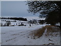
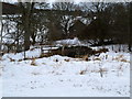
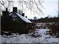
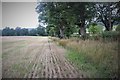
Nearby Images from Geograph Britain and Ireland:
©2010(licence)
©2010(licence)
©2010(licence)
©2018(licence)
©2017(licence)
The above images may not be of the site on this page, they are loaded from Geograph.
Please Submit an Image of this site or go out and take one for us!
Click here to see more info for this site
Nearby sites
Key: Red: member's photo, Blue: 3rd party photo, Yellow: other image, Green: no photo - please go there and take one, Grey: site destroyed
Download sites to:
KML (Google Earth)
GPX (GPS waypoints)
CSV (Garmin/Navman)
CSV (Excel)
To unlock full downloads you need to sign up as a Contributory Member. Otherwise downloads are limited to 50 sites.
Turn off the page maps and other distractions
Nearby sites listing. In the following links * = Image available
690m NE 37° Dargill* Standing Stone (Menhir) (NN85922004)
1.1km ESE 109° Crieff Cursus Cursus (NN86561910)
1.2km ESE 116° Crieff Cursus Cursus (NN86531897)
1.5km NE 52° Crieff Cursus Cursus (NN86702040)
1.7km NE 38° Duchlage, Crieff Standing Stone (Menhir) (NN86552079)
1.7km NW 309° Rottenreoch Chambered Cairn (NN842206)
2.2km NNE 25° Crieff Cross Slab* Class III Pictish Cross Slab (NN865215)
3.3km E 83° Millhills Stone Circle (NN88801981)
3.6km NNE 30° Ferntower* Stone Circle (NN874226)
3.8km WNW 288° Strowan (Crieff)* Cairn (NN819208)
3.9km NW 309° Samson's Stone Standing Stone (Menhir) (NN82512202)
4.7km SW 222° Dalchirla North (Muthill) Standing Stone (Menhir) (NN8227416125)
4.7km SW 218° Dalchirla East (Muthill) Standing Stones (NN8244615893)
5.4km NNE 28° Monzie Circle* Stone Circle (NN88162417)
5.4km NNE 26° Witches' Stone, Monzie* Standing Stone (Menhir) (NN87982431)
5.5km NE 42° Cultoquhey* Chambered Cairn (NN8923723485)
5.5km N 356° Stonefield Circle Stone Circle (NN85252505)
5.6km NW 309° Clathick House Standing Stone (Menhir) (NN81212315)
6.2km NNE 22° Keppoch Standing Stones (NN87982517)
6.2km WNW 299° Lawers* Standing Stone (Menhir) (NN80102267)
6.4km WSW 254° Craigneich Farm* Standing Stone (Menhir) (NN7922617871)
6.7km W 269° Auchingarrich Farm Standing Stone (Menhir) (NN78731958)
6.8km WSW 248° Dunruchan C (Muthill)* Standing Stone (Menhir) (NN7910817137)
6.9km WSW 246° Dunruchan D (Muthill)* Standing Stone (Menhir) (NN7904416881)
7.0km WSW 246° Dunruchan E (Muthill)* Standing Stone (Menhir) (NN7899716819)
View more nearby sites and additional images


 We would like to know more about this location. Please feel free to add a brief description and any relevant information in your own language.
 Wir möchten mehr über diese Stätte erfahren. Bitte zögern Sie nicht, eine kurze Beschreibung und relevante Informationen in Deutsch hinzuzufügen.
 Nous aimerions en savoir encore un peu sur les lieux. S'il vous plaît n'hesitez pas à ajouter une courte description et tous les renseignements pertinents dans votre propre langue.
 Quisieramos informarnos un poco más de las lugares. No dude en añadir una breve descripción y otros datos relevantes en su propio idioma.