

Corrimony
Submitted by Andy B on Monday, 23 June 2025 Page Views: 24810
Neolithic and Bronze AgeSite Name: CorrimonyCountry: Scotland County: Highlands Type: Clava Cairn
Nearest Town: Inverness Nearest Village: Cannich
Map Ref: NH38303029 Landranger Map Number: 26
Latitude: 57.334371N Longitude: 4.687933W
Condition:
| 5 | Perfect |
| 4 | Almost Perfect |
| 3 | Reasonable but with some damage |
| 2 | Ruined but still recognisable as an ancient site |
| 1 | Pretty much destroyed, possibly visible as crop marks |
| 0 | No data. |
| -1 | Completely destroyed |
| 5 | Superb |
| 4 | Good |
| 3 | Ordinary |
| 2 | Not Good |
| 1 | Awful |
| 0 | No data. |
| 5 | Can be driven to, probably with disabled access |
| 4 | Short walk on a footpath |
| 3 | Requiring a bit more of a walk |
| 2 | A long walk |
| 1 | In the middle of nowhere, a nightmare to find |
| 0 | No data. |
| 5 | co-ordinates taken by GPS or official recorded co-ordinates |
| 4 | co-ordinates scaled from a detailed map |
| 3 | co-ordinates scaled from a bad map |
| 2 | co-ordinates of the nearest village |
| 1 | co-ordinates of the nearest town |
| 0 | no data |
In The Old Stones Book: p.326
Internal Links:


External Links:


I have visited· I would like to visit
PAB SumDoood would like to visit
TomSheep visited on 1st Jan 2025
Vale_of_Ash visited on 1st Apr 2024 Featured in Julian Cope's "Modern Antiquarian" - very easy to find and very close to the road. An atmospheric cairn in a peaceful location.
SandyG visited on 13th Jul 2018
lichen visited on 31st Aug 2016
SolarMegalith visited on 16th Jun 2015
soulsurfer visited on 10th Jul 2012 Brilliant site with very easy access.
ChrisHealey visited on 20th Oct 2007 It was a long time ago that I visited this site, as I recall it was in the midst of a large nature reserve. It was one of the best preserved cairns I've visited and the setting was very peaceful. The only noise was birdsong. I'd love to go back one day.
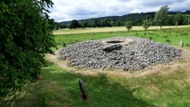
markj99 visited on 3rd May 2006 Corrimony Clava Cairn has been excavated at least twice: first in 1830, then again in 1952. The central chamber was covered in 1830 but it is now open to the sky. Trove.scot Place 12256 states that 4 of the 11 outer stones are modern additions and 2 stones have been reset in modern times. With all this interference there is some doubt as to the authenticity of the clava cairn in its current form.
DrewParsons davidmorgan have visited here
Log in or create a free account to see how our visitors rate this site for condition, ambience and access, and to record your own visits.
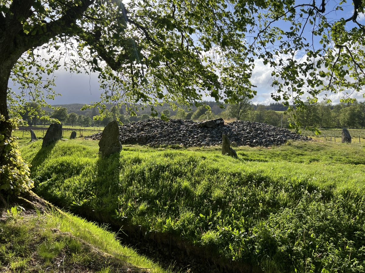
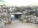
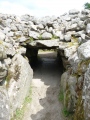
See the pictures below of the narrow entrance passage (complete with puddle!). The walls of this and the chamber are made with large orthostats (upright stones).
Access: In state care. Easy to find along the A831 in Glen Urquhart, west of Loch Ness. Signposted
The streaks of colour in the standing stones are outstanding (best seen in the hi-res images).
You may be viewing yesterday's version of this page. To see the most up to date information please register for a free account.


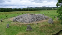







These are just the first 25 photos of Corrimony. If you log in with a free user account you will be able to see our entire collection.
Do not use the above information on other web sites or publications without permission of the contributor.
Click here to see more info for this site
All Nearby sites
 Click here to view sites on an interactive OS map
Download sites to:
KML (Google Earth)
GPX (GPS waypoints)
CSV (Garmin/Navman)
CSV (Excel)
To unlock full downloads you need to sign up as a Society Member. Otherwise downloads are limited to 50 sites.





Turn off the page maps and other distractions
Nearby sites listing. In the following links * = Image available
120m NE 39° Corrimony mound Artificial Mound (NH38383038)
812m WSW 252° Mony's Stone* Standing Stone (Menhir) (NH3751530072)
856m NNE 29° Curadan's Well* Holy Well or Sacred Spring (NH38753102)
1.4km NE 39° Buntait Barrows* Barrow Cemetery (NH39233135)
1.7km ENE 62° Buntait Cup Marked Stone* Rock Art (NH39793102)
4.5km WNW 292° Mullach An Tuir* Chambered Cairn (NH34143216)
4.6km NNW 343° St Ignatius' Well* Holy Well or Sacred Spring (NH3709934761)
5.8km W 275° Comar Wood* Stone Fort or Dun (NH3250931008)
9.6km N 6° Dun Coille Struy Broch or Nuraghe (NH39643976)
11.2km E 82° Clachmhor, Culnakirk* Rock Art (NH49443145)
11.2km E 82° Carn Daley* Clava Cairn (NH4945431458)
11.4km SE 138° Boulder near Creag Dhearg Natural Stone / Erratic / Other Natural Feature (NH456215)
14.3km NE 48° Boblainy* Stone Circle (NH49343951)
14.7km E 89° Holy Well (Drumnadrochit)* Holy Well or Sacred Spring (NH530300)
15.7km NE 41° Culburnie* Stone Circle (NH491418)
16.1km NE 44° Bruiach* Cairn (NH49984143)
16.2km NE 42° Beaufort Cottages Cairn* Cairn (NH49654188)
17.2km NE 48° Meg's Stone* Standing Stone (Menhir) (NH5164541196)
17.3km NE 52° Allt Eoghainn* Chambered Tomb (NH5236240392)
17.4km NE 47° Belladrum South Chambered Tomb (NH5161041578)
17.6km NE 46° Belladrum Chambered Cairn* Chambered Cairn (NH5141742120)
18.5km NE 38° Ballblair Wood Chambered Cairn (NH502445)
19.7km NE 51° Castle Spynie Broch or Nuraghe (NH54144204)
20.1km S 177° Cherry Island* Crannog (NH385102)
21.4km NE 49° Balblair Class I Pictish Symbol Stone (NH55184357)
View more nearby sites and additional images

 We would like to know more about this location. Please feel free to add a brief description and any relevant information in your own language.
 Wir möchten mehr über diese Stätte erfahren. Bitte zögern Sie nicht, eine kurze Beschreibung und relevante Informationen in Deutsch hinzuzufügen.
 Nous aimerions en savoir encore un peu sur les lieux. S'il vous plaît n'hesitez pas à ajouter une courte description et tous les renseignements pertinents dans votre propre langue.
 Quisieramos informarnos un poco más de las lugares. No dude en añadir una breve descripción y otros datos relevantes en su propio idioma.