Register here - as a registered user you get more features and fewer ads.
Ancient Sites in Co. Westmeath, Ireland (Republic of)
5 sites recorded, with photos, maps and visitor reports

Showing 5 sites in list and on map
View on Interactive Map View on 3D globe map
Site Matches - Showing 5 sites in list and on map View Most Recent
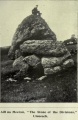
Aill na Mireann . Standing Stone (Menhir) in Co. Westmeath
Posted by durhamnature on Saturday, 20 October 2012
Condition: 5, Ambience: 5, Accuracy: 4 (Our Pic)
Moyvoughley . Standing Stone (Menhir) in Co. Westmeath
Posted by Anthony_Weir on Sunday, 13 October 2002
Condition: 4, Ambience: 5, Access: 4, Accuracy: 3 (Other Pic)
St Brigid's Well, Cullion . Holy Well or Sacred Spring in Co. Westmeath
Posted by AngieLake on Thursday, 21 November 2019
Accuracy: 5 (Our Pic)
No Comments
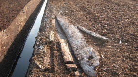
Mayne Bog Trackway . Ancient Trackway in Co. Westmeath
Posted by Anne T on Sunday, 07 June 2026
Condition: 1, Ambience: 3, Access: 3, Accuracy: 5 (Other Pic)
No Comments
Snimnagorta Clogh Stuckagh . Standing Stone (Menhir) in Co. Westmeath
Posted by Anne T on Saturday, 19 September 2026
Condition: 4, Ambience: 3, Access: 2, Accuracy: 5 (No Pic)
No Comments
We now have our own powerful Text Search which searches everything including Comments, Visit Logs and Gallery text - give it a try!