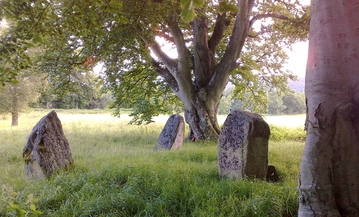
Submitted by enkidu41 on Saturday, 13 June 2026 (12684 reads)
Neolithic and Bronze AgeRemnants of a ruined stone circle near to the southern end of Loch Frisa on the Isle of Mull. The circle would have had a diameter of approx. 33m - 40m with 4 surviving stones from an original estimated 11 to 14. The stones range in height from 0.95m to 2.2m. Image submitted by Rthoyle
Submitted by Anne T on Friday, 12 June 2026 (90 reads)
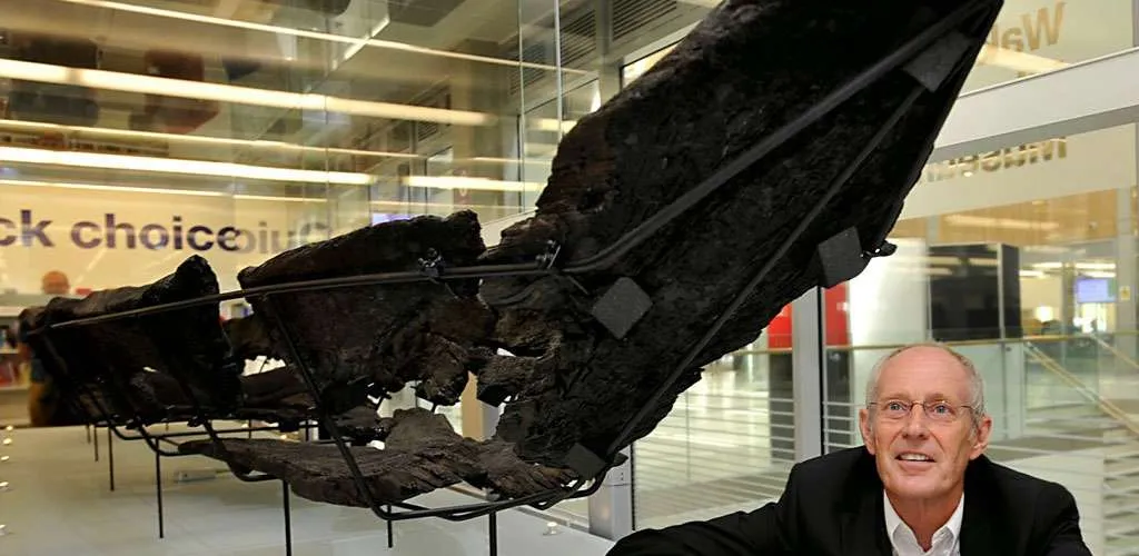
Early MedievalCurrently on display in the library above Wakefield Museum, this log boat is on loan from York Museums Trust, this is "Britain's only known Anglo-Scandinavian boat", discovered beneath the bed of the River Calder in 1838 during construction of the Stanley Ferry Aqueduct, and is a rare example of a Viking-period dugout boat in Britain. Image submitted by Anne T
Submitted by MattM on Tuesday, 09 June 2026 (928 reads)
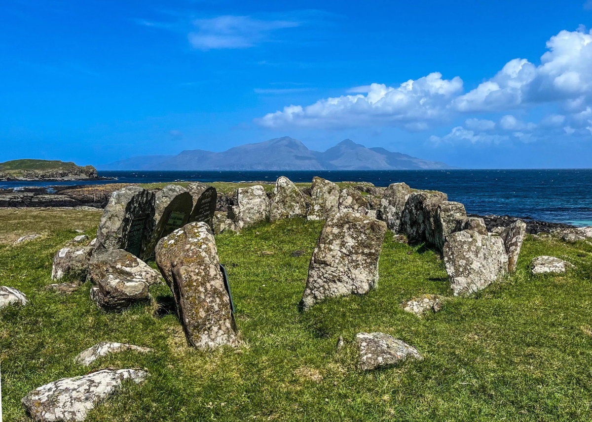
Neolithic and Bronze AgeTwo cairns - burial monuments dating from the Neolithic or Early Bronze Age, visible as two stony mounds. On the headland at Gallanach Bay, Isle of Muck. Image submitted by MattM
Submitted by bec-zog on Monday, 08 June 2026 (17765 reads)
Neolithic and Bronze AgeNeolithic (and Roman) Long Barrow which comprises a 44m long 15m wide, 2.5 m high earthen and turf covered chalk structure. A flint axe head dating to circa 2000BCE was found in the core. A ditch extends along eastern and western side side and southern end. In the upper layer of the ditch 4 Romano British burials were found. Image submitted by Brian_Eyes
The White Horse Mummers Present (June 21st 7pm) - A Summer Solstice Special: The Ghosts of Midsummer Arise, A Merry Mayhem In Three Acts Mummers Play at Julliberrie's Grave long barrow. Followed by revelry, music, dance and more at the White Horse pub Chilham. Details on our page Read Article | 11 News and Comments | Category: Our Photo Pages
Submitted by Andy B on Sunday, 07 June 2026 (7876 reads)
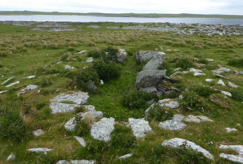
Neolithic and Bronze AgeAn Early Neolithic stalled chambered cairn at the northern tip of Holm of Papa Westray, the small islet lying east of Papa Westray, Orkney. Ancient DNA results published in 2026 by Prof. Vicki Cummings and colleagues identified a father and son entombed here in the mid-3300s BCE alongside the father's maternal uncle or half-brother, and revealed that two of the women buried here were genetically connected to a male at Tulach an t-Sionnaich in Caithness - family links across the Pentland Firth at the very edge of early Neolithic Britain. Image submitted by PAB
Ancient DNA sampled from human remains placed in five chambered tombs in Caithness and Orkney - father, son and grandson in one tomb and family ties across the Pentland Firth - more on our pages Read Article | 2 News and Comments | Category: Our Photo Pages
Submitted by Cosmic on Saturday, 06 June 2026 (9563 reads)
Neolithic and Bronze AgeA setting of three stones, older reports describe a fourth fallen stone. Variously described as standing stones or the remains of a circle. They appear too small to be a recumbent stone circle so more likely a four poster. Image submitted by golux
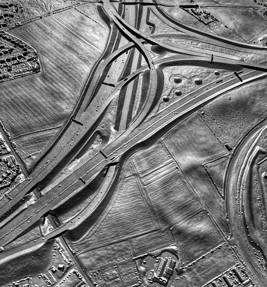
Submitted by Bladup on Saturday, 06 June 2026 (10254 reads)
Neolithic and Bronze AgeThe Holmfield Interchange, where the M62 meets the A1(M). But look, a henge, seen to the lower right in this stunning LiDAR image by Dr John Wells. The henge survives as low earthworks but is in danger from ploughing. Image submitted by Bladup
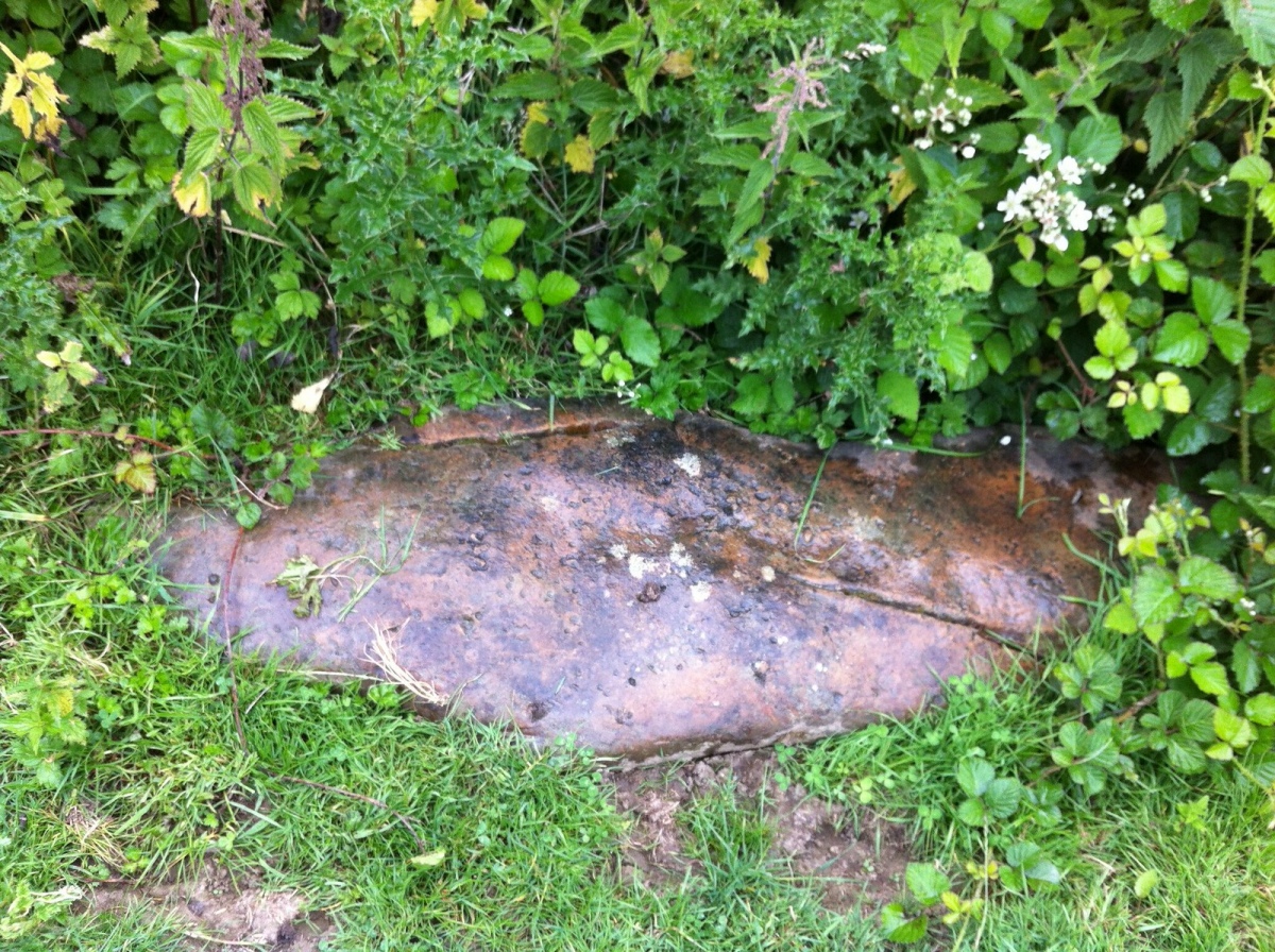
Submitted by Andy B on Saturday, 06 June 2026 (6855 reads)
Multi-periodA lovely National Trust house but listed on the Portal because of Charles Darwin's 'Earthworm Stone' in the grounds. This was one of the sources of the research for Darwin's classic earthworm paper and book which are still cited by archaeologists today. The house also has some recently re-discovered wall paintings from the 1960s which are apparently copies of those at Knossos Palace on the island of Crete. Image submitted by Jon Agar
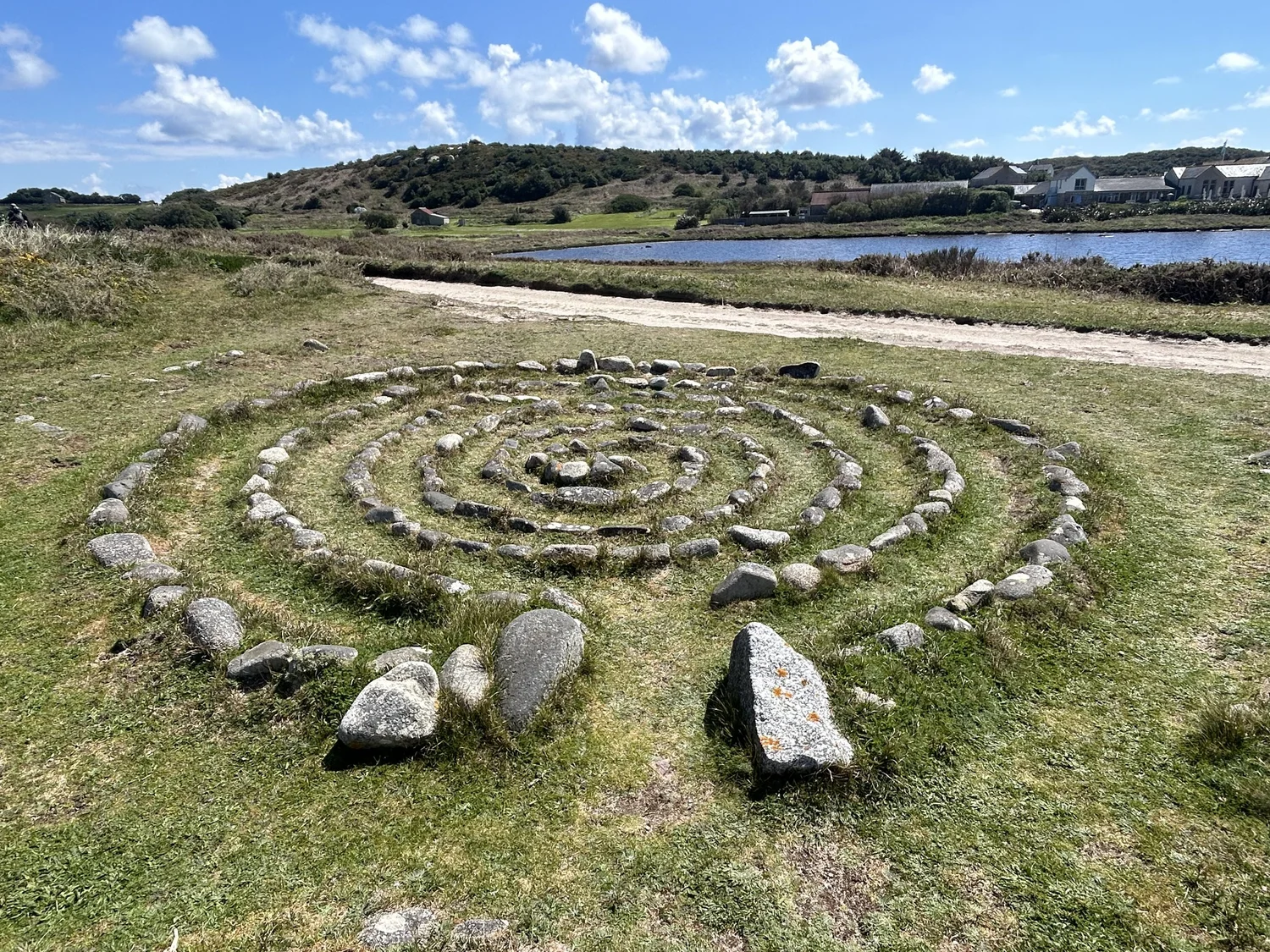
Submitted by Anne T on Tuesday, 02 June 2026 (705 reads)
Modern SitesA small stone labyrinth on Bryher, one of the Isles of Scilly. Created in the 1990s, the labyrinth is formed from rounded rocks gathered from the adjacent storm beach and is 5.0 metres in diameter, with two larger rocks placed at the entrance. The design is basically a spiral with five circuits, but with several choices and switch-backs that increase its complexity and make it a simple maze rather than a true labyrinth. Image submitted by Anne T
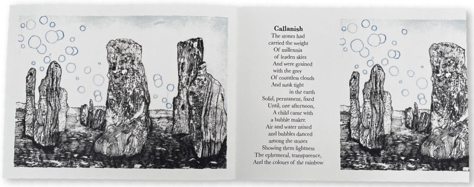
Submitted by TheCaptain on Tuesday, 02 June 2026 (23384 reads)
Neolithic and Bronze AgeThe main Calanais I site forms a sort of Celtic Cross shape. Check the nearby sites list and map from our page for more details of this and each of the dozens of surrounding standing stone sites. Image submitted by Andy B
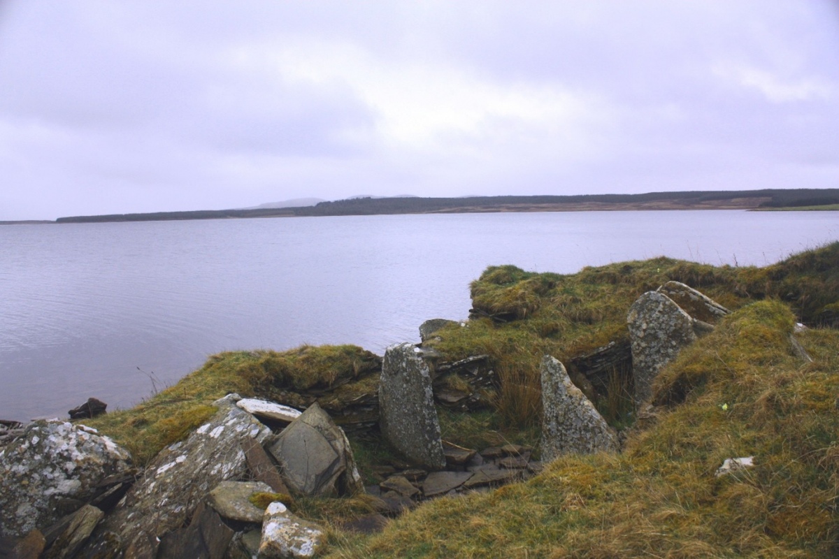
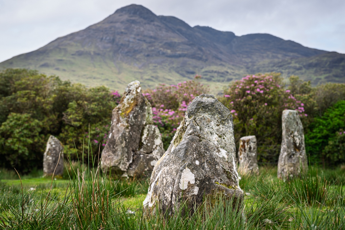
Submitted by enkidu41 on Sunday, 31 May 2026 (23221 reads)
Neolithic and Bronze AgeA stone circle on Mull set in a natural amphitheatre formed by the surrounding hills - a magical place. The 13.4m diameter circle originally consisted of 9 stones, one of which has disappeared and been replaced with a small boulder. The stones range in height from 1.2m to 2m and have flat faces faced inwards. There are 3 outliers, the nearest of which is 0.85m high and lies just to the SE, the tallest 2.7m to the SW. Image submitted by MegalithicMouse
Submitted by Anne T on Sunday, 31 May 2026 (1357 reads)
Neolithic and Bronze AgeA Neolithic stone axe quarry on Lambay Island, a small island 4 km off the north Dublin coast, east of Rush. Stone from the island's porphyritic andesite (Lambay Porphyry) outcrops was quarried and worked into polished stone axes from the early Neolithic onwards. Lambay axes have been found at sites across eastern Ireland. The only Neolithic stone axe quarry in Ireland with evidence for all stages of production, from quarrying to final polishing. The island setting meant all raw material had to be transported to the mainland by boat, indicating the value placed on this particular stone source and the maritime capabilities of Neolithic communities in the Irish Sea. Image submitted by Anne T
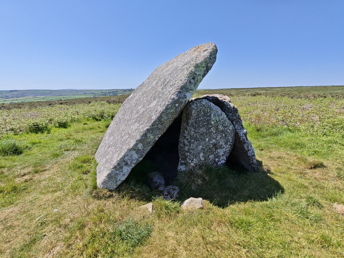
Submitted by hamish on Tuesday, 26 May 2026 (18702 reads)
Neolithic and Bronze AgeOne of the smallest Penwith chambered tombs. Only 3 of the 4 support stones remain so the 2.9m square capstone has slipped and leans against the 3m x 1.7m x 1.7m high chamber. Similar to Chûn Quoit but sadly not as well preserved. The capstone has fallen and now leans on the two remaining uprights. There is a possible cup mark on the capstone. Image submitted by Bladup
Submitted by dooclay on Monday, 25 May 2026 (781 reads)
Neolithic and Bronze AgeAt a prominent height in an area of gravel eskers. A shallow forecourt at the eastern end opens between tall portal stones into a two-segment burial gallery. One huge slipped capstone survives. The gallery is surrounded by a rectangular cairn, approx. 30m long x 15m wide. The gallery is 2.25m wide. In the rear of the cairn are two lateral chambers, originally reached between portals tones from the long sides of the cairn. Image submitted by dooclay
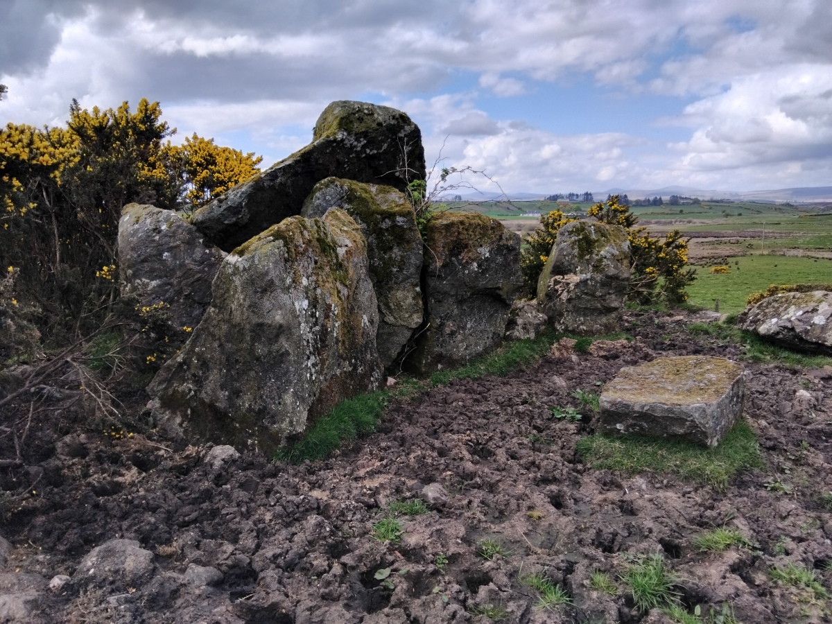
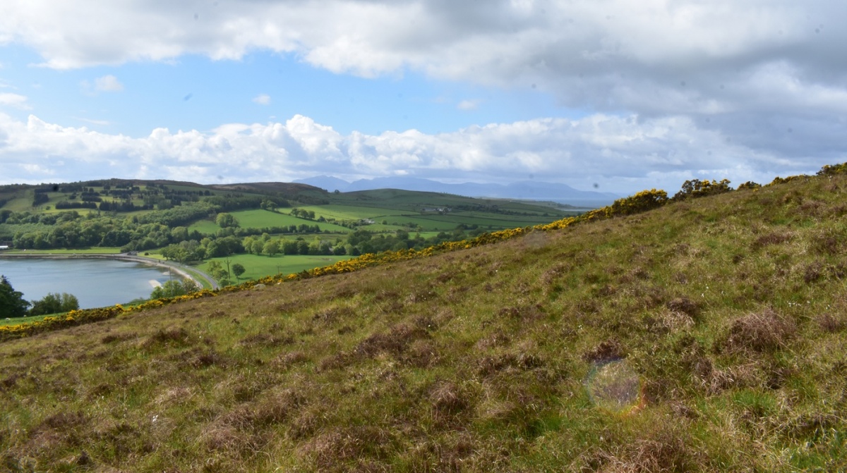
Submitted by drolaf on Monday, 25 May 2026 (819 reads)
Neolithic and Bronze AgeIn a lovely location overlooking Kames bay and the mainland hills, but positioned so there are also views of North Arran. It's hard to get photos of the stones as the cairn is covered in gorse. A short but stiff hike up the hill from the road layby. Image submitted by drolaf
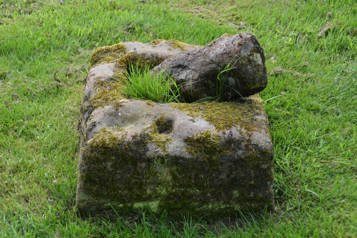
Submitted by Anne T on Sunday, 24 May 2026 (642 reads)
Early MedievalWith its early origins, we hunted around for any signs of a preaching cross, and whilst there were odd rectangular, worked sandstone blocks around the churchyard, I (Anne T) spotted this limestone Anglo Saxon cross base. A very pleasant location, and interesting to look around. More photos from the church, including Roman pottery, on our page Image submitted by Anne T
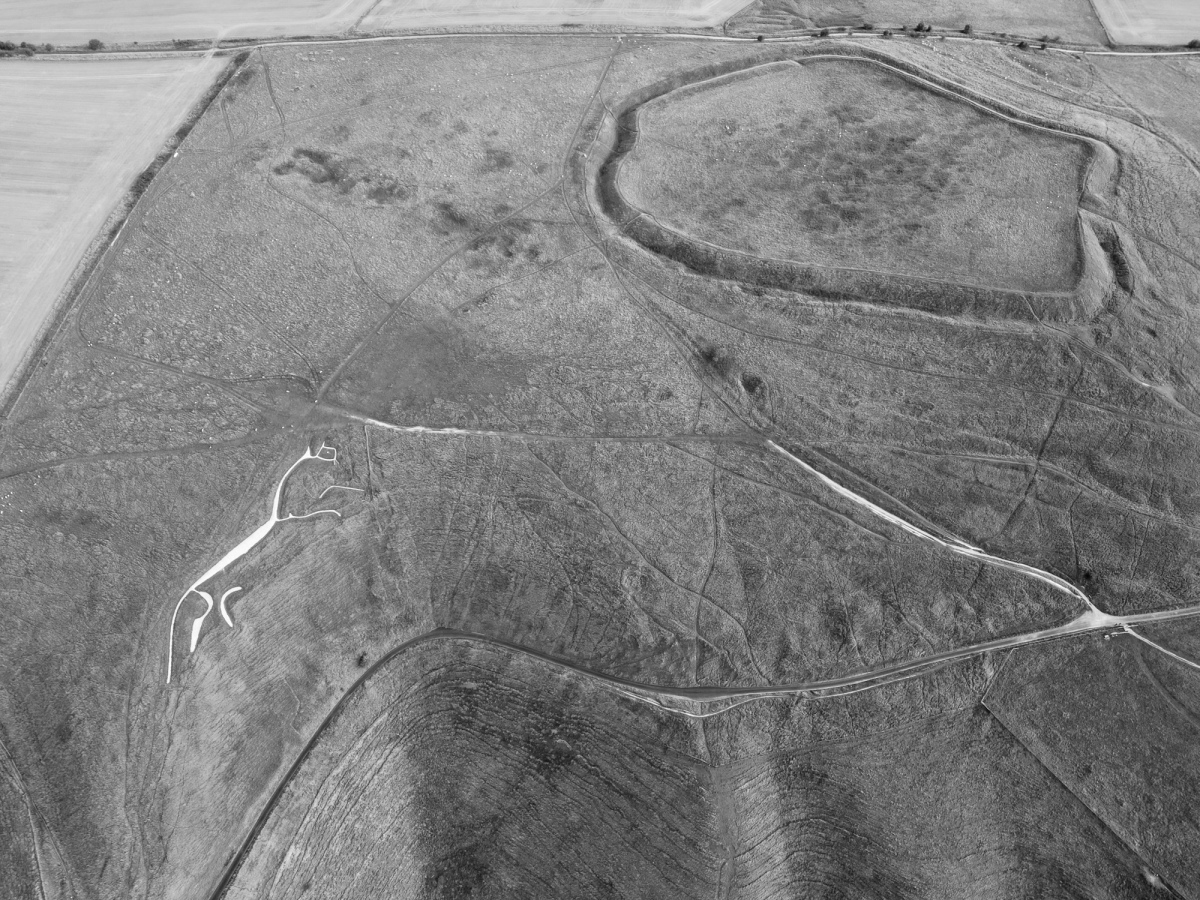
Submitted by h_fenton on Sunday, 24 May 2026 (9346 reads)
Neolithic and Bronze AgeA barrow 25 metres long by up to 12 metres across and 0.3 metres high. The barrow is aligned roughly southwest to northeast about 70 metres north of Uffington Castle. The long barrow also seems to be the focal point of a later Romano-British inhumation cemetery. Image submitted by Horatio
You can see the outline of the barrow in the centre - the white chalk path from the right is pointing at the barrow, between the horse and the fort Read Article | 1 News and Comments | Category: Our Photo Pages
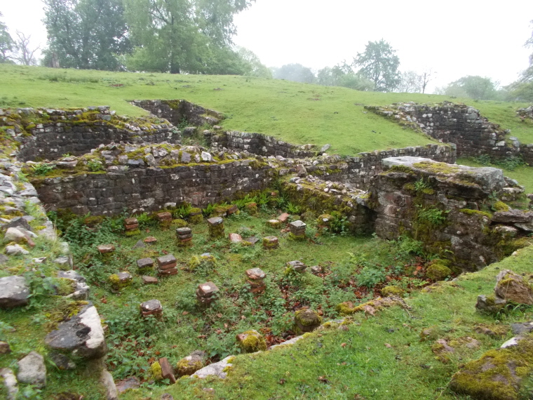
Submitted by AngieLake on Saturday, 23 May 2026 (15646 reads)
Multi-periodA promontory fort some 5 acres in size was established at Lydney in or just before the 1st century BC and was subsequently during the 2nd. & 3rd. cents. CE, occupied by a Romano-British population engaged to some extent in iron-mining. Image submitted by AngieLake
Last chances to visit Lydney Park Gardens, Hillfort and Romano-British temple for this year are this Sun 24th, Mon 25th, Fri 29th, Sat 30th and Sun 31st May, more details in the comment on our page Read Article | 7 News and Comments | Category: Our Photo Pages
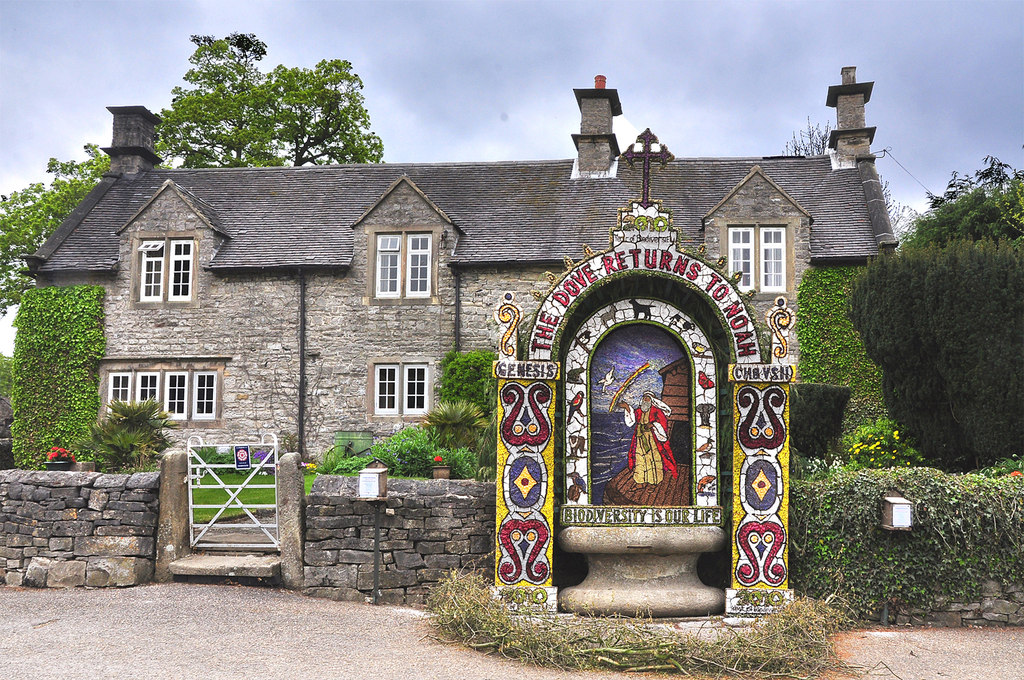
Submitted by Anne T on Thursday, 21 May 2026 (6033 reads)
Springs and Holy WellsTissington in Derbyshire is known as the mother place of well dressing and visitors come from all over the world to witness the annual well dressing ceremony. This takes place on Ascension Day, (May 14th this year) when five attractive wells are dressed together with a children’s well. Image submitted by Creative Commons