 with our Megalithic Portal iPhone app")

Register here - as a registered user you get more features and fewer ads.
Dr. Peter Purton writes: Larger castles have been well studied. Lesser ones have not. There are probably at least a thousand earthworks in what was then England, most of which have never been excavated, never dated, their function only guessed at. Many are called “mottes” with no more evidence than that they look like one. The old certainty that all Norman castles were originally of motte and bailey design has been replaced with awareness that the recognisable conical mound forming the motte was sometimes added later to a simpler enclosure defined by a ditch, rampart and palisade. The bailey too is proving more complex: why did some castles have two (or more), why are some so vast? Some now seem to have enclosed whole villages, others are too cramped for any but the smallest buildings. The CST-funded project at Caus (Shropshire) tackles this question.
950 years after William began the conquest of England, we are asking questions about Norman castles based not on old prejudices about what castles were, but on historical and archaeological study based in a better understanding of the reality of eleventh and twelfth century societies.
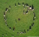
Earthwork, geophysical and photogrammetric survey at Caus Castle, Shropshire
The site, a large motte-and-bailey structure with some sections of upstanding masonry, has been frequently referenced previously but has never actually been subject to any form of detailed archaeological research. The focus of the proposed project is the outer bailey of Roger fitz Corbet, the ramparts of which enclose the medieval borough. The borough of Caus is well attested to in documentary sources, from the granting of a market charter in 1200 to its decline in the 16th century. The physical archaeology of the site is much less known.
A three-pronged approach is used: earthwork survey, geophysical survey, and photogrammetic survey. The project is led by Michael Fradley, and the results will be archived with the Shropshire HER and submitted to the Transactions of the Shropshire Archaeological and Historical Society.
Some of the project questions cannot be conclusively answered, in particular as to whether the outer enclosure originated as an Iron-Age hillfort, although several new observations have been made on the subject.
http://castlestudiestrust.org/Caus-Castle.html
Earthwork, geophysical and photogrammetric survey funded by the Castle Studies Trust.
https://sketchfab.com/models/f9b556632b7d496eb25acab738eeb987
Audio: Caus Castle - how much can we learn without putting a spade in the ground?
https://soundcloud.com/castle-studies-trust
ELECTRICAL RESISTANCE SURVEY, CAUS CASTLE, WESTBURY, SHROPSHIRE (2MB PDF)
http://castlestudiestrust.org/docs/ESA-7959.pdf
ARCHAEO-TOPOGRAPHICAL SURVEY CAUS CASTLE, WESTBURY SHROPSHIRE, A preliminary report (3.2MB PDF)
http://castlestudiestrust.org/docs/ESA-8179.pdf
Something is not right. This message is just to keep things from messing up down the road