

Register here - as a registered user you get more features and fewer ads.
Excerpts from R. Hansford Worth’s Survey of The Prehistoric Monuments of Scorhill, Buttern Hill and Shuggledown (Shoveldown) as read at Paignton on 21st June 1932.
[Reprinted from the Transactions of the Devonshire Association for the Advancement of Science, Literature, and Art. 1932. – Vol. lxiv, pp. 279-287.]
NB: There was no copyright note on either* of the Transactions of the Devonshire Assoc. booklets that I bought recently in a hospice charity shop in Exeter. * [The second is The Stone Rows of Dartmoor, Part 1].
Btw: Letters after his name = R. Hansford Worth, M. Inst. C. E., F.G.S. (Presumably a Civil Engineer and fellow of Geological Soc.?, who should have been capable of producing a very accurate survey and account.)
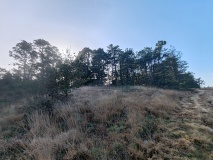
STONE ROWS ON SHUGGLEDOWN
Before starting at the beginning of his lecture on Shuggledown (Shoveldown), it might be helpful to look at R. Hansford Worth’s plan of his 1931 survey on Meg P’s site page for ‘Shovel Down’, and read a summing-up paragraph that explains the ‘lay [or lie] of the land’:
“As regarding the whole group, a plan alone is capable of some misinterpretation, the levels have a great influence in any attempt at realizing the conditions. In this case the line of the rows crosses a ridge. The rows north of F lie on ground descending to the north, and those south of H lie on ground descending to the south. The two sets, north of F and south of H, are each wholly invisible from any part of the other. Even in each group there are parts obscured from points in the same group. Thus from the north end of the row lying north of the Longstone, that menhir can not be seen.”
At the beginning of his lecture Hansford Worth made this interesting comment:
“It has been alleged by more than one writer that the rows on Shuggledown form part of a series which once extended from the Fernworthy Circle to the Scorhill Circle.” However, he found no evidence for this during his detailed surveys.
According to Worth, the best approach to Shuggledown Rows is from Batworthy Corner, starting at the north end of the group. “Standing at Batworthy Corner and looking a little west of south, you will see at a distance of about 285 feet the first stone of a row; except where it has been robbed the row is double. It is obvious that the north end has been much more severely despoiled than the south part, probably as being much nearer the walls and fences of Batworthy, which have very possibly swallowed a considerable length of the row.”
“This row, marked A-B on the plan, is in length 595’-7” to the centre of a barrow with a fourfold circle which forms its southern terminus. I noted 34 stones still standing, and four fallen. Between the pairs of stones constituting the double row the average distance is 3ft. 6ins. The two last stones, before the circle is reached, are both fallen, both are larger far than the other members, the one further from the circle being 7ft. 4ins. in length, and the nearer being 11ft. 6ins. In length; this latter is inscribed with the letters “G.P.” being a boundary mark of Gidleigh Parish, an adopted use.”
He mentions Croker [1852] as giving the most accurate description of the fourfold circle: “a set of circles of upright stones placed as follows: the outermost circle consists of 17 stones, the second of 6 stones, the third of 8 stones, and within this are 3 stones irregularly placed, the whole being 15 feet in circumference.” Here, Hansford Worth points out Croker’s error – “circumference” should read “radius”.
H. Worth observes: “Today”.. [1931]..”the outermost circle contains nine stones standing and one fallen (Ormerod, 1858, say ten stones in all), and has evident gaps; it may well be that seven stones have been removed since 1852, indeed, the least number required to fill the gaps would be five. The second circle still presents six stones, all standing, and probably once had four more. The third circle still has eight stones, all standing, and probably once had two more. (There is an obvious error in Ormerod’s statement that the diameter of this circle is 3 feet; the measure is 16 feet.) The fourth and inmost circle has four standing stones, two fallen, and room for two more. This fourfold circle has its parallel in the much larger example on Yellowmead Down which is over twice the diameter.”
“The direction of length of the row A-B is S. 1⁰- 40’ E. About 83 feet north-west of the centre of the fourfold circle is the end of another double row” .. [D-E].. “which extends 476 feet in a direction N. 21⁰-15’ W.” [NB: Later Worth gives Row E-D’s orientation as “S. 21⁰-15’ E.] “The average distance between the lines of stones is a little over four feet, but it varies considerably. For the more part the stones of one or the other line are missing and there are but nine pairs standing as such. I counted forty stones in all. No special feature now marks either end of the row, neither barrow, menhir, nor blocking stone.”
“On a bearing a little to the north of west from the north end of row D-E, and at a distance of 207 feet is the centre of the geometric circle which would pass through three stones still standing.” [‘CIRCLE ?’ on plan]. “Whether these stones are in fact the remains of a circle cannot be determined; they are three standing stones, and the greatest breadth of each is set tangentially to the circle which can be described as passing through them, and would have a diameter of 56 feet 6 inches.” [NB: In the early days – 1997? – of my membership of our local dowsing group we did extensive archaeological dowsing surveys on Shovel Down, and found a circle in this area. It dowsed as ceremonial, rather than just a hut circle, btw.]
“Returning to the point B, almost due west from this, and at a distance of 65 feet 6 inches, is the commencement of yet another double row, C-F, the direction of which is S. 28-30’ E.,” [see table of orientations of rows]* “the length of which to the centre of the barrow which forms the southern end is 386 feet. The two lines of this row are 5 feet apart, twelve pairs of stones still stand, thirty-one stones stand the companions of which have been removed, and there are six fallen stones. At a point 94 feet along the row, measured south from C, and at a distance 29 feet to the east is a barrow of 13 feet diameter.” [Marked ‘CAIRN’, below ‘B’]
“The Barrow at F, which forms the southern terminus of the row C-F, has a diameter of about thirteen feet. It may have contained a kistvaen; indeed, Ormerod describes this row as ending in a kistvaen.” [1858?]
“About 225 feet to the S.S.E. from the centre of the barrow at F are the first remaining stones of a double row which runs S. 3⁰ E. for a distance of 485 feet, to the Longstone, with which it terminates. Of this row ten pairs still stand, and thirty stones which have lost their companions, while five have fallen. The average distance between the rows would appear to have been about 3 feet three inches.”
[This row seen starting below ‘G’ on the plan.]
“The Longstone is a fine menhir, measuring at the base, N. 35 ½ inches, E. 24 inches, S. 33 inches and W. 21 inches; its height is 10 feet 5 inches (Croker and Page both give the height as 12 feet).” [The latter pair writing in 1851? and 1889?]
“Due South of the Longstone, at a distance of about 555 feet, is an isolated menhir, the last of three associated stones, known as the Three Boys, which Ormerod suggests were once the supporters of a cromlech. (More probably these were merely selected large stones at the end of the row, as at the fourfold circle.) The two missing stones have doubtless gone as gateposts to the Thornworthy enclosures; and the same enclosures have absorbed in their fences the stones of a double row which formerly connected the Longstone and the Three Boys. Ormerod states that, in 1858, the pits left by the removal of the stones of this avenue were still to be seen in the turf.”
“The remaining “Boy” is now much out of the perpendicular, and the length out of ground is about 4 feet 6 inches.”
[A point of interest: when I first met the dowsers whose group I subsequently joined, they were surveying and dowsing the Longstone, and had dowsed a circle of stones surrounding it.]
Hansford Worth continues: “We may now return to the row running north from the Longstone. This has a companion lying at an average distance of forty feet to the east, being sixty feet away on the south and converging toward the Longstone Row to the north. Excepting Baring-Gould”.. [1900?].. “no previous writer has mentioned this row, and his plan shows it as, in part at least, double. It is now single, and appears always to have been so. From H to K it pursues a straight course, S. 11⁰ E., 95 feet in length, and contains thirty small stones still set, the largest of which is 25 inches in height. But from H northward there is a curious apparent extension, consisting of nine small stones and a terminal of larger size which has fallen, its length is 4 feet 6 inches and its greatest width 2 feet 9 inches. This extension curves to the west, toward the point F. It may really be an independent row.”
“The interest of this group as a whole is increased by the fact that it supplies instances of rows which fail to conform with the rule that the direction should lie somewhere between South and West, and exceptions to that rule are exceedingly rare. Here we have the following directions: -
1. Row A-B. S. 1⁰-40’ E.
2. Row E-D. S. 21⁰-15’ E.
3. Row C-F S. 28⁰-30’ E.*
4. Row H-K S. 11⁰-0’ E.
5. Longstone Row. S. 3⁰-0’ E.
6. Longstone to Three Boys, due S.
*[NB: Worth did not put a ⁰ sign after ‘28’ on his earlier statement regarding row C-F, but this orientation in the table above seems more accurate when compared to his plan.]
“The deviations from the rule may be ignored in the case of 1, 5 and 6, but 2, 3 and 4 are a different matter. No explanation can be offered; we know too little.”
“It remains to mention a kistvaen which lies 177 feet distant from Thornworthy Corner, on a bearing N. 14⁰ W., one side stone measures 5 feet 6 inches, and the direction of length is S. 1⁰ E., conforming to the kistvaen rule as to the direction lying within the south-east quadrant. This kistvaen has not previously been reported.”
I hope Meg P readers will find this useful. I've been there many times but never with such detailed information at hand. Even if this is now superseded by Butler's more modern surveys it might be useful to compare the number of stones left today, and how they once leaned over, or matched in pairs along a row, and even follow the missing row? Maybe someone has excavated the 'circle?'...?
[As well as dowsing that one, our group - while I was working full-time - dowsed a huge circle on the summit of Shovel Down. A 'cromlech' at its centre aligned with sunrise rising over Kestor Rock on Summer Solstice. Members Tony and Jackie observed and filmed this event. As with all the group's dowsing surveys, careful plans were drawn up, so there's a written and drawn record of the circle, which they christened 'The Arena Circle'.]
Something is not right. This message is just to keep things from messing up down the road