Register here - as a registered user you get more features and fewer ads.
I drove to the Menhir da Meada from Castelo de Vide in April 2010. The menhir is 15 kilometres to the north of the town. Initially I took the Póvoa e Meadas road reached north of Casetlo de Vide from the N246-1. I continued along the Póvoa e Meadas road for approximately 7 kilometres. I then turned right (east) and drove for 6 kilometres to a T junction. Here I turned left (north) and drive for a kilometre to a road on the right where there was a sign for the menhir. The nice park containing the menhir is 800 metres down this lane. On the way back I took the more direct road towards Castelo de Vide but I think trying to find this route from the town towards the menhir might be more complex as the road near the town has may side roads and branches. The GPS coordinates for the menhir taken at the site with my hand held GPS were: 39.49603N and 07.44572W which confirm those taken by Magalhaes in 2006.
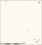
This is perhaps the tallest menhir in Iberia. Made of granite and recently restored (1993), it is thought to have been part of an alignment of menhirs each intervisible. Hence its height as it was located in a slight depression. It is huge at 7 metres tall and 1.25 metres diameter.
Something is not right. This message is just to keep things from messing up down the road


