Register here - as a registered user you get more features and fewer ads.
I found this last night by Googling:
"Gournay-sur-Aronde
The site in Northern France known as Gournay-sur-Aronde can be classified as a site similar to Stonehenge or similar to Cahokia. Gournay-sur-Aronde is similar to Cahokia and Stonehenge as to the way it is setup. Although Cahokia is not a ritual site, Stonehenge is, as well as Gournay-sur-Aronde and all three are built according to the alignment of the stars. The site at Gournay-sur-Aronde was built by the warlike tribe called Belgae dating to the ending of the fourth century to the beginning of the third century BC. The ritual site was built as a center for the Celts; they positioned the site in the pathway of the sun and the location of the Pole star in the night sky. The ritual site at Gournay-sur-Aronde in ancient Gaul was rectangular in shape, surrounded by a ditch of two meters and a wall that was 150 feet by 125 feet. The site is located near a marshy swamp, because the Celts believed their gods preferred the dead stench of the water. On the eastern wall was a entrance and once inside it contains one large pit surrounded by three pits to the North, three pits to the West, and three pits to the South. There is evidence that the entire site was decorated and painted according to Celtic standards.
The main purpose of this ritual site is sacrificial, sacrificial to humans, animals, and other items. The Celts rituals had a variety of meaning, there is fact that a single old oxen was sacrificed in the large central pit and left to decompose. They performed this ritual as an offering to the underground divinities to ensure the potential fertility of the Celts oxen herds. The nine pits located to the West, North, and South is where the Celts deposited their animal victims, and the sacrifice of weapons. This is a peculiar ritual the Celts performed, the sacrifice of weapons and armor, up to 500 different sets of armor have been found at Gournay-sur-Aronde, swords are broken, shields are twisted, scabbards busted, helmets dented. It is not understood as to whether this armor is an offering to gods or taken from an enemy. What was taken from the enemy is evident, the Celts were bloodthirsty and they beheaded their enemies after death as a punishment. It is believed they did this to honor the divinity. They hung the heads of their enemies above the eastern entrance as archaeological digs suggest. Finally, the ditch surrounding the wall plays an important part as well, human remains along with animal remains suggests this is where they dumped victims that were no longer necessary, and so the next ritual could begin."
http://www.mnsu.edu/emuseum/archaeology/sites/europe/gournay-sur-aronde.htm
I was very interested when I stumbled across this place whilst reading Mysteries of the Ancient World [Editor Judith Flanders, Weidenfield & Nicolson, 1998] in a chapter about the Druids.
On a visit in 2002 to Bryn Celli Ddu I dowsed the Ox Burial site outside the entrance to the chamber, and found that the movement was labyrinth-like, yet kept to the shape of a rectangular border around the Ox Burial area. If there is a link with Druids, then there are many tales of Druids' links with Anglesey.
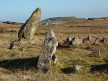
It also set me wondering about King Arthur's Hall on Bodmin Moor. Though I didn't get labyrinth-like movement there, I did follow movement around the outside, first high up on the top of the bank, anticlockwise, from SW to N. At N my rods turned 5 times towards S as I moved along anticlockwise, then I was 'taken' down to a lower level at the foot of the [inner] bank, moving [still anticlockwise] from NW to N. On arriving at the centre of the N side, the rods 'took me' into the centre, though I was unable to follow this due to the boggy ground. In the above website text, it refers to boggy ground being favoured for these sites. (See King Arthur's Hall page for photos that day.) I had a theory about the stones lining the rectangle at West being similar to Bull's horns too.
I'll try to post up more from the book, as that shows a plan of the enclosing ditch at Gournay-sur-Aronde.
Something is not right. This message is just to keep things from messing up down the road


