<< Text Pages >> Fittleton 5 Long Barrow - Long Barrow in England in Wiltshire
Submitted by SolarMegalith on Thursday, 07 March 2013 Page Views: 2652
Neolithic and Bronze AgeSite Name: Fittleton 5 Long BarrowCountry: England
NOTE: This site is 0.5 km away from the location you searched for.
County: Wiltshire Type: Long Barrow
Map Ref: SU19885166
Latitude: 51.263754N Longitude: 1.71646W
Condition:
| 5 | Perfect |
| 4 | Almost Perfect |
| 3 | Reasonable but with some damage |
| 2 | Ruined but still recognisable as an ancient site |
| 1 | Pretty much destroyed, possibly visible as crop marks |
| 0 | No data. |
| -1 | Completely destroyed |
| 5 | Superb |
| 4 | Good |
| 3 | Ordinary |
| 2 | Not Good |
| 1 | Awful |
| 0 | No data. |
| 5 | Can be driven to, probably with disabled access |
| 4 | Short walk on a footpath |
| 3 | Requiring a bit more of a walk |
| 2 | A long walk |
| 1 | In the middle of nowhere, a nightmare to find |
| 0 | No data. |
| 5 | co-ordinates taken by GPS or official recorded co-ordinates |
| 4 | co-ordinates scaled from a detailed map |
| 3 | co-ordinates scaled from a bad map |
| 2 | co-ordinates of the nearest village |
| 1 | co-ordinates of the nearest town |
| 0 | no data |
Internal Links:
External Links:
Long Barrow in Wiltshire
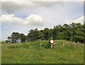
A Neolithic long barrow of 45 x 17m dimensions and maximum height of 1.5 m. It was recorded as Fittleton 5 by Grinsell.
Read More at Pastscape.
You may be viewing yesterday's version of this page. To see the most up to date information please register for a free account.
Do not use the above information on other web sites or publications without permission of the contributor.
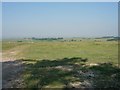
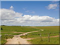
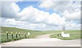
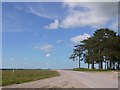
Nearby Images from Geograph Britain and Ireland:
©2006(licence)
©2015(licence)
©2011(licence)
©2015(licence)
©2015(licence)
The above images may not be of the site on this page, they are loaded from Geograph.
Please Submit an Image of this site or go out and take one for us!
Click here to see more info for this site
Nearby sites
Key: Red: member's photo, Blue: 3rd party photo, Yellow: other image, Green: no photo - please go there and take one, Grey: site destroyed
Download sites to:
KML (Google Earth)
GPX (GPS waypoints)
CSV (Garmin/Navman)
CSV (Excel)
To unlock full downloads you need to sign up as a Contributory Member. Otherwise downloads are limited to 50 sites.
Turn off the page maps and other distractions
Nearby sites listing. In the following links * = Image available
642m ESE 123° Weather Hill Disc Barrow* Round Barrow(s) (SU20425131)
1.2km NE 39° Weatherhill Henge* Henge (SU20635259)
2.0km ENE 74° Snail Down Barrow Cemetery* Barrow Cemetery (SU218522)
2.1km SE 124° Sidbury Camp* Hillfort (SU216505)
3.0km E 91° Cow Down Barrow Cemetery Barrow Cemetery (SU229516)
3.5km NNE 23° Collingbourne Kingston 2 Bowl Barrow Round Barrow(s) (SU2122454921)
3.6km WNW 298° Lidbury Camp Hillfort (SU16645335)
3.8km SSW 202° Figheldean Earthwork* Misc. Earthwork (SU1846348131)
3.9km SW 227° Idmiston Cursus Cursus (SU1749)
4.0km NNE 29° Collingbourne Kingston 3 Bowl Barrow Round Barrow(s) (SU21845520)
4.7km NNW 342° Everleigh Barrows Barrow Cemetery (SU184561)
4.9km S 189° Silk Hill Barrow Cemetery (SU1915246835)
5.2km WNW 296° Chisenbury Camp Hillfort (SU15195387)
5.5km SE 127° Tidworth Bowl Barrow Round Barrow(s) (SU24274837)
5.5km SSE 160° Devil's Ditch (Wiltshire) Misc. Earthwork (SU21744649)
5.5km WNW 287° East Chisenbury Midden Ancient Village or Settlement (SU14605323)
5.7km SW 230° Gallows Barrow Round Barrow(s) (SU15564800)
5.7km SSE 162° Milston Down Long Barrows* Long Barrow (SU2171146251)
5.8km SW 215° Ablington Barrow Clump* Round Barrow(s) (SU1654546924)
6.5km E 95° Ludgershall Castle Southern Enclosure* Misc. Earthwork (SU2639051130)
6.6km N 352° Giant's Grave (Wiltshire)* Long Barrow (SU18925820)
6.7km ENE 77° Collingbourne Ducis 22 Bowl Barrow* Round Barrow(s) (SU26405317)
7.0km W 270° Enfold Bowl Barrow* Round Barrow(s) (SU129516)
7.0km WSW 254° Netheravon Cursus Cursus (SU131497)
7.6km NE 49° Collingbourne Kingston 21 Long Barrow* Long Barrow (SU25645671)
View more nearby sites and additional images


 We would like to know more about this location. Please feel free to add a brief description and any relevant information in your own language.
 Wir möchten mehr über diese Stätte erfahren. Bitte zögern Sie nicht, eine kurze Beschreibung und relevante Informationen in Deutsch hinzuzufügen.
 Nous aimerions en savoir encore un peu sur les lieux. S'il vous plaît n'hesitez pas à ajouter une courte description et tous les renseignements pertinents dans votre propre langue.
 Quisieramos informarnos un poco más de las lugares. No dude en añadir una breve descripción y otros datos relevantes en su propio idioma.