<< Our Photo Pages >> Harkerside Moor circle - Stone Circle in England in Yorkshire (North)
Submitted by Bladup on Sunday, 26 May 2013 Page Views: 4842
Neolithic and Bronze AgeSite Name: Harkerside Moor circleCountry: England
NOTE: This site is 1.0 km away from the location you searched for.
County: Yorkshire (North) Type: Stone Circle
Map Ref: SE035976
Latitude: 54.373895N Longitude: 1.947628W
Condition:
| 5 | Perfect |
| 4 | Almost Perfect |
| 3 | Reasonable but with some damage |
| 2 | Ruined but still recognisable as an ancient site |
| 1 | Pretty much destroyed, possibly visible as crop marks |
| 0 | No data. |
| -1 | Completely destroyed |
| 5 | Superb |
| 4 | Good |
| 3 | Ordinary |
| 2 | Not Good |
| 1 | Awful |
| 0 | No data. |
| 5 | Can be driven to, probably with disabled access |
| 4 | Short walk on a footpath |
| 3 | Requiring a bit more of a walk |
| 2 | A long walk |
| 1 | In the middle of nowhere, a nightmare to find |
| 0 | No data. |
| 5 | co-ordinates taken by GPS or official recorded co-ordinates |
| 4 | co-ordinates scaled from a detailed map |
| 3 | co-ordinates scaled from a bad map |
| 2 | co-ordinates of the nearest village |
| 1 | co-ordinates of the nearest town |
| 0 | no data |
Internal Links:
External Links:
I have visited· I would like to visit
Hayden would like to visit
")
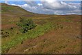
A stone circle on Harkerside Moor, All it says on the OS map is Hut circle, of which there's a few near it, but the stone circle appears to be totally unmarked.
You may be viewing yesterday's version of this page. To see the most up to date information please register for a free account.
")
Do not use the above information on other web sites or publications without permission of the contributor.
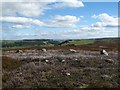
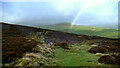
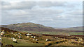
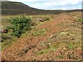
Nearby Images from Geograph Britain and Ireland:
©2016(licence)
©2020(licence)
©2011(licence)
©2016(licence)
©2008(licence)
The above images may not be of the site on this page, they are loaded from Geograph.
Please Submit an Image of this site or go out and take one for us!
Click here to see more info for this site
Nearby sites
Key: Red: member's photo, Blue: 3rd party photo, Yellow: other image, Green: no photo - please go there and take one, Grey: site destroyed
Download sites to:
KML (Google Earth)
GPX (GPS waypoints)
CSV (Garmin/Navman)
CSV (Excel)
To unlock full downloads you need to sign up as a Contributory Member. Otherwise downloads are limited to 50 sites.
Turn off the page maps and other distractions
Nearby sites listing. In the following links * = Image available
1.3km WNW 295° Maiden Castle Barrow (Yorkshire North) Round Barrow(s) (SE02349814)
1.4km WNW 290° Maiden Castle (N Yorks)* Ancient Village or Settlement (SE02189808)
4.2km NE 47° Whitton Burn(Rock Art) Rock Art (NZ066005)
5.0km NE 54° Forty Acres 03 (Stelling) Rock Art (NZ07580058)
8.3km SSW 200° St Matthew's Well (Carperby)* Holy Well or Sacred Spring (SE0065689756)
8.4km SSW 200° Carperby Cross* Ancient Cross (SE0063189729)
8.7km SSW 211° Carperby Stone Circle* Stone Circle (SD99009013)
9.5km NNE 16° Frankinshaw* Cairn (NZ06170672)
9.9km SE 145° Holy Trinity (Wensley)* Ancient Cross (SE09228954)
10.0km N 10° Barningham Moor 60* Rock Art (NZ0520607422)
10.0km NNE 13° How Tallon Cairn* Cairn (NZ05730740)
10.1km NNE 13° Barningham Moor 61 Rock Art (NZ0573907410)
10.1km N 9° How Tallon Stone Circle* Stone Circle (NZ05150755)
10.2km N 10° Barningham Moor 59* Rock Art (NZ0522007624)
10.2km N 10° Barningham Moor 58* Rock Art (NZ0523207672)
10.2km NNE 13° Barningham Moor 137 Rock Art (NZ0575907606)
10.3km N 10° Barningham Moor 89 Rock Art (NZ0534107709)
10.3km NNE 13° Barningham Moor 90* Rock Art (NZ0574707633)
10.3km N 11° Barningham Moor 81 Rock Art (NZ0544307698)
10.3km NNE 11° Barningham Moor 95 Rock Art (NZ0551607685)
10.3km N 11° Barningham Moor 118 Rock Art (NZ0549207690)
10.3km N 11° Barningham Moor 77 Rock Art (NZ0547407695)
10.3km NNE 11° Barningham Moor 74 Rock Art (NZ0552607687)
10.3km NNE 11° Barningham Moor 29 Rock Art (NZ0552707688)
10.3km N 11° Barningham Moor 122 Rock Art (NZ0548507697)
View more nearby sites and additional images


 We would like to know more about this location. Please feel free to add a brief description and any relevant information in your own language.
 Wir möchten mehr über diese Stätte erfahren. Bitte zögern Sie nicht, eine kurze Beschreibung und relevante Informationen in Deutsch hinzuzufügen.
 Nous aimerions en savoir encore un peu sur les lieux. S'il vous plaît n'hesitez pas à ajouter une courte description et tous les renseignements pertinents dans votre propre langue.
 Quisieramos informarnos un poco más de las lugares. No dude en añadir una breve descripción y otros datos relevantes en su propio idioma.