<< Our Photo Pages >> Priddy Circles Unfinished N - Henge in England in Somerset
Submitted by TheCaptain on Sunday, 07 December 2003 Page Views: 11213
Neolithic and Bronze AgeSite Name: Priddy Circles Unfinished N Alternative Name: Priddy Circle 4Country: England County: Somerset Type: Henge
Nearest Town: Wells Nearest Village: Priddy
Map Ref: ST54215355 Landranger Map Number: 182
Latitude: 51.279242N Longitude: 2.657878W
Condition:
| 5 | Perfect |
| 4 | Almost Perfect |
| 3 | Reasonable but with some damage |
| 2 | Ruined but still recognisable as an ancient site |
| 1 | Pretty much destroyed, possibly visible as crop marks |
| 0 | No data. |
| -1 | Completely destroyed |
| 5 | Superb |
| 4 | Good |
| 3 | Ordinary |
| 2 | Not Good |
| 1 | Awful |
| 0 | No data. |
| 5 | Can be driven to, probably with disabled access |
| 4 | Short walk on a footpath |
| 3 | Requiring a bit more of a walk |
| 2 | A long walk |
| 1 | In the middle of nowhere, a nightmare to find |
| 0 | No data. |
| 5 | co-ordinates taken by GPS or official recorded co-ordinates |
| 4 | co-ordinates scaled from a detailed map |
| 3 | co-ordinates scaled from a bad map |
| 2 | co-ordinates of the nearest village |
| 1 | co-ordinates of the nearest town |
| 0 | no data |
Internal Links:
External Links:
I have visited· I would like to visit
TheCaptain Andy B have visited here

From Somerset HER site No 24046.
Details:
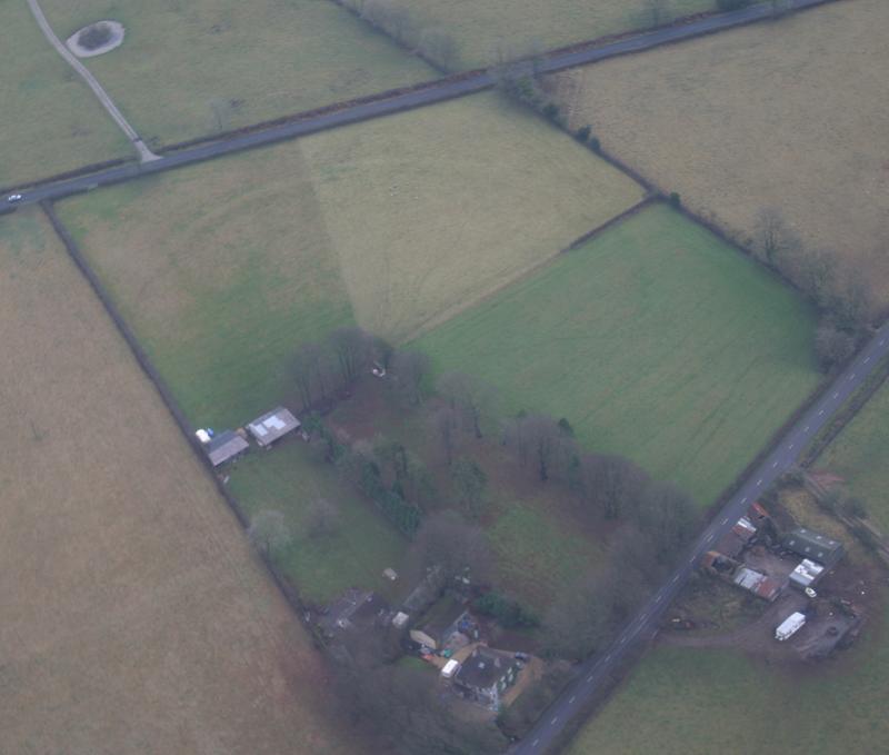
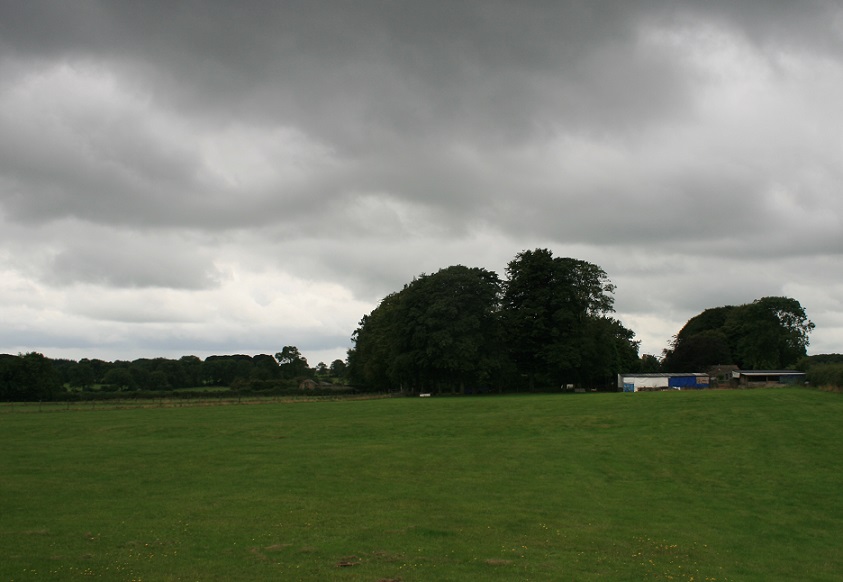
One of the Priddy circles, the most northerly of the four. Belongs to the secondary Neolithic period and falls into the henge group of monuments Banks average 1m high and the ditch 0.4m deep. {1}
Only E part survives. Bank 5m wide with outer ditch 4m wide at best 0.75m from ditch bottom to bank crest. Earthwork has obviously been ploughed in the past. Excellent close cropped turf - no damage. {2}
Associated with five possible barrows (PRNs 24047 24048 24049 24050 24051). Was in East Harptree parish but now in Priddy following formation of Avon County in 1974. {3}
Many of the surface depressions in and around the Priddy Circles are natural sinkholes, not mine workings. The construction of the Circles involved levelling several pre-existing sinkholes, but the ground remained liable to subsidence. Unsatisfactory ground conditions may have been one of the factors that led to the abandonment of the whole ceremonial site before the Circles were completed. {5}
See PRN 90072 for inconclusive geophysical survey and discussion. {7}
The monument appears stable under pasture. {8}
The northernmost of the four Priddy Circles, centred at ST 5421 5355 and described above in (1) to (9) was mapped and recorded as part of a survey of aerial photographs and Lidar in the Mendip AONB. The associated barrows that could be identified through aerial survey were also recorded (PRNs 24047, 24048 and 24049). This circle is detached from the other three which are located 330m to the southwest.
Priddy Circles are thought to be henge monuments dating to the Neolithic and were possibly used for a ceremonial or ritual purpose.
The circle is incomplete with a section missing in the southwest quadrant. The full diameter would be 173m. The largest continuous section of the circle earthworks is defined by an earthwork bank with an external ditch extending from ST 5421 5362 to ST 5425 5349. The circle continues from that point defined by the external ditch only up to ST 5417 5346. The bank measures up to 9m in width and the ditch measures up to 6m in width.
Two sections of the circle are visible in the northwest quadrant defined only by a bank. The first extends from ST 5411 5356 to ST 5413 5359. This section of bank was only visible on Lidar. The second extends from ST 5415 5361 to ST 5419 5362. The bank measures up to 11m in width. {10}
References:
1 Detailed records - Ordnance Survey Archaeology Division 1966 ST55SW4 (SCC Planning Department)
2 Detailed records - HBMC Field Monument Wardens report (SCC Planning Department)
3 Personal communication - Dennison, E Somerset County Council 12.09.85
4 Map - HBMC Field Monument Wardens report (SCC Planning Department)
5 Detailed records - Proceedings of the University of Bristol Spelaeological Society Stanton, W.I. 1986 "Natural sinkholes...Priddy Circles..." Vol 17(3), 355-8
6 Correspondence - English Heritage to Somerset County Council (20.2.1997) in HER files
7 Personal communication - Webster, CJ SMRO (14/12/1998)
8 Site visit report - Graham, A. EH field Monument Warden (/2000) report in HER files
9 Personal communication - Matthew Nicholas, Somerset County Council (7/7/2003)
10 Aerial photographs - RAF 3G/TUD/UK/25 5342-3 14-JAN-1946 in National Monuments Record
You may be viewing yesterday's version of this page. To see the most up to date information please register for a free account.


Do not use the above information on other web sites or publications without permission of the contributor.
Click here to see more info for this site
Nearby sites
Key: Red: member's photo, Blue: 3rd party photo, Yellow: other image, Green: no photo - please go there and take one, Grey: site destroyed
Download sites to:
KML (Google Earth)
GPX (GPS waypoints)
CSV (Garmin/Navman)
CSV (Excel)
To unlock full downloads you need to sign up as a Contributory Member. Otherwise downloads are limited to 50 sites.
Turn off the page maps and other distractions
Nearby sites listing. In the following links * = Image available
543m SSW 192° Priddy Circles N* Henge (ST54095302)
761m NW 321° Pool Farm Cist* Rock Art (ST53745415)
779m SSW 195° Priddy Circles* Henge (ST54005280)
786m SSW 194° Priddy Circles C* Henge (ST54015279)
1.0km SSW 195° Priddy Circles S* Henge (ST53945255)
1.0km SSE 162° Castle Farm Long Barrow* Long Barrow (ST54525255)
1.5km S 191° Ashen Hill Barrows* Barrow Cemetery (ST53905205)
1.6km NW 316° Wright's Piece barrows (N)* Barrow Cemetery (ST531547)
1.8km WNW 302° Wright's Piece barrows (S)* Barrow Cemetery (ST527545)
2.1km S 187° Priddy Nine Barrows* Barrow Cemetery (ST53925149)
2.6km NW 311° Whites Town Farm Tumulus* Round Barrow(s) (ST5223355265)
2.7km SW 216° Priddy Church Barrows* Barrow Cemetery (ST526514)
2.8km S 173° Fair Lady Well* Holy Well or Sacred Spring (ST54515079)
2.8km NNW 331° Fernhill Farm* Modern Stone Circle etc (ST52865606)
3.0km S 188° Eastwater Tumuli Round Barrow(s) (ST5377250539)
3.3km SW 234° Townsend Farm Barrow Cemetery* Barrow Cemetery (ST5152851658)
3.5km WSW 252° Cheddar Head Stone Circle (ST509525)
3.7km WSW 239° Bristol Plain Farm Barrow Cemetery* Barrow Cemetery (ST5097951665)
3.8km N 352° Barrow Well (Compton Martin) Holy Well or Sacred Spring (ST537573)
3.8km SW 226° Priddy long barrow* Long Barrow (ST5141550915)
3.8km SSE 153° Hunter's Lodge Inn Barrow* Round Barrow(s) (ST559501)
4.1km WNW 302° Nordrach Tumulus* Round Barrow(s) (ST5078755765)
4.1km SSE 155° Drove Cottage Henge* Henge (ST559498)
4.4km WNW 299° Charterhouse settlement* Misc. Earthwork (ST504557)
4.6km SW 226° Westbury-Sub-Mendip Cave or Rock Shelter (ST50855036)
View more nearby sites and additional images


 We would like to know more about this location. Please feel free to add a brief description and any relevant information in your own language.
 Wir möchten mehr über diese Stätte erfahren. Bitte zögern Sie nicht, eine kurze Beschreibung und relevante Informationen in Deutsch hinzuzufügen.
 Nous aimerions en savoir encore un peu sur les lieux. S'il vous plaît n'hesitez pas à ajouter une courte description et tous les renseignements pertinents dans votre propre langue.
 Quisieramos informarnos un poco más de las lugares. No dude en añadir una breve descripción y otros datos relevantes en su propio idioma.