<< Text Pages >> Leather Barrow - Round Barrow(s) in England in Somerset
Submitted by davidmorgan on Friday, 11 January 2013 Page Views: 2011
Neolithic and Bronze AgeSite Name: Leather BarrowCountry: England County: Somerset Type: Round Barrow(s)
Nearest Town: Minehead
Map Ref: SS98903553
Latitude: 51.110118N Longitude: 3.445584W
Condition:
| 5 | Perfect |
| 4 | Almost Perfect |
| 3 | Reasonable but with some damage |
| 2 | Ruined but still recognisable as an ancient site |
| 1 | Pretty much destroyed, possibly visible as crop marks |
| 0 | No data. |
| -1 | Completely destroyed |
| 5 | Superb |
| 4 | Good |
| 3 | Ordinary |
| 2 | Not Good |
| 1 | Awful |
| 0 | No data. |
| 5 | Can be driven to, probably with disabled access |
| 4 | Short walk on a footpath |
| 3 | Requiring a bit more of a walk |
| 2 | A long walk |
| 1 | In the middle of nowhere, a nightmare to find |
| 0 | No data. |
| 5 | co-ordinates taken by GPS or official recorded co-ordinates |
| 4 | co-ordinates scaled from a detailed map |
| 3 | co-ordinates scaled from a bad map |
| 2 | co-ordinates of the nearest village |
| 1 | co-ordinates of the nearest town |
| 0 | no data |
Internal Links:
External Links:
Round Barrow in Somerset
A large well preserved bowl barrow 3.3 metres high and 23 metres in diameter.
Pastscape monument no. 36615.
You may be viewing yesterday's version of this page. To see the most up to date information please register for a free account.
Do not use the above information on other web sites or publications without permission of the contributor.
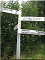
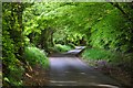
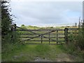
Nearby Images from Geograph Britain and Ireland:
©2019(licence)

©2013(licence)
©2013(licence)

©2013(licence)
©2015(licence)
The above images may not be of the site on this page, they are loaded from Geograph.
Please Submit an Image of this site or go out and take one for us!
Click here to see more info for this site
Nearby sites
Key: Red: member's photo, Blue: 3rd party photo, Yellow: other image, Green: no photo - please go there and take one, Grey: site destroyed
Download sites to:
KML (Google Earth)
GPX (GPS waypoints)
CSV (Garmin/Navman)
CSV (Excel)
To unlock full downloads you need to sign up as a Contributory Member. Otherwise downloads are limited to 50 sites.
Turn off the page maps and other distractions
Nearby sites listing. In the following links * = Image available
1.8km ESE 111° Wiveliscombe Barrow* Round Barrow(s) (ST00553486)
2.4km W 273° Cutcombe Barrow* Round Barrow(s) (SS9649635711)
2.7km NNE 21° Druids Combe wood boundary stone Marker Stone (SS99923799)
2.8km ESE 111° Naked Boy stone* Standing Stone (Menhir) (ST01493447)
3.1km NE 52° Langridge Wood Cist* Burial Chamber or Dolmen (ST01403740)
3.8km SE 129° Dun's Stone Natural Stone / Erratic / Other Natural Feature (ST018331)
4.2km ESE 108° Huish Champflower Barrow* Round Barrow(s) (ST0286234167)
4.3km WNW 289° Lype Hill Barrows* Barrow Cemetery (SS949370)
6.7km N 358° Bat's Castle* Hillfort (SS988422)
6.7km NNW 330° Timberscobe Wood Hill Fort Hillfort (SS956414)
6.9km NE 50° St Pancras Well* Holy Well or Sacred Spring (ST043398)
8.3km E 101° Elworthy Barrows hillfort* Hillfort (ST070338)
8.3km N 356° St. Leonard's Well (Dunster)* Holy Well or Sacred Spring (SS9850443867)
10.1km WSW 258° Caratacus Stone* Standing Stone (Menhir) (SS88973355)
10.3km NE 45° St Decumen's Well* Holy Well or Sacred Spring (ST064426)
10.5km NE 53° Battlegore* Round Barrow(s) (ST07454162)
10.8km SW 226° Oldberry Castle Hillfort (SS90932820)
10.8km NW 310° Robin How* Cairn (SS90764273)
10.9km NW 311° Joaney How Cairn (SS90814279)
11.3km W 263° Wambarrows* Barrow Cemetery (SS87613431)
11.4km NE 45° Watchet Market House Museum* Museum (ST0710043439)
11.4km WNW 301° Dunkery Beacon* Barrow Cemetery (SS892416)
11.7km ENE 74° Curdon Camp Hillfort (ST102385)
11.9km WNW 297° Codsend Moor Multiple Stone Rows / Avenue (SS88364110)
11.9km WSW 239° Mounsey Castle Hillfort (SS88562955)
View more nearby sites and additional images


 We would like to know more about this location. Please feel free to add a brief description and any relevant information in your own language.
 Wir möchten mehr über diese Stätte erfahren. Bitte zögern Sie nicht, eine kurze Beschreibung und relevante Informationen in Deutsch hinzuzufügen.
 Nous aimerions en savoir encore un peu sur les lieux. S'il vous plaît n'hesitez pas à ajouter une courte description et tous les renseignements pertinents dans votre propre langue.
 Quisieramos informarnos un poco más de las lugares. No dude en añadir una breve descripción y otros datos relevantes en su propio idioma.