<< Our Photo Pages >> Waun Sarn Cairn - Cairn in Wales in Powys
Submitted by elanvalleypastandpre on Monday, 02 August 2021 Page Views: 263
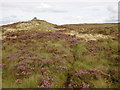
Date UncertainSite Name: Waun Sarn CairnCountry: Wales County: Powys Type: Cairn
Nearest Town: Rhayader Nearest Village: Elan Village
Map Ref: SN93066161
Latitude: 52.242252N Longitude: 3.567635W
Condition:
| 5 | Perfect |
| 4 | Almost Perfect |
| 3 | Reasonable but with some damage |
| 2 | Ruined but still recognisable as an ancient site |
| 1 | Pretty much destroyed, possibly visible as crop marks |
| 0 | No data. |
| -1 | Completely destroyed |
| 5 | Superb |
| 4 | Good |
| 3 | Ordinary |
| 2 | Not Good |
| 1 | Awful |
| 0 | No data. |
| 5 | Can be driven to, probably with disabled access |
| 4 | Short walk on a footpath |
| 3 | Requiring a bit more of a walk |
| 2 | A long walk |
| 1 | In the middle of nowhere, a nightmare to find |
| 0 | No data. |
| 5 | co-ordinates taken by GPS or official recorded co-ordinates |
| 4 | co-ordinates scaled from a detailed map |
| 3 | co-ordinates scaled from a bad map |
| 2 | co-ordinates of the nearest village |
| 1 | co-ordinates of the nearest town |
| 0 | no data |
Internal Links:
External Links:
")
You may be viewing yesterday's version of this page. To see the most up to date information please register for a free account.
")
Do not use the above information on other web sites or publications without permission of the contributor.
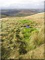
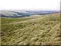
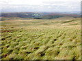
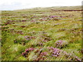
Nearby Images from Geograph Britain and Ireland:
©2009(licence)
©2009(licence)
©2009(licence)
©2009(licence)
©2009(licence)
The above images may not be of the site on this page, they are loaded from Geograph.
Please Submit an Image of this site or go out and take one for us!
Click here to see more info for this site
Nearby sites
Key: Red: member's photo, Blue: 3rd party photo, Yellow: other image, Green: no photo - please go there and take one, Grey: site destroyed
Download sites to:
KML (Google Earth)
GPX (GPS waypoints)
CSV (Garmin/Navman)
CSV (Excel)
To unlock full downloads you need to sign up as a Contributory Member. Otherwise downloads are limited to 50 sites.
Turn off the page maps and other distractions
Nearby sites listing. In the following links * = Image available
671m NW 316° Gro Hill Cairn 5* Cairn (SN926621)
743m NW 310° Gro Hill Cairn 4* Cairn (SN925621)
777m NNW 331° Gro Hill Cairns* Cairn (SN927623)
787m NW 326° Gro Hill Cairn 2* Cairn (SN92636227)
792m N 354° Crugian Bach prehistoric monument complex* Barrow Cemetery (SN930624)
796m N 5° Crugian Bach Stone Circle* Stone Circle (SN9314762402)
828m NW 325° Gro Hill Cist* Cist (SN926623)
987m WNW 298° Gro Hill Cairn 6* Cairn (SN922621)
1.0km WNW 303° Gro Hill Cairn 8* Cairn (SN922622)
1.2km W 278° Garn Lwyd Cairn* Ring Cairn (SN919618)
1.2km NW 315° Gro Hill Cairn 7* Cairn (SN922625)
1.3km E 98° y Gamriw 1* Ring Cairn (SN943614)
1.7km N 354° Ty'n Y Pant Cairn* Cairn (SN92936327)
1.7km N 359° Ty'n Y Pant Stone* Standing Stone (Menhir) (SN93086332)
2.2km E 86° y Gamriw 2* Cairn (SN953617)
2.3km ESE 124° Saith Maen WSW* Stone Row / Alignment (SN9492160315)
2.5km SW 236° Llwydnant Cairn II* Cairn (SN9090560238)
2.6km ESE 111° Carnau Cefn-y-Ffordd Standing Stone* Standing Stone (Menhir) (SN955606)
2.7km SW 236° Llwydnant Cairn 1* Cairn (SN9079860131)
2.8km WNW 299° Rhos Y Gelynnen Cairn* Cairn (SN9062163055)
2.9km ESE 113° Carnau Cefn-y-Ffordd Ring Cairns* Ring Cairn (SN957604)
2.9km WNW 299° Rhos y Gelynen Stones* Stone Row / Alignment (SN9054363085)
3.0km N 352° Elan Valley Visitor Centre* Modern Stone Circle etc (SN9272064599)
3.2km SSW 206° Gorllwyn* Cairn (SN9159858800)
3.2km SE 129° Drum Ddu cairns* Cairn (SN95535951)
View more nearby sites and additional images


 We would like to know more about this location. Please feel free to add a brief description and any relevant information in your own language.
 Wir möchten mehr über diese Stätte erfahren. Bitte zögern Sie nicht, eine kurze Beschreibung und relevante Informationen in Deutsch hinzuzufügen.
 Nous aimerions en savoir encore un peu sur les lieux. S'il vous plaît n'hesitez pas à ajouter une courte description et tous les renseignements pertinents dans votre propre langue.
 Quisieramos informarnos un poco más de las lugares. No dude en añadir una breve descripción y otros datos relevantes en su propio idioma.