<< Text Pages >> Comrie Cursus - Cursus in Scotland in Perth and Kinross
Submitted by EssexMan on Wednesday, 07 April 2010 Page Views: 3061
Neolithic and Bronze AgeSite Name: Comrie CursusCountry: Scotland
NOTE: This site is 0.5 km away from the location you searched for.
County: Perth and Kinross Type: Cursus
Nearest Town: Crieff Nearest Village: Comrie
Map Ref: NN77252048 Landranger Map Number: 51
Latitude: 56.360666N Longitude: 3.988395W
Condition:
| 5 | Perfect |
| 4 | Almost Perfect |
| 3 | Reasonable but with some damage |
| 2 | Ruined but still recognisable as an ancient site |
| 1 | Pretty much destroyed, possibly visible as crop marks |
| 0 | No data. |
| -1 | Completely destroyed |
| 5 | Superb |
| 4 | Good |
| 3 | Ordinary |
| 2 | Not Good |
| 1 | Awful |
| 0 | No data. |
| 5 | Can be driven to, probably with disabled access |
| 4 | Short walk on a footpath |
| 3 | Requiring a bit more of a walk |
| 2 | A long walk |
| 1 | In the middle of nowhere, a nightmare to find |
| 0 | No data. |
| 5 | co-ordinates taken by GPS or official recorded co-ordinates |
| 4 | co-ordinates scaled from a detailed map |
| 3 | co-ordinates scaled from a bad map |
| 2 | co-ordinates of the nearest village |
| 1 | co-ordinates of the nearest town |
| 0 | no data |
Internal Links:
External Links:
Cruciform Long Enclosure in Perthshire
Status: Possible
NMR No. NN72SE 79
Extent: 175mx25m
Pit-defined
Note: This location marks one terminal (end) of a cursus monument. The location of the other terminal can be found in the Nearby Site list below.
You may be viewing yesterday's version of this page. To see the most up to date information please register for a free account.
Do not use the above information on other web sites or publications without permission of the contributor.
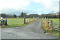
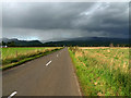
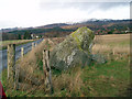
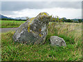
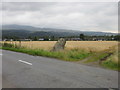
Nearby Images from Geograph Britain and Ireland:
©2013(licence)
©2009(licence)
©2007(licence)
©2009(licence)
©2019(licence)
The above images may not be of the site on this page, they are loaded from Geograph.
Please Submit an Image of this site or go out and take one for us!
Click here to see more info for this site
Nearby sites
Key: Red: member's photo, Blue: 3rd party photo, Yellow: other image, Green: no photo - please go there and take one, Grey: site destroyed
Download sites to:
KML (Google Earth)
GPX (GPS waypoints)
CSV (Garmin/Navman)
CSV (Excel)
To unlock full downloads you need to sign up as a Contributory Member. Otherwise downloads are limited to 50 sites.
Turn off the page maps and other distractions
Nearby sites listing. In the following links * = Image available
170m E 92° Comrie Cursus Cursus (NN77422047)
255m NE 48° West Cowden* Stone Row / Alignment (NN7744520645)
972m WNW 281° Craggish Stone Row / Alignment (NN763207)
1.0km NW 306° Comrie Cursus Cursus (NN76422112)
1.1km NE 43° Dalginross* Stone Circle (NN7802521264)
1.3km NW 312° Craggish (Comrie) Standing Stones (NN763214)
1.5km N 349° Tom na Chessaig Stone Circle (NN770220)
1.7km ESE 120° Auchingarrich Farm Standing Stone (Menhir) (NN78731958)
1.9km N 7° Coney Hill (Comrie)* Misc. Earthwork (NN77552238)
2.7km NW 317° Tullybannocher* Stone Circle (NN75482247)
3.1km SSE 155° Giant's Knowe (Culloch) Cairn (NN78481762)
3.3km SE 141° Craigneich Farm* Standing Stone (Menhir) (NN7922617871)
3.6km NE 51° Lawers* Standing Stone (Menhir) (NN80102267)
3.8km SSE 149° Dunruchan C (Muthill)* Standing Stone (Menhir) (NN7910817137)
4.0km SSE 152° Dunruchan D (Muthill)* Standing Stone (Menhir) (NN7904416881)
4.1km SSE 153° Dunruchan E (Muthill)* Standing Stone (Menhir) (NN7899716819)
4.1km SSE 154° Craigneich Stones* Standing Stones (NN7894816756)
4.1km NW 306° Cluan-Glasdale Stone Circle (NN7423)
4.6km E 84° Strowan (Crieff)* Cairn (NN819208)
4.8km NE 54° Clathick House Standing Stone (Menhir) (NN81212315)
4.8km NNE 12° Balmuick* Stone Circle (NN78362513)
5.5km ENE 72° Samson's Stone Standing Stone (Menhir) (NN82512202)
5.5km WNW 295° Loch Earn Chambered Cairn (NN723230)
5.7km WNW 297° Kindrochat Chambered Cairn (NN722232)
6.6km SE 129° Dalchirla North (Muthill) Standing Stone (Menhir) (NN8227416125)
View more nearby sites and additional images


 We would like to know more about this location. Please feel free to add a brief description and any relevant information in your own language.
 Wir möchten mehr über diese Stätte erfahren. Bitte zögern Sie nicht, eine kurze Beschreibung und relevante Informationen in Deutsch hinzuzufügen.
 Nous aimerions en savoir encore un peu sur les lieux. S'il vous plaît n'hesitez pas à ajouter une courte description et tous les renseignements pertinents dans votre propre langue.
 Quisieramos informarnos un poco más de las lugares. No dude en añadir una breve descripción y otros datos relevantes en su propio idioma.