<< Our Photo Pages >> Cromrar 2 - Rock Art in Scotland in Perth and Kinross
Submitted by vicky on Tuesday, 08 October 2002 Page Views: 6265
Rock ArtSite Name: Cromrar 2Country: Scotland County: Perth and Kinross Type: Rock Art
Map Ref: NN72344507 Landranger Map Number: 51
Latitude: 56.580137N Longitude: 4.079851W
Condition:
| 5 | Perfect |
| 4 | Almost Perfect |
| 3 | Reasonable but with some damage |
| 2 | Ruined but still recognisable as an ancient site |
| 1 | Pretty much destroyed, possibly visible as crop marks |
| 0 | No data. |
| -1 | Completely destroyed |
| 5 | Superb |
| 4 | Good |
| 3 | Ordinary |
| 2 | Not Good |
| 1 | Awful |
| 0 | No data. |
| 5 | Can be driven to, probably with disabled access |
| 4 | Short walk on a footpath |
| 3 | Requiring a bit more of a walk |
| 2 | A long walk |
| 1 | In the middle of nowhere, a nightmare to find |
| 0 | No data. |
| 5 | co-ordinates taken by GPS or official recorded co-ordinates |
| 4 | co-ordinates scaled from a detailed map |
| 3 | co-ordinates scaled from a bad map |
| 2 | co-ordinates of the nearest village |
| 1 | co-ordinates of the nearest town |
| 0 | no data |
Internal Links:
External Links:
I have visited· I would like to visit
radrad would like to visit
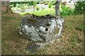
PhilipBurton visited on 23rd Mar 2018 - their rating: Cond: 3 Amb: 3 Access: 4 There are three boulders on this small knoll – the big cupmarked one pictured, measuring 1.8m x 1.6m x 0.9m high (Burl/Canmore), a broken one to the west and a slab at the south-west. Some of the cupmarks are quite large.
From this picture Cramrar 3 will be down on the roadside not far from the house on the left, perhaps hidden by the big stone.
")
"A large prominent boulder, measuring 1.8m x 1.6m x 0.9m high, bearing c.13 cup-marks on its upper surface." - Canmore site no. 24971.
You may be viewing yesterday's version of this page. To see the most up to date information please register for a free account.
Do not use the above information on other web sites or publications without permission of the contributor.
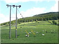
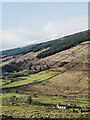
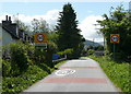
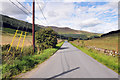
Nearby Images from Geograph Britain and Ireland:
©2011(licence)
©2023(licence)
©2011(licence)
©2010(licence)
©2007(licence)
The above images may not be of the site on this page, they are loaded from Geograph.
Please Submit an Image of this site or go out and take one for us!
Click here to see more info for this site
Nearby sites
Key: Red: member's photo, Blue: 3rd party photo, Yellow: other image, Green: no photo - please go there and take one, Grey: site destroyed
Download sites to:
KML (Google Earth)
GPX (GPS waypoints)
CSV (Garmin/Navman)
CSV (Excel)
To unlock full downloads you need to sign up as a Contributory Member. Otherwise downloads are limited to 50 sites.
Turn off the page maps and other distractions
Nearby sites listing. In the following links * = Image available
174m WSW 245° Cromrar 3 Rock Art (NN72184500)
188m SW 236° Fearnan Rock Art (NN72184497)
273m NNE 27° Cromrar 1* Rock Art (NN72474531)
573m SW 233° Clach-na-Cruich (Fearnan) Rock Art (NN7186844743)
770m S 181° Oakbank Crannog* Crannog (NN723443)
1.6km NNE 29° Bridge of Lyon Standing Stones* Standing Stones (NN73144641)
1.6km NNE 21° Bridge of Lyon long cairn* Long Barrow (NN72964655)
1.7km NNE 27° Lyon Bridge Cairn* Cairn (NN73174657)
2.4km NE 34° Fortingall Modern Stone Circle* Modern Stone Circle etc (NN73754703)
2.5km NE 41° Clach a' Phlaigh* Standing Stone (Menhir) (NN74064693)
2.7km NE 42° Fortingall church crosses* Ancient Cross (NN74204702)
2.9km NE 47° Fortingall SW* Stone Circle (NN7451446960)
2.9km NE 48° Fortingall S* Stone Circle (NN7454746927)
2.9km NE 47° Fortingall NE* Stone Circle (NN7453546977)
3.0km NNW 334° Coille Dhubh Standing Stones (NN711478)
4.1km SW 233° Allt Coire Phadairlidh 1* Rock Art (NN690427)
4.3km ESE 118° Acharn Burn* Cairn (NN76074294)
4.6km ESE 116° Queen's Wood (Acharn) Rock Art (NN76404291)
4.7km E 90° Scottish Crannog Centre* Museum (NN7704444910)
4.9km E 88° Spar Island* Crannog (NN773451)
5.1km ESE 118° Acharn Falls* Stone Circle (NN7678742495)
5.1km ESE 104° Balmacnaughton* Rock Art (NN7729043649)
6.4km WNW 291° Dericambus Standing Stone (Menhir) (NN66484757)
6.4km SW 218° Machuinn* Stone Circle (NN6820140156)
6.6km ENE 73° Comrie Bridge Stone Circle (NN787468)
View more nearby sites and additional images


 We would like to know more about this location. Please feel free to add a brief description and any relevant information in your own language.
 Wir möchten mehr über diese Stätte erfahren. Bitte zögern Sie nicht, eine kurze Beschreibung und relevante Informationen in Deutsch hinzuzufügen.
 Nous aimerions en savoir encore un peu sur les lieux. S'il vous plaît n'hesitez pas à ajouter une courte description et tous les renseignements pertinents dans votre propre langue.
 Quisieramos informarnos un poco más de las lugares. No dude en añadir una breve descripción y otros datos relevantes en su propio idioma.