

<< Our Photo Pages >> Sluggan Standing Stone - Standing Stone (Menhir) in Scotland in Argyll
Submitted by Anonymous on Thursday, 15 February 2001 Page Views: 4470
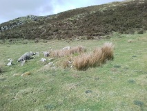
Neolithic and Bronze AgeSite Name: Sluggan Standing StoneCountry: Scotland County: Argyll Type: Standing Stone (Menhir)
Map Ref: NM8404207571 Landranger Map Number: 55
Latitude: 56.211558N Longitude: 5.483999W
Condition:
| 5 | Perfect |
| 4 | Almost Perfect |
| 3 | Reasonable but with some damage |
| 2 | Ruined but still recognisable as an ancient site |
| 1 | Pretty much destroyed, possibly visible as crop marks |
| 0 | No data. |
| -1 | Completely destroyed |
| 5 | Superb |
| 4 | Good |
| 3 | Ordinary |
| 2 | Not Good |
| 1 | Awful |
| 0 | No data. |
| 5 | Can be driven to, probably with disabled access |
| 4 | Short walk on a footpath |
| 3 | Requiring a bit more of a walk |
| 2 | A long walk |
| 1 | In the middle of nowhere, a nightmare to find |
| 0 | No data. |
| 5 | co-ordinates taken by GPS or official recorded co-ordinates |
| 4 | co-ordinates scaled from a detailed map |
| 3 | co-ordinates scaled from a bad map |
| 2 | co-ordinates of the nearest village |
| 1 | co-ordinates of the nearest town |
| 0 | no data |
Be the first person to rate this site - see the 'Contribute!' box in the right hand menu.
Internal Links:
External Links:
")
Mid Argyll
You may be viewing yesterday's version of this page. To see the most up to date information please register for a free account.
")
")
Do not use the above information on other web sites or publications without permission of the contributor.
Nearby Images from Geograph Britain and Ireland:

©2013(licence)

©2006(licence)

©2006(licence)

©2014(licence)

©2010(licence)
The above images may not be of the site on this page, they are loaded from Geograph.
Please Submit an Image of this site or go out and take one for us!
Click here to see more info for this site
Nearby sites
Key: Red: member's photo, Blue: 3rd party photo, Yellow: other image, Green: no photo - please go there and take one, Grey: site destroyed
Download sites to:
KML (Google Earth)
GPX (GPS waypoints)
CSV (Garmin/Navman)
CSV (Excel)
To unlock full downloads you need to sign up as a Contributory Member. Otherwise downloads are limited to 50 sites.
![]()
Turn off the page maps and other distractions
Nearby sites listing. In the following links * = Image available
149m NW 314° Sluggan Cairn* Cairn (NM83940768)
863m SW 223° Dunan Aula* Cist (NM83420697)
1.5km SW 215° Barbreck* Standing Stones (NM83130639)
2.1km SW 227° Barbreck Well* Holy Well or Sacred Spring (NM824062)
2.1km SE 138° Tur A' Bhodaich Stone Fort or Dun (NM854059)
2.6km SSW 196° The Watch Stone (Kintraw)* Standing Stone (Menhir) (NM83200509)
2.6km SSW 196° Kintraw hill platform* Cairn (NM83170507)
2.7km S 184° Dun Na Ban-Oige* Stone Fort or Dun (NM837049)
2.8km SSW 198° Kintraw (Kilmartin)* Standing Stone (Menhir) (NM83050497)
2.9km SSW 194° Kintraw (Argyll) Stone Fort or Dun (NM832048)
3.5km S 177° Salachary* Stone Row / Alignment (NM8405604024)
3.6km SE 137° Dun Dubh Stone Fort or Dun (NM864048)
3.6km SW 222° Eilean Carnaich* Cairn (NM81450501)
3.7km SSW 193° Bealoch Mor Stone Circle (NM8304)
3.9km W 269° Caisteal Nan Coin Dubh Stone* Standing Stone (Menhir) (NM8014907733)
4.0km W 268° Caisteal Nan Coin Dubh (Craobh Haven)* Hillfort (NM80000762)
4.1km SSW 199° Lochan Druim An Rathaid Cairn (NM825038)
4.1km W 266° Caisteal Nan Coin Dubh Cairn* Cairn (NM7993107519)
4.1km SW 229° Beinn An Duin* Stone Fort or Dun (NM80790499)
4.2km SSE 158° Dun Chonallaich* Stone Fort or Dun (NM85440365)
4.6km SW 225° Clach An T-Sagairt (Soroba)* Chambered Tomb (NM80630451)
4.7km ESE 122° Torran Standing Stone* Standing Stone (Menhir) (NM8790104877)
4.7km W 272° Eilean An Dùin* Vitrified Fort (NM7929407959)
4.8km SSE 167° Dun Na Nighinn Stone Fort or Dun (NM84910282)
4.9km NW 319° Creag Aoil Promontory Fort / Cliff Castle (NM80991139)
View more nearby sites and additional images


 We would like to know more about this location. Please feel free to add a brief description and any relevant information in your own language.
 Wir möchten mehr über diese Stätte erfahren. Bitte zögern Sie nicht, eine kurze Beschreibung und relevante Informationen in Deutsch hinzuzufügen.
 Nous aimerions en savoir encore un peu sur les lieux. S'il vous plaît n'hesitez pas à ajouter une courte description et tous les renseignements pertinents dans votre propre langue.
 Quisieramos informarnos un poco más de las lugares. No dude en añadir una breve descripción y otros datos relevantes en su propio idioma.