<< Our Photo Pages >> Upper Lodge - Stone Row / Alignment in Wales in Pembrokeshire
Submitted by vicky on Sunday, 07 December 2003 Page Views: 6817
Neolithic and Bronze AgeSite Name: Upper LodgeCountry: Wales County: Pembrokeshire Type: Stone Row / Alignment
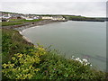
Nearest Town: Haverfordwest Nearest Village: Broad Haven
Map Ref: SM861142 Landranger Map Number: 157
Latitude: 51.785463N Longitude: 5.102645W
Condition:
| 5 | Perfect |
| 4 | Almost Perfect |
| 3 | Reasonable but with some damage |
| 2 | Ruined but still recognisable as an ancient site |
| 1 | Pretty much destroyed, possibly visible as crop marks |
| 0 | No data. |
| -1 | Completely destroyed |
| 5 | Superb |
| 4 | Good |
| 3 | Ordinary |
| 2 | Not Good |
| 1 | Awful |
| 0 | No data. |
| 5 | Can be driven to, probably with disabled access |
| 4 | Short walk on a footpath |
| 3 | Requiring a bit more of a walk |
| 2 | A long walk |
| 1 | In the middle of nowhere, a nightmare to find |
| 0 | No data. |
| 5 | co-ordinates taken by GPS or official recorded co-ordinates |
| 4 | co-ordinates scaled from a detailed map |
| 3 | co-ordinates scaled from a bad map |
| 2 | co-ordinates of the nearest village |
| 1 | co-ordinates of the nearest town |
| 0 | no data |
Internal Links:
External Links:
")
These two stones are marked on the OS map (at SM861143) and are found partially buried in the roadside bank. Interstingly the CARN database also calls the pair the 'Cliff Cottage Circle'.
You may be viewing yesterday's version of this page. To see the most up to date information please register for a free account.
")
Do not use the above information on other web sites or publications without permission of the contributor.
coldrum has found this location on Google Street View:
Nearby Images from Geograph Britain and Ireland:
©2018(licence)
©2014(licence)
©2017(licence)
©2023(licence)
©2017(licence)
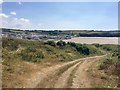
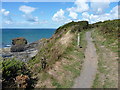
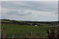
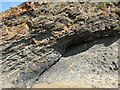
The above images may not be of the site on this page, they are loaded from Geograph.
Please Submit an Image of this site or go out and take one for us!
Click here to see more info for this site
Nearby sites
Key: Red: member's photo, Blue: 3rd party photo, Yellow: other image, Green: no photo - please go there and take one, Grey: site destroyed
Download sites to:
KML (Google Earth)
GPX (GPS waypoints)
CSV (Garmin/Navman)
CSV (Excel)
To unlock full downloads you need to sign up as a Contributory Member. Otherwise downloads are limited to 50 sites.
Turn off the page maps and other distractions
Nearby sites listing. In the following links * = Image available
520m N 4° Harold Stone (Broad Haven) Standing Stone (Menhir) (SM8615514717)
2.7km N 3° Druidston Stones* Standing Stones (SM86361690)
3.5km E 80° Hangstone Davy Standing Stone (Menhir) (SM89581465)
5.0km SE 133° Romans Castle* Ancient Village or Settlement (SM896106)
5.9km S 190° Longstone Field Standing Stone (Menhir) (SM84870842)
5.9km S 189° Longstone Field Circle 1 Timber Circle (SM849084)
5.9km S 189° Longstone Field Circle 2 Timber Circle (SM849084)
5.9km S 190° Sandy Haven's Farm* Standing Stone (Menhir) (SM848084)
7.4km SSW 204° Mabesgate Longstone* Standing Stone (Menhir) (SM828076)
7.7km SSE 154° Long Stone (Hubberston)* Standing Stone (Menhir) (SM89200717)
7.7km WSW 244° Nab Head (Pembrokeshire)* Ancient Village or Settlement (SM79051111)
7.9km WSW 242° Tower Point* Promontory Fort / Cliff Castle (SM790108)
7.9km E 87° St David's Well (Haverfordwest) Holy Well or Sacred Spring (SM94001423)
8.0km NNW 348° Newgale Submerged Forest Not Known (by us) (SM8475422138)
8.1km E 87° St Caradoc's Well Holy Well or Sacred Spring (SM9423714271)
8.4km SE 127° Steynton standing stone* Standing Stone (Menhir) (SM92570886)
8.6km SE 136° St Peter's Church (Steynton) Sculptured Stone (SM918078)
9.4km NNW 336° Dinas Fach* Promontory Fort / Cliff Castle (SM82572290)
9.4km E 81° Lady Well (Haverfordwest) Holy Well or Sacred Spring (SM9547615217)
9.5km E 89° Upper Haroldston Ancient Village or Settlement (SM95661395)
9.8km N 356° Brawdy Church Early Christian Sculptured Stone (SM858240)
9.8km SSW 201° Dale Fort* Hillfort (SM822052)
10.1km E 83° Higgon's Well Holy Well or Sacred Spring (SM9618015071)
10.5km SSW 214° Great Castle Head Hillfort (SM799057)
10.6km NNE 16° Rhyndaston-Fawr Tump Round Barrow(s) (SM89422425)
View more nearby sites and additional images


 We would like to know more about this location. Please feel free to add a brief description and any relevant information in your own language.
 Wir möchten mehr über diese Stätte erfahren. Bitte zögern Sie nicht, eine kurze Beschreibung und relevante Informationen in Deutsch hinzuzufügen.
 Nous aimerions en savoir encore un peu sur les lieux. S'il vous plaît n'hesitez pas à ajouter une courte description et tous les renseignements pertinents dans votre propre langue.
 Quisieramos informarnos un poco más de las lugares. No dude en añadir una breve descripción y otros datos relevantes en su propio idioma.