 with our Megalithic Portal iPhone app")


<< Our Photo Pages >> Dolmen de La Siureda - Burial Chamber or Dolmen in France in Languedoc:Pyrénées-Orientales 66
Submitted by TheCaptain on Thursday, 10 February 2005 Page Views: 7816
Neolithic and Bronze AgeSite Name: Dolmen de La SiuredaCountry: France Département: Languedoc:Pyrénées-Orientales 66 Type: Burial Chamber or Dolmen
Nearest Town: Céret Nearest Village: Maureillas
Latitude: 42.463100N Longitude: 2.791400E
Condition:
| 5 | Perfect |
| 4 | Almost Perfect |
| 3 | Reasonable but with some damage |
| 2 | Ruined but still recognisable as an ancient site |
| 1 | Pretty much destroyed, possibly visible as crop marks |
| 0 | No data. |
| -1 | Completely destroyed |
| 5 | Superb |
| 4 | Good |
| 3 | Ordinary |
| 2 | Not Good |
| 1 | Awful |
| 0 | No data. |
| 5 | Can be driven to, probably with disabled access |
| 4 | Short walk on a footpath |
| 3 | Requiring a bit more of a walk |
| 2 | A long walk |
| 1 | In the middle of nowhere, a nightmare to find |
| 0 | No data. |
| 5 | co-ordinates taken by GPS or official recorded co-ordinates |
| 4 | co-ordinates scaled from a detailed map |
| 3 | co-ordinates scaled from a bad map |
| 2 | co-ordinates of the nearest village |
| 1 | co-ordinates of the nearest town |
| 0 | no data |
Internal Links:
External Links:
I have visited· I would like to visit
DrewParsons SolarMegalith would like to visit
DrTrojan visited on 1st Jan 2008 - their rating: Cond: 4 Amb: 4 Access: 4
")
You may be viewing yesterday's version of this page. To see the most up to date information please register for a free account.
")
")
Do not use the above information on other web sites or publications without permission of the contributor.
Nearby Images from Flickr
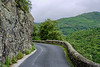
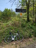

The above images may not be of the site on this page, but were taken nearby. They are loaded from Flickr so please click on them for image credits.
Click here to see more info for this site
Nearby sites
Click here to view sites on an interactive map of the areaKey: Red: member's photo, Blue: 3rd party photo, Yellow: other image, Green: no photo - please go there and take one, Grey: site destroyed
Download sites to:
KML (Google Earth)
GPX (GPS waypoints)
CSV (Garmin/Navman)
CSV (Excel)
To unlock full downloads you need to sign up as a Contributory Member. Otherwise downloads are limited to 50 sites.
Turn off the page maps and other distractions
Nearby sites listing. In the following links * = Image available
3.0km WSW 237° Stele des Evades Modern Stone Circle etc
4.5km ENE 62° Fortification Romaine dite Castell Dels Moros* Ancient Village or Settlement
5.2km E 100° Col de Panissars* Ancient Trackway
6.4km SE 129° Menhir dels Planers de la Serafina* Standing Stone (Menhir)
6.4km SE 129° Dolmen dels Planers de la Serafina Burial Chamber or Dolmen
7.0km WNW 283° Cova de la Fontcalda Cave or Rock Shelter
7.1km WNW 282° Dolmen de la Tomba d'en Jan Sarris Burial Chamber or Dolmen
7.1km WNW 283° Cova de la Dona Cave or Rock Shelter
7.8km SSE 148° Menhir de Mas del Puig Standing Stone (Menhir)
7.9km SSE 148° Menhir del Camp de la Matalena Standing Stone (Menhir)
7.9km ESE 103° Dolmen dels Pedreguers Burial Chamber or Dolmen
8.0km SE 134° Dolmen de Rocalba* Burial Chamber or Dolmen
8.1km S 172° Dolmen del Pardal* Burial Chamber or Dolmen
8.1km ENE 72° Balma de Na Cristiana* Burial Chamber or Dolmen
8.4km S 190° Dolmen de Can Vinyes Burial Chamber or Dolmen
8.8km NNW 335° Dolmen du Serrat de Galuert Burial Chamber or Dolmen
9.1km S 173° Dolmen Puig de Caneres* Burial Chamber or Dolmen
9.2km SSW 200° Menhir de Can Coll Standing Stone (Menhir)
9.2km SSE 155° Menhir del Roc del Frare* Standing Stone (Menhir)
9.4km SSW 202° Menhires del Paseo de Maçanet Standing Stone (Menhir)
9.5km WNW 300° Dolmen du Camp d'en Séris Burial Chamber or Dolmen
9.6km SE 135° Menhir de Palaus* Standing Stone (Menhir)
9.9km SW 233° Menhir del Coll de la Dona Morta Standing Stone (Menhir)
9.9km SSW 205° Menhir Pedra Dreta* Standing Stone (Menhir)
10.1km SSE 154° Menhir el Roc del Capellà Standing Stone (Menhir)
View more nearby sites and additional images


 We would like to know more about this location. Please feel free to add a brief description and any relevant information in your own language.
 Wir möchten mehr über diese Stätte erfahren. Bitte zögern Sie nicht, eine kurze Beschreibung und relevante Informationen in Deutsch hinzuzufügen.
 Nous aimerions en savoir encore un peu sur les lieux. S'il vous plaît n'hesitez pas à ajouter une courte description et tous les renseignements pertinents dans votre propre langue.
 Quisieramos informarnos un poco más de las lugares. No dude en añadir una breve descripción y otros datos relevantes en su propio idioma.