

<< Text Pages >> Allée Couverte de Lobo - Passage Grave in France in Bretagne:Morbihan (56)
Submitted by TheCaptain on Monday, 03 January 2005 Page Views: 2969
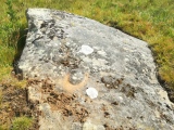
Neolithic and Bronze AgeSite Name: Allée Couverte de Lobo Alternative Name: Lobo (Haut Pinel)Country: France Département: Bretagne:Morbihan (56) Type: Passage Grave
Nearest Town: Ploërmel Nearest Village: Caro
Latitude: 47.848203N Longitude: 2.323521W
Condition:
| 5 | Perfect |
| 4 | Almost Perfect |
| 3 | Reasonable but with some damage |
| 2 | Ruined but still recognisable as an ancient site |
| 1 | Pretty much destroyed, possibly visible as crop marks |
| 0 | No data. |
| -1 | Completely destroyed |
| 5 | Superb |
| 4 | Good |
| 3 | Ordinary |
| 2 | Not Good |
| 1 | Awful |
| 0 | No data. |
| 5 | Can be driven to, probably with disabled access |
| 4 | Short walk on a footpath |
| 3 | Requiring a bit more of a walk |
| 2 | A long walk |
| 1 | In the middle of nowhere, a nightmare to find |
| 0 | No data. |
| 5 | co-ordinates taken by GPS or official recorded co-ordinates |
| 4 | co-ordinates scaled from a detailed map |
| 3 | co-ordinates scaled from a bad map |
| 2 | co-ordinates of the nearest village |
| 1 | co-ordinates of the nearest town |
| 0 | no data |
Be the first person to rate this site - see the 'Contribute!' box in the right hand menu.
Internal Links:
External Links:
Allée Couverte in Morbihan
Caro, Ploërmel, Vannes, Morbihan, Brittany
Source Location: T4T35.fr
You may be viewing yesterday's version of this page. To see the most up to date information please register for a free account.
Do not use the above information on other web sites or publications without permission of the contributor.
Nearby sites
Click here to view sites on an interactive map of the areaDownload sites to:
KML (Google Earth)
GPX (GPS waypoints)
CSV (Garmin/Navman)
CSV (Excel)
To unlock full downloads you need to sign up as a Contributory Member. Otherwise downloads are limited to 50 sites.
Nearby sites listing. In the following links * = Image available
1.0km W 277° Grand Village allée couverte* Passage Grave
1.5km W 280° Allée Couverte du Grand-Village Ouest Passage Grave
1.6km E 100° Bodel Menhir* Standing Stone (Menhir)
1.7km ESE 105° Allée Couverte du Haut Bodel* Passage Grave
3.1km WNW 297° Gajal allée couverte* Passage Grave
4.4km SSE 161° Menhir de Digoit Standing Stone (Menhir)
4.6km NNW 335° Piprais menhir* Standing Stone (Menhir)
4.7km NNW 337° Maison Neuve menhir* Standing Stone (Menhir)
4.8km S 183° Alignement d'Evas Stone Row / Alignment
4.9km WSW 249° Allée Couverte du Pray Passage Grave
5.7km NE 36° Allée couverte dite la Roche des Fées* Passage Grave
5.7km S 177° Menhir du Cimetière* Standing Stone (Menhir)
5.7km NW 314° Tumulus La Ville au voyer (Monterrein)* Passage Grave
5.9km NW 317° Dolmen de la Maison-Trouvée* Burial Chamber or Dolmen
6.0km NW 306° Alignement dit le Pas de Gargantua* Stone Row / Alignment
6.1km WNW 302° Pas de Gargantua (Le Bignon) Passage Grave
6.3km NW 306° Allée couverte dite la Maison du Diable* Passage Grave
6.6km WNW 299° Allée Couverte de Saint-Méen 1* Passage Grave
6.6km NW 304° Allée couverte dite les Chambrettes* Passage Grave
6.7km WNW 299° Allée Couverte de Saint-Méen 2* Passage Grave
7.2km S 172° Menhir de Beaumont Standing Stone (Menhir)
7.2km S 172° Allée couverte de Chateau de Beaumont Passage Grave
7.2km S 173° Dolmen del Courtil des Fées Burial Chamber or Dolmen
7.3km SW 230° Bois-Solon Menhirs Standing Stones
7.9km E 93° Dolmen de Madry Burial Chamber or Dolmen


 We would like to know more about this location. Please feel free to add a brief description and any relevant information in your own language.
 Wir möchten mehr über diese Stätte erfahren. Bitte zögern Sie nicht, eine kurze Beschreibung und relevante Informationen in Deutsch hinzuzufügen.
 Nous aimerions en savoir encore un peu sur les lieux. S'il vous plaît n'hesitez pas à ajouter une courte description et tous les renseignements pertinents dans votre propre langue.
 Quisieramos informarnos un poco más de las lugares. No dude en añadir una breve descripción y otros datos relevantes en su propio idioma.