
, Aubrey Burl")
<< Our Photo Pages >> Tregaminion Holy Well - Holy Well or Sacred Spring in England in Cornwall
Submitted by Thorgrim on Thursday, 29 April 2004 Page Views: 6274
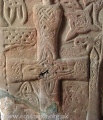
Springs and Holy WellsSite Name: Tregaminion Holy WellCountry: England County: Cornwall Type: Holy Well or Sacred Spring
Nearest Town: Penzance Nearest Village: Morvah
Map Ref: SW401359 Landranger Map Number: 203
Latitude: 50.166019N Longitude: 5.640716W
Condition:
| 5 | Perfect |
| 4 | Almost Perfect |
| 3 | Reasonable but with some damage |
| 2 | Ruined but still recognisable as an ancient site |
| 1 | Pretty much destroyed, possibly visible as crop marks |
| 0 | No data. |
| -1 | Completely destroyed |
| 5 | Superb |
| 4 | Good |
| 3 | Ordinary |
| 2 | Not Good |
| 1 | Awful |
| 0 | No data. |
| 5 | Can be driven to, probably with disabled access |
| 4 | Short walk on a footpath |
| 3 | Requiring a bit more of a walk |
| 2 | A long walk |
| 1 | In the middle of nowhere, a nightmare to find |
| 0 | No data. |
| 5 | co-ordinates taken by GPS or official recorded co-ordinates |
| 4 | co-ordinates scaled from a detailed map |
| 3 | co-ordinates scaled from a bad map |
| 2 | co-ordinates of the nearest village |
| 1 | co-ordinates of the nearest town |
| 0 | no data |
Internal Links:
External Links:
I have visited· I would like to visit
ocifant micske would like to visit
lucasn visited on 24th Oct 2019 - their rating: Cond: 4 Amb: 4 Access: 3
cazzyjane have visited here
")
Have you visited this site? Please add a comment below.
You may be viewing yesterday's version of this page. To see the most up to date information please register for a free account.
")
Do not use the above information on other web sites or publications without permission of the contributor.
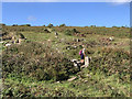
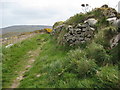
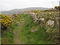
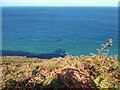
Nearby Images from Geograph Britain and Ireland:
©2019(licence)
©2010(licence)
©2010(licence)

©2010(licence)
©2021(licence)
The above images may not be of the site on this page, they are loaded from Geograph.
Please Submit an Image of this site or go out and take one for us!
Click here to see more info for this site
Nearby sites
Key: Red: member's photo, Blue: 3rd party photo, Yellow: other image, Green: no photo - please go there and take one, Grey: site destroyed
Download sites to:
KML (Google Earth)
GPX (GPS waypoints)
CSV (Garmin/Navman)
CSV (Excel)
To unlock full downloads you need to sign up as a Contributory Member. Otherwise downloads are limited to 50 sites.
Turn off the page maps and other distractions
Nearby sites listing. In the following links * = Image available
797m W 267° Chypraze* Round Barrow(s) (SW393359)
1.1km SE 132° Trevowhan Standing Stone* Standing Stone (Menhir) (SW40893512)
1.1km SE 139° Carne Farm Hut Circle* Ancient Village or Settlement (SW408350)
1.2km SSE 157° Carne Farm Settlement* Ancient Village or Settlement (SW405348)
1.2km SE 134° Trevowhan standing stones* Standing Stones (SW40943502)
1.4km ESE 112° Watch Croft Settlements* Ancient Village or Settlement (SW414353)
1.6km SSE 167° Chun Tumulus Round Barrow(s) (SW404343)
1.6km ENE 73° Rosemergy Stone Circle (SW417363)
1.7km SE 132° The Carn Field System* Misc. Earthwork (SW413347)
1.7km SE 126° Bosullow Quoit* Modern Stone Circle etc (SW41453483)
1.7km S 176° Tor Noon Tumulus and Homestead* Round Barrow(s) (SW40143418)
1.8km WSW 255° Pendeen Fogou* Souterrain (Fogou, Earth House) (SW3836535533)
1.8km E 94° Watch Croft Cairns* Cairn (SW419357)
1.9km NE 55° Bosigran Castle* Promontory Fort / Cliff Castle (SW41693688)
1.9km SSE 151° Bosullow Trehyllys Fogou* Souterrain (Fogou, Earth House) (SW40933422)
1.9km SSE 149° Bosullow Trehyllys Settlement* Ancient Village or Settlement (SW410342)
1.9km S 174° Chun Quoit* Chambered Cairn (SW40223396)
2.0km ESE 118° Dakota Homestead Ancient Village or Settlement (SW418349)
2.0km SSE 166° Chun Castle Well* Holy Well or Sacred Spring (SW40503396)
2.0km SSE 166° Chun Castle* Hillfort (SW40503395)
2.0km E 93° Watch Croft Standing Stone* Standing Stone (Menhir) (SW421357)
2.1km ESE 113° Dakota Standing Stone* Standing Stone (Menhir) (SW41993498)
2.1km ENE 63° Bosigran Settlement* Ancient Village or Settlement (SW42053677)
2.2km SE 138° Kerrow Bosullow Standing stone* Standing Stone (Menhir) (SW415342)
2.3km E 84° White downs hut circle and pound* Ancient Village or Settlement (SW42423603)
View more nearby sites and additional images


 We would like to know more about this location. Please feel free to add a brief description and any relevant information in your own language.
 Wir möchten mehr über diese Stätte erfahren. Bitte zögern Sie nicht, eine kurze Beschreibung und relevante Informationen in Deutsch hinzuzufügen.
 Nous aimerions en savoir encore un peu sur les lieux. S'il vous plaît n'hesitez pas à ajouter une courte description et tous les renseignements pertinents dans votre propre langue.
 Quisieramos informarnos un poco más de las lugares. No dude en añadir una breve descripción y otros datos relevantes en su propio idioma.