

<< Our Photo Pages >> Mony's Stone - Standing Stone (Menhir) in Scotland in Highlands
Submitted by cosmic on Sunday, 14 December 2003 Page Views: 9217
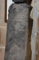
Neolithic and Bronze AgeSite Name: Mony's StoneCountry: Scotland County: Highlands Type: Standing Stone (Menhir)
Nearest Town: Inverness Nearest Village: Corrimony
Map Ref: NH3751530072 Landranger Map Number: 26
Latitude: 57.332136N Longitude: 4.700814W
Condition:
| 5 | Perfect |
| 4 | Almost Perfect |
| 3 | Reasonable but with some damage |
| 2 | Ruined but still recognisable as an ancient site |
| 1 | Pretty much destroyed, possibly visible as crop marks |
| 0 | No data. |
| -1 | Completely destroyed |
| 5 | Superb |
| 4 | Good |
| 3 | Ordinary |
| 2 | Not Good |
| 1 | Awful |
| 0 | No data. |
| 5 | Can be driven to, probably with disabled access |
| 4 | Short walk on a footpath |
| 3 | Requiring a bit more of a walk |
| 2 | A long walk |
| 1 | In the middle of nowhere, a nightmare to find |
| 0 | No data. |
| 5 | co-ordinates taken by GPS or official recorded co-ordinates |
| 4 | co-ordinates scaled from a detailed map |
| 3 | co-ordinates scaled from a bad map |
| 2 | co-ordinates of the nearest village |
| 1 | co-ordinates of the nearest town |
| 0 | no data |
Internal Links:
External Links:
I have visited· I would like to visit
SolarMegalith visited on 16th Jun 2015 - their rating: Cond: 4 Amb: 4 Access: 4
")
Have you visited this site? Please add a comment below.
You may be viewing yesterday's version of this page. To see the most up to date information please register for a free account.
")
")
")
")
Do not use the above information on other web sites or publications without permission of the contributor.
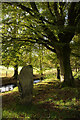
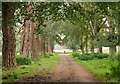
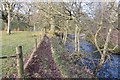
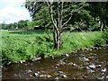
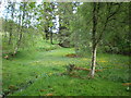
Nearby Images from Geograph Britain and Ireland:
©2012(licence)
©2019(licence)
©2015(licence)
©2008(licence)
©2010(licence)
The above images may not be of the site on this page, they are loaded from Geograph.
Please Submit an Image of this site or go out and take one for us!
Click here to see more info for this site
Nearby sites
Key: Red: member's photo, Blue: 3rd party photo, Yellow: other image, Green: no photo - please go there and take one, Grey: site destroyed
Download sites to:
KML (Google Earth)
GPX (GPS waypoints)
CSV (Garmin/Navman)
CSV (Excel)
To unlock full downloads you need to sign up as a Contributory Member. Otherwise downloads are limited to 50 sites.
Turn off the page maps and other distractions
Nearby sites listing. In the following links * = Image available
812m ENE 72° Corrimony* Clava Cairn (NH38303029)
915m ENE 68° Corrimony mound Artificial Mound (NH38383038)
1.6km NE 50° Curadan's Well* Holy Well or Sacred Spring (NH38753102)
2.5km ENE 65° Buntait Cup Marked Stone* Rock Art (NH39793102)
4.7km N 353° St Ignatius' Well* Holy Well or Sacred Spring (NH3709934761)
5.1km W 278° Comar Wood* Stone Fort or Dun (NH3250931008)
9.9km N 10° Dun Coille Struy Broch or Nuraghe (NH39643976)
11.8km SE 134° Boulder near Creag Dhearg Natural Stone / Erratic / Other Natural Feature (NH456215)
12.0km E 81° Clachmhor, Culnakirk* Rock Art (NH49443145)
12.0km E 81° Carn Daley* Clava Cairn (NH4945431458)
15.1km NE 49° Boblainy* Stone Circle (NH49343951)
15.4km E 88° Holy Well (Drumnadrochit)* Holy Well or Sacred Spring (NH530300)
16.4km NE 42° Culburnie* Stone Circle (NH491418)
16.8km NE 45° Bruiach* Cairn (NH49984143)
17.9km NE 49° Meg's Stone* Standing Stone (Menhir) (NH5164541196)
18.0km NE 53° Allt Eoghainn* Chambered Tomb (NH5236240392)
18.1km NE 48° Belladrum South Chambered Tomb (NH5161041578)
18.4km NE 47° Belladrum Chambered Cairn* Chambered Cairn (NH5141742120)
19.2km NE 39° Ballblair Wood Chambered Cairn (NH502445)
19.9km S 175° Cherry Island* Crannog (NH385102)
20.4km NE 52° Castle Spynie Broch or Nuraghe (NH54144204)
22.2km NE 50° Balblair Class I Pictish Symbol Stone (NH55184357)
22.4km NNE 26° Cnoc Udais Cairn* Cairn (NH48154984)
22.8km NE 51° Giant's Grave (Highlands) Chambered Cairn (NH55904369)
23.1km ENE 73° Aldourie* Ring Cairn (NH59993587)
View more nearby sites and additional images


 We would like to know more about this location. Please feel free to add a brief description and any relevant information in your own language.
 Wir möchten mehr über diese Stätte erfahren. Bitte zögern Sie nicht, eine kurze Beschreibung und relevante Informationen in Deutsch hinzuzufügen.
 Nous aimerions en savoir encore un peu sur les lieux. S'il vous plaît n'hesitez pas à ajouter une courte description et tous les renseignements pertinents dans votre propre langue.
 Quisieramos informarnos un poco más de las lugares. No dude en añadir una breve descripción y otros datos relevantes en su propio idioma.