


<< Our Photo Pages >> Tillytarmont 2 - Class I Pictish Symbol Stone in Scotland in Aberdeenshire
Submitted by alligator on Thursday, 26 February 2004 Page Views: 6069
Early Medieval (Dark Age)Site Name: Tillytarmont 2 Alternative Name: Tilleytarmont 2, Whitestones HouseCountry: Scotland County: Aberdeenshire Type: Class I Pictish Symbol Stone
Map Ref: NJ52974705 Landranger Map Number: 29
Latitude: 57.511180N Longitude: 2.786619W
Condition:
| 5 | Perfect |
| 4 | Almost Perfect |
| 3 | Reasonable but with some damage |
| 2 | Ruined but still recognisable as an ancient site |
| 1 | Pretty much destroyed, possibly visible as crop marks |
| 0 | No data. |
| -1 | Completely destroyed |
| 5 | Superb |
| 4 | Good |
| 3 | Ordinary |
| 2 | Not Good |
| 1 | Awful |
| 0 | No data. |
| 5 | Can be driven to, probably with disabled access |
| 4 | Short walk on a footpath |
| 3 | Requiring a bit more of a walk |
| 2 | A long walk |
| 1 | In the middle of nowhere, a nightmare to find |
| 0 | No data. |
| 5 | co-ordinates taken by GPS or official recorded co-ordinates |
| 4 | co-ordinates scaled from a detailed map |
| 3 | co-ordinates scaled from a bad map |
| 2 | co-ordinates of the nearest village |
| 1 | co-ordinates of the nearest town |
| 0 | no data |
Be the first person to rate this site - see the 'Contribute!' box in the right hand menu.
Internal Links:
External Links:
I have visited· I would like to visit
ellawoo would like to visit
LenGilbert visited on 4th Aug 2015 - their rating: Cond: 3 Amb: 4 Access: 4 Site includes Tillytarmont 2 & 3 as well as the Redhill stone. All are weathered, but kind of pleasantly displayed in a garden-like setting. This is not the original location for any of the stones, but they were found nearby.
")
For details, visit: http://www.archaeoptics.co.uk/products/ecms/92.html
You may be viewing yesterday's version of this page. To see the most up to date information please register for a free account.
")
")
")
Do not use the above information on other web sites or publications without permission of the contributor.
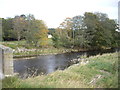
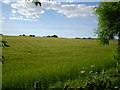
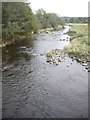
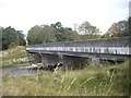
Nearby Images from Geograph Britain and Ireland:
©2011(licence)
©2007(licence)
©2011(licence)
©2011(licence)
©2011(licence)
The above images may not be of the site on this page, they are loaded from Geograph.
Please Submit an Image of this site or go out and take one for us!
Click here to see more info for this site
Nearby sites
Key: Red: member's photo, Blue: 3rd party photo, Yellow: other image, Green: no photo - please go there and take one, Grey: site destroyed
Download sites to:
KML (Google Earth)
GPX (GPS waypoints)
CSV (Garmin/Navman)
CSV (Excel)
To unlock full downloads you need to sign up as a Contributory Member. Otherwise downloads are limited to 50 sites.
Turn off the page maps and other distractions
Nearby sites listing. In the following links * = Image available
1.0km E 101° Avochie* Rock Art (NJ5398046840)
1.4km E 89° Kimmonity Stone Circle (NJ54394707)
1.5km S 174° Arnhill* Stone Circle (NJ531456)
2.7km NE 51° Rothiemay* Stone Circle (NJ55084872)
6.1km ESE 112° Westertown* Stone Circle (NJ58594467)
7.0km S 169° Battle Hill Dolmen Cairn (NJ542401)
7.1km S 180° Stannin Steens O Strathbogie* Class I Pictish Symbol Stone (NJ529399)
7.1km S 180° Huntly Stone Circle (NJ529399)
7.2km E 99° Yonder Bognie* Stone Circle (NJ601458)
7.4km SW 236° Gingomyres Stone Circle (NJ46794294)
7.4km ENE 64° Marnoch Church* Stone Circle (NJ5970250206)
8.2km ENE 60° The White Stone, Whitemuir Farm Natural Stone / Erratic / Other Natural Feature (NJ60125110)
8.2km SE 146° Gerrieswells Long Barrow (NJ575402)
8.2km ENE 65° Bellman's Wood* Stone Circle (NJ6047150429)
8.8km SSW 214° Bowman Hillock* Stone Circle (NJ480398)
9.1km ESE 117° Frendraught* Stone Circle (NJ6110442869)
9.5km NNE 33° Thorax* Stone Circle (NJ58225495)
9.5km ESE 110° Raich Stone Circle* Stone Circle (NJ6187543655)
9.9km E 101° Conwath Stone (Inverkeithny) Standing Stone (Menhir) (NJ62654507)
10.3km W 272° Tobar na Cailleach Holy Well or Sacred Spring (NJ4265947528)
11.1km S 185° Hill Of Bucharn Stone Circle (NJ518360)
11.1km SSE 147° Stonyfield* Stone Circle (NJ589376)
13.8km ESE 103° The Harestanes (Feith Hill)* Stone Circle (NJ6646043833)
13.9km SW 228° Nether Dumeath* Stone Circle (NJ425378)
14.3km E 92° Backhill Of Drachlaw* Stone Circle (NJ67294633)
View more nearby sites and additional images


 We would like to know more about this location. Please feel free to add a brief description and any relevant information in your own language.
 Wir möchten mehr über diese Stätte erfahren. Bitte zögern Sie nicht, eine kurze Beschreibung und relevante Informationen in Deutsch hinzuzufügen.
 Nous aimerions en savoir encore un peu sur les lieux. S'il vous plaît n'hesitez pas à ajouter une courte description et tous les renseignements pertinents dans votre propre langue.
 Quisieramos informarnos un poco más de las lugares. No dude en añadir una breve descripción y otros datos relevantes en su propio idioma.