

<< Our Photo Pages >> The Soldiers Trench - Stone Circle in England in Yorkshire (West)
Submitted by Anonymous on Tuesday, 04 May 2004 Page Views: 16117
Neolithic and Bronze AgeSite Name: The Soldiers Trench Alternative Name: Soldier's Ring; Brackenhall Ring; Bracken Hall Circle; Catstones RingCountry: England County: Yorkshire (West) Type: Stone Circle
Nearest Town: Shipley Nearest Village: Baildon
Map Ref: SE13043908 Landranger Map Number: 104
Latitude: 53.847798N Longitude: 1.803278W
Condition:
| 5 | Perfect |
| 4 | Almost Perfect |
| 3 | Reasonable but with some damage |
| 2 | Ruined but still recognisable as an ancient site |
| 1 | Pretty much destroyed, possibly visible as crop marks |
| 0 | No data. |
| -1 | Completely destroyed |
| 5 | Superb |
| 4 | Good |
| 3 | Ordinary |
| 2 | Not Good |
| 1 | Awful |
| 0 | No data. |
| 5 | Can be driven to, probably with disabled access |
| 4 | Short walk on a footpath |
| 3 | Requiring a bit more of a walk |
| 2 | A long walk |
| 1 | In the middle of nowhere, a nightmare to find |
| 0 | No data. |
| 5 | co-ordinates taken by GPS or official recorded co-ordinates |
| 4 | co-ordinates scaled from a detailed map |
| 3 | co-ordinates scaled from a bad map |
| 2 | co-ordinates of the nearest village |
| 1 | co-ordinates of the nearest town |
| 0 | no data |
Internal Links:
External Links:
I have visited· I would like to visit
BolshieBoris visited on 1st Sep 1988 - their rating: Cond: 3 Amb: 3 Access: 5
BolshieBoris visited on 1st Jan 1987 - their rating: Cond: 2 Amb: 3 Access: 5
Average ratings for this site from all visit loggers: Condition: 2.5 Ambience: 3 Access: 5
")
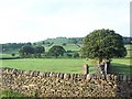
The circle is beside the road from Baildon to Eldwick, nearly opposite the Bracken Hall field centre. There's a tree on the edge of it. It has been messed around considerably, tidied up and rearranged by Victorians who used the area as a playground (Shipley Glen is a lovely little valley, and they added a funfair and a cliff railway from Saltaire too). There does appear to be a double circle, but that is a mixture of fortuitous and the rearrangement. The stones are large in the 'boulder' sense, rather than standing stones or massive lumps. It is easy enough to pass by without noticing, as the ground around is quite rocky. It's about 20yds across, maybe. I feel no special 'vibe' to it. It's not easy to photograph.
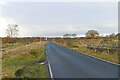
Further along the road to the W is a massive wall to the left side, thought to be Iron Age; up on the moor to the right is a collection of cup-and-ring stones that are overshadowed locally only by those on Rombalds (Ilkley) Moor.
For more information see both Pastscape Monument 49552 and The Northern Antiquarian page for Brackenhall Circle, Baildon Moor, West Yorkshire, which gives directions on how to find this site along with a brief archaeology and history and a plan of this double ring of stones.
You may be viewing yesterday's version of this page. To see the most up to date information please register for a free account.
")
")
")
Do not use the above information on other web sites or publications without permission of the contributor.
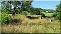
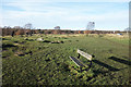
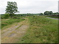
Nearby Images from Geograph Britain and Ireland:
©2022(licence)
©2018(licence)
©2018(licence)
©2005(licence)
©2021(licence)
The above images may not be of the site on this page, they are loaded from Geograph.
Please Submit an Image of this site or go out and take one for us!
Click here to see more info for this site
Nearby sites
Key: Red: member's photo, Blue: 3rd party photo, Yellow: other image, Green: no photo - please go there and take one, Grey: site destroyed
Download sites to:
KML (Google Earth)
GPX (GPS waypoints)
CSV (Garmin/Navman)
CSV (Excel)
To unlock full downloads you need to sign up as a Contributory Member. Otherwise downloads are limited to 50 sites.
Turn off the page maps and other distractions
Nearby sites listing. In the following links * = Image available
10m S 170° Soldier's Trench 01b* Rock Art (SE1304239070)
19m NE 47° Soldier's Trench 02* Rock Art (SE1305439093)
22m NE 51° Soldier's Trench 03* Rock Art (SE1305739094)
30m W 266° Soldier's Trench 01a* Rock Art (SE1301039078)
154m W 278° Glen Road 01 Rock Art (SE1288739100)
171m ENE 64° Bracken Hall Farm* Rock Art (SE1319439155)
178m ESE 117° Bracken Hall Countryside Centre* Rock Art (SE132390)
244m SE 131° Catten Stones 01a* Rock Art (SE1322638921)
248m SE 131° Catten Stones 01b* Rock Art (SE1322738916)
252m SE 126° Catten Stones 01c* Rock Art (SE1324438932)
258m SE 126° Catten Stones 02* Rock Art (SE1325138930)
273m SE 125° Catten Stones 03* Rock Art (SE1326538925)
317m WNW 281° Loadpit Beck 01 Rock Art (SE1272839142)
344m ESE 123° Catten Stones 08* Rock Art (SE1333138895)
344m SE 126° Catten Stones 04* Rock Art (SE1331938877)
346m SE 126° Catten Stones 05* Rock Art (SE1332138877)
349m SE 126° Catten Stones 06* Rock Art (SE1332338874)
355m ESE 122° Catten Stones 07* Rock Art (SE1334138891)
434m NNW 341° Bracken Hall Crag 01* Rock Art (SE1289739490)
603m ESE 119° Prod Lane 01 Rock Art (SE1357038790)
732m NNW 340° Lode Pit Lane 03 Rock Art (SE1279239769)
733m NNW 329° Lode Pit Lane 01 Rock Art (SE1266439710)
735m NNW 338° Lode Pit Lane 02 Rock Art (SE1276039760)
854m NE 51° Dobrudden South 05* Rock Art (SE1370039624)
856m NE 51° Dobrudden South 06* Rock Art (SE1370739620)
View more nearby sites and additional images


 We would like to know more about this location. Please feel free to add a brief description and any relevant information in your own language.
 Wir möchten mehr über diese Stätte erfahren. Bitte zögern Sie nicht, eine kurze Beschreibung und relevante Informationen in Deutsch hinzuzufügen.
 Nous aimerions en savoir encore un peu sur les lieux. S'il vous plaît n'hesitez pas à ajouter une courte description et tous les renseignements pertinents dans votre propre langue.
 Quisieramos informarnos un poco más de las lugares. No dude en añadir una breve descripción y otros datos relevantes en su propio idioma.