
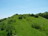

<< Our Photo Pages >> Leachkin - Chambered Cairn in Scotland in Highlands
Submitted by vicky on Sunday, 22 December 2002 Page Views: 10702
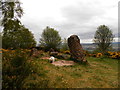
Neolithic and Bronze AgeSite Name: LeachkinCountry: Scotland County: Highlands Type: Chambered Cairn
Nearest Town: Inverness
Map Ref: NH62964416 Landranger Map Number: 26
Latitude: 57.466943N Longitude: 4.28641W
Condition:
| 5 | Perfect |
| 4 | Almost Perfect |
| 3 | Reasonable but with some damage |
| 2 | Ruined but still recognisable as an ancient site |
| 1 | Pretty much destroyed, possibly visible as crop marks |
| 0 | No data. |
| -1 | Completely destroyed |
| 5 | Superb |
| 4 | Good |
| 3 | Ordinary |
| 2 | Not Good |
| 1 | Awful |
| 0 | No data. |
| 5 | Can be driven to, probably with disabled access |
| 4 | Short walk on a footpath |
| 3 | Requiring a bit more of a walk |
| 2 | A long walk |
| 1 | In the middle of nowhere, a nightmare to find |
| 0 | No data. |
| 5 | co-ordinates taken by GPS or official recorded co-ordinates |
| 4 | co-ordinates scaled from a detailed map |
| 3 | co-ordinates scaled from a bad map |
| 2 | co-ordinates of the nearest village |
| 1 | co-ordinates of the nearest town |
| 0 | no data |
Internal Links:
External Links:
")
Read More at Canmore.
You may be viewing yesterday's version of this page. To see the most up to date information please register for a free account.
")
Do not use the above information on other web sites or publications without permission of the contributor.
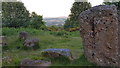
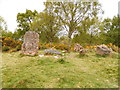
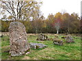
Nearby Images from Geograph Britain and Ireland:
©2018(licence)
©2019(licence)
©2009(licence)
©2019(licence)
©2016(licence)
The above images may not be of the site on this page, they are loaded from Geograph.
Please Submit an Image of this site or go out and take one for us!
Click here to see more info for this site
Nearby sites
Key: Red: member's photo, Blue: 3rd party photo, Yellow: other image, Green: no photo - please go there and take one, Grey: site destroyed
Download sites to:
KML (Google Earth)
GPX (GPS waypoints)
CSV (Garmin/Navman)
CSV (Excel)
To unlock full downloads you need to sign up as a Contributory Member. Otherwise downloads are limited to 50 sites.
Turn off the page maps and other distractions
Nearby sites listing. In the following links * = Image available
1.1km SW 219° Ladystone Farm* Stone Row / Alignment (NH62204330)
1.5km NE 43° Craig Phadraig* Vitrified Fort (NH640452)
3.3km ENE 77° Knocknagael* Class I Pictish Symbol Stone (NH662448)
3.8km ENE 73° Inverness Museum* Museum (NH66684519)
3.9km ENE 72° Clach-na-Crudainn* Standing Stone (Menhir) (NH66684521)
4.0km SSE 157° Torbreck* Stone Circle (NH64384039)
4.3km ENE 78° Broad Stone Early Christian Sculptured Stone (NH672449)
5.2km S 187° Kinchyle Of Dores* Stone Circle (NH62153898)
5.9km E 79° Raigmore* Clava Cairn (NH6878445083)
5.9km ESE 109° Druidtemple* Stone Circle (NH685420)
6.0km E 84° Essich House Class I Pictish Symbol Stone (NH69004456)
6.2km SSE 160° Essich Moor* Chambered Cairn (NH649383)
6.2km ENE 78° Beechwood Farm Site Ancient Mine, Quarry or other Industry (NH6908045190)
7.1km W 264° Giant's Grave (Highlands) Chambered Cairn (NH55904369)
7.8km W 264° Balblair Class I Pictish Symbol Stone (NH55184357)
8.2km ENE 69° Milton Stone Row Stone Row / Alignment (NH70704690)
8.3km SE 143° Tomfat Plantation* Chambered Cairn (NH678374)
8.5km N 350° The Temple (Tore)* Chambered Tomb (NH6179952610)
8.8km SSW 198° Aldourie* Ring Cairn (NH59993587)
9.0km WSW 255° Castle Spynie Broch or Nuraghe (NH54144204)
9.3km ENE 66° Allanfearn* Chambered Cairn (NH716476)
9.3km NW 324° Mains of Kilcoy SE* Cairn (NH57765186)
9.3km NW 324° Mains of Kilcoy NW* Cairn (NH57725191)
9.4km NW 325° Carn Glas* Chambered Cairn (NH578520)
9.4km E 81° St Mary's Well (Culloden)* Holy Well or Sacred Spring (NH723453)
View more nearby sites and additional images


 We would like to know more about this location. Please feel free to add a brief description and any relevant information in your own language.
 Wir möchten mehr über diese Stätte erfahren. Bitte zögern Sie nicht, eine kurze Beschreibung und relevante Informationen in Deutsch hinzuzufügen.
 Nous aimerions en savoir encore un peu sur les lieux. S'il vous plaît n'hesitez pas à ajouter une courte description et tous les renseignements pertinents dans votre propre langue.
 Quisieramos informarnos un poco más de las lugares. No dude en añadir una breve descripción y otros datos relevantes en su propio idioma.